
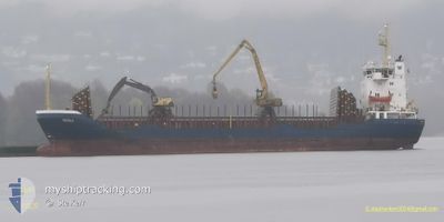
WILSON GRIMSBY
General Cargo
Current Trip
| Trip Time | 21 h, 48 mins |
|---|---|
| Trip Distance | 122.37 nm |
| AVG Speed | 7.5 Knots |
| MAX Speed | 12.6 Knots |
| Draught | 3.7 m |
| AVG Wind | 18.1 knots |
| MAX Wind | 28.3 knots |
| MIN Temp | 4.1°C / 39.38°F |
| MAX Temp | 7.9°C / 46.22°F |
| Position Received | 8 h, 33 m ago |
Current Position
| Longitude | -6.05668° |
|---|---|
| Latitude | 54.01307° |
| Status | Under way using engine |
| Speed | 10.4 Knots |
| Course | 305.4° |
| Area | Irish Sea and St. George's Channel |
| Station | T-AIS |
| Position Received | 8 h, 33 m ago |
Info
Information
The current position of WILSON GRIMSBY is in Irish Sea and St. George's Channel with coordinates 54.01307° / -6.05668° as reported on 2025-02-05 11:32 by AIS to our vessel tracker app. The vessel's current speed is 10.4 Knots and is currently inside the port of WARRENPOINT.
The vessel WILSON GRIMSBY (IMO: 9056040, MMSI: 257836000) is a General Cargo that was built in 1993 ( 32 years old ). It's sailing under the flag of [NO] Norway.
In this page you can find informations about the vessels current position, last detected port calls, and current voyage information. If the vessels is not in coverage by AIS you will find the latest position.
The current position of WILSON GRIMSBY is detected by our AIS receivers and we are not responsible for the reliability of the data. The last position was recorded while the vessel was in Coverage by the Ais receivers of our vessel tracking app.
The current draught of WILSON GRIMSBY as reported by AIS is 3.7 meters
Weather
| Temperature | 3.8°C / 38.84°F |
|---|---|
| Wind Speed | 3 knots |
| Direction | 245° WSW |
| Pressure | 1041.9 hPa |
| Humidity | 86.6 % |
| Cloud Coverage | --- |
Featured Company
Last Port Calls
| Port | Arrival | Departure | Time In Port |
|---|---|---|---|
| 2025-02-05 12:23 | |||
| 2025-02-01 01:15 | 2025-02-04 14:35 | 3 d | |
| 2025-01-27 22:22 | 2025-01-27 22:28 | 5 m | |
| 2025-01-21 04:45 | |||
| 2025-01-12 17:47 | 2025-01-15 10:29 | 2 d | |
| 2025-01-08 04:07 | 2025-01-10 02:31 | 1 d | |
| 2025-01-05 21:26 | 2025-01-06 15:24 | 17 h | |
| 2025-01-04 19:27 | 2025-01-05 21:17 | 1 d | |
| 2024-12-30 12:31 | 2025-01-02 15:14 | 3 d | |
| 2024-12-28 08:08 | 2024-12-29 16:56 | 1 d |
Most Visited Ports (Last year)
| Port | Arrivals | |
|---|---|---|
| 2 | ||
| 2 | ||
| 2 | ||
| 1 | ||
| 1 | ||
| 1 |
Last Trips
| Origin | Departure | Destination | Arrival | Distance | |
|---|---|---|---|---|---|
| 2025-02-04 14:35 | 2025-02-05 12:23 | 122.37 nm | |||
| 2025-01-27 23:28 | 2025-02-01 01:15 | 634.76 nm | |||
| 2025-01-15 10:29 | 2025-01-27 23:22 | 489.53 nm | |||
| 2025-01-15 10:29 | 2025-01-21 05:45 | 489.40 nm | |||
| 2025-01-10 03:31 | 2025-01-12 17:47 | 584.30 nm | |||
| 2025-01-06 16:24 | 2025-01-08 05:07 | 123.74 nm | |||
| 2025-01-05 22:17 | 2025-01-05 22:26 | 0.43 nm | |||
| 2025-01-02 16:14 | 2025-01-04 20:27 | 438.60 nm | |||
| 2024-12-29 17:56 | 2024-12-30 13:31 | 135.02 nm | |||
| 2024-12-12 14:11 | 2024-12-28 09:08 | 3483.34 nm |
Events
| Time | Event | Details | Position / Dest | Info |
|---|---|---|---|---|
| 2025-02-05 12:35 | STOP Moving |
54.09962 / -6.25978
[GB] WARRENPOINT
|
Speed: Course: 133° |
|
| 2025-02-05 12:23 | PORT ARRIVAL |
|
54.09742 / -6.25759
[GB] WARRENPOINT
|
Speed: 4.3 kn Course: 308° |
| 2025-02-05 11:39 | Status Changed | Default Under way using engine |
54.02509 / -6.08865
GBSIL>GBWPT
|
Speed: 10.4 kn Course: 305.4° |
| 2025-02-05 11:32 | OUT of Coverage |
54.01307 / -6.05668
Irish Sea and St. George's Channel
[GB] WARRENPOINT
|
Speed: 10.4 kn Course: 305.4° |
|
| 2025-02-05 11:32 | Status Changed | Under way using engine Default |
54.01189 / -6.05389
GBSIL>GBWPT
|
Speed: 9.1 kn Course: 309° |
| 2025-02-05 11:27 | IN Coverage |
54.01189 / -6.05389
Irish Sea and St. George's Channel
|
Speed: 9.7 kn Course: 307° |
|
| 2025-02-05 11:11 | START Moving | 3.88 nm, South of KILKEEL |
53.99369 / -5.98782
GBSIL>GBWPT
|
Speed: 5.8 kn Course: 285° |
| 2025-02-05 06:30 | STOP Moving | 3.94 nm, South of KILKEEL |
53.99282 / -5.98263
GBSIL>GBWPT
|
Speed: 0.3 kn Course: 279° |
| 2025-02-05 06:21 | Status Changed | Default Under way using engine |
53.99242 / -5.98243
GBSIL>GBWPT
|
Speed: 2.1 kn Course: 282° |
| 2025-02-05 06:17 | OUT of Coverage |
53.99195 / -5.97802
Irish Sea and St. George's Channel
GBSIL>GBWPT
|
Speed: 2.1 kn Course: 300.5° |