
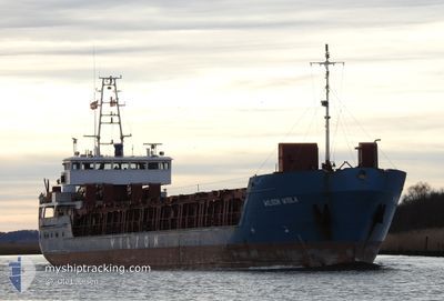
WILSON WISLA
General Cargo
Current Trip
| Time Travelled | 1 day |
|---|---|
| Remaining Time | --- |
| Distance Travelled | 269.94 nm |
| Remaining Distance | --- |
| AVG Speed | 7.1 Knots |
| MAX Speed | 10.4 Knots |
| AVG Wind | 21.8 knots |
| MAX Wind | 36 knots |
| MIN Temp | 0.8°C / 33.44°F |
| MAX Temp | 7.5°C / 45.5°F |
| Draught | 4.7 m |
| Position Received | 6 h, 24 m ago |
Current Position
| Longitude | 2.83637° |
|---|---|
| Latitude | 58.72143° |
| Status | Under way using engine |
| Speed | 9.2 Knots |
| Course | 196.3° |
| Area | North Sea |
| Station | T-AIS |
| Position Received | 6 h, 24 m ago |
Info
Information
The current position of WILSON WISLA is in North Sea with coordinates 58.72143° / 2.83637° as reported on 2025-02-07 17:53 by AIS to our vessel tracker app. The vessel's current speed is 9.2 Knots and is heading at the port of FLIXBOROUGH. The estimated time of arrival as calculated by MyShipTracking vessel tracking app is 2025-02-09 12:00 LT
The vessel WILSON WISLA (IMO: 9156175, MMSI: 314473000) is a General Cargo that was built in 1996 ( 29 years old ). It's sailing under the flag of [BB] Barbados.
In this page you can find informations about the vessels current position, last detected port calls, and current voyage information. If the vessels is not in coverage by AIS you will find the latest position.
The current position of WILSON WISLA is detected by our AIS receivers and we are not responsible for the reliability of the data. The last position was recorded while the vessel was in Coverage by the Ais receivers of our vessel tracking app.
The current draught of WILSON WISLA as reported by AIS is 4.7 meters
Weather
| Temperature | 5.7°C / 42.26°F |
|---|---|
| Wind Speed | 25 knots |
| Direction | 115° ESE |
| Pressure | 1035.3 hPa |
| Humidity | 67.7 % |
| Cloud Coverage | 71 % |
Featured Company
Last Port Calls
| Port | Arrival | Departure | Time In Port |
|---|---|---|---|
| 2025-02-04 15:16 | 2025-02-06 09:18 | 1 d | |
| 2025-02-02 13:46 | 2025-02-03 15:11 | 1 d | |
| 2025-01-22 19:56 | 2025-01-23 14:08 | 18 h | |
| 2025-01-14 21:04 | 2025-01-15 15:58 | 18 h | |
| 2025-01-11 20:16 | 2025-01-11 20:52 | 36 m | |
| 2025-01-11 19:38 | 2025-01-11 19:55 | 17 m | |
| 2025-01-11 09:34 | 2025-01-11 18:52 | 9 h | |
| 2025-01-10 21:58 | 2025-01-10 22:12 | 14 m | |
| 2025-01-10 21:02 | 2025-01-10 21:43 | 41 m | |
| 2025-01-10 09:31 | 2025-01-10 17:47 | 8 h |
Last Trips
| Origin | Departure | Destination | Arrival | Distance | |
|---|---|---|---|---|---|
| 2025-02-03 16:11 | 2025-02-04 16:16 | 211.97 nm | |||
| 2025-01-23 16:08 | 2025-02-02 14:46 | 1431.73 nm | |||
| 2025-01-15 16:58 | 2025-01-22 21:56 | 1637.27 nm | |||
| 2025-01-11 20:52 | 2025-01-14 22:04 | 680.95 nm | |||
| 2025-01-11 19:55 | 2025-01-11 20:16 | 1.93 nm | |||
| 2025-01-11 18:52 | 2025-01-11 19:38 | 4.63 nm | |||
| 2025-01-10 22:12 | 2025-01-11 09:34 | 4.20 nm | |||
| 2025-01-10 21:43 | 2025-01-10 21:58 | 2.13 nm | |||
| 2025-01-08 12:59 | 2025-01-10 21:02 | 323.47 nm | |||
| 2025-01-08 12:59 | 2025-01-10 09:31 | 297.29 nm |
Events
| Time | Event | Details | Position / Dest | Info |
|---|---|---|---|---|
| 2025-02-07 18:16 | Status Changed | Default Under way using engine |
58.66263 / 2.80853
FLIXBOROUGH
|
Speed: 9.2 kn Course: 196.3° |
| 2025-02-07 17:53 | Status Changed | Under way using engine Default |
58.72143 / 2.83637
FLIXBOROUGH
|
Speed: 9.7 kn Course: 194° |
| 2025-02-07 17:53 | OUT of Coverage |
58.72143 / 2.83637
North Sea
FLIXBOROUGH
|
Speed: 9.2 kn Course: 196.3° |
|
| 2025-02-07 17:28 | Status Changed | Default Under way using engine |
58.78497 / 2.86651
FLIXBOROUGH
|
Speed: 9.3 kn Course: 193.2° |
| 2025-02-07 17:24 | Status Changed | Under way using engine Default |
58.79601 / 2.87172
FLIXBOROUGH
|
Speed: 9.5 kn Course: 193° |
| 2025-02-07 17:08 | Status Changed | Default Under way using engine |
58.83707 / 2.89078
FLIXBOROUGH
|
Speed: 9.5 kn Course: 192.2° |
| 2025-02-07 07:15 | ETA Changed | 2025/02/09 12:00 2025/02/09 03:00 |
60.33894 / 3.66119
FLIXBOROUGH
|
Speed: 9 kn Course: 191.8° |
| 2025-02-07 02:04 | Change Sea Area | Norwegian part of the North Sea Norwegian part of the Norwegian Sea |
60.99686 / 4.00173
North Sea
FLIXBOROUGH
|
Speed: 7.3 kn Course: 193.2° |
| 2025-02-06 09:18 | PORT DEPARTURE |
|
62.05099 / 5.51817
FLIXBOROUGH
|
Speed: 4.8 kn Course: 3° |
| 2025-02-06 09:15 | START Moving |
62.04678 / 5.52134
[NO] AAHEIM
|
Speed: 4.8 kn Course: 3° |