
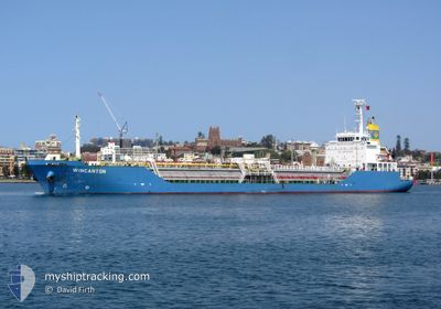
WINCANTON
Lpg Tanker
Current Trip
| Time Travelled | 12 days |
|---|---|
| Remaining Time | 3 h, 21 mins |
| Distance Travelled | 1297.92 nm |
| Remaining Distance | 27.34 nm |
| AVG Speed | 8.1 Knots |
| MAX Speed | 12.7 Knots |
| AVG Wind | 19.4 knots |
| MAX Wind | 33 knots |
| MIN Temp | 12.6°C / 54.68°F |
| MAX Temp | 27.8°C / 82.04°F |
| Draught | 5.8 m |
| Position Received | 1 h, 54 m ago |
Current Position
| Longitude | 152.07840° |
|---|---|
| Latitude | -33.12417° |
| Status | Under way using engine |
| Speed | 7.5 Knots |
| Course | 211.1° |
| Area | Tasman Sea |
| Station | T-AIS |
| Position Received | 1 h, 54 m ago |
Information
The current position of WINCANTON is in Tasman Sea with coordinates -33.12417° / 152.07840° as reported on 2025-05-29 02:27 by AIS to our vessel tracker app. The vessel's current speed is 7.5 Knots and is heading at the port of NEWCASTLE. The estimated time of arrival as calculated by MyShipTracking vessel tracking app is 2025-05-29 07:42 LT
The vessel WINCANTON (IMO: 9212462, MMSI: 357800000) is a Lpg Tanker that was built in 2000 ( 25 years old ). It's sailing under the flag of [PA] Panama.
In this page you can find informations about the vessels current position, last detected port calls, and current voyage information. If the vessels is not in coverage by AIS you will find the latest position.
The current position of WINCANTON is detected by our AIS receivers and we are not responsible for the reliability of the data. The last position was recorded while the vessel was in Coverage by the Ais receivers of our vessel tracking app.
The current draught of WINCANTON as reported by AIS is 5.8 meters
Weather
| Temperature | 17.3°C / 63.14°F |
|---|---|
| Wind Speed | 20 knots |
| Direction | 216° SW |
| Pressure | 1018 hPa |
| Humidity | 79.2 % |
| Cloud Coverage | 100 % |
Featured Company
Last Port Calls
| Port | Arrival | Departure | Time In Port |
|---|---|---|---|
| 2025-05-16 05:53 | 2025-05-17 04:11 | 22 h | |
| 2025-05-04 10:51 | 2025-05-06 03:54 | 1 d | |
| 2025-04-14 05:37 | 2025-04-14 23:09 | 17 h | |
| 2025-04-09 19:36 | 2025-04-10 21:29 | 1 d | |
| 2025-04-06 14:05 | 2025-04-07 05:58 | 15 h | |
| 2025-03-28 22:47 | 2025-04-03 13:57 | 5 d | |
| 2025-03-21 22:53 | 2025-03-22 19:35 | 20 h | |
| 2025-03-11 18:39 | 2025-03-12 19:40 | 1 d |
Last Trips
| Origin | Departure | Destination | Arrival | Distance | |
|---|---|---|---|---|---|
| 2025-05-06 13:54 | 2025-05-16 15:53 | 818.75 nm | |||
| 2025-04-15 09:09 | 2025-05-04 20:51 | 2233.47 nm | |||
| 2025-04-11 07:29 | 2025-04-14 15:37 | 680.19 nm | |||
| 2025-04-07 15:58 | 2025-04-10 05:36 | 721.31 nm | |||
| 2025-04-04 00:57 | 2025-04-07 00:05 | 690.48 nm | |||
| 2025-03-23 05:35 | 2025-03-29 09:47 | 712.81 nm | |||
| 2025-03-13 06:40 | 2025-03-22 08:53 | 701.36 nm | |||
| 2025-02-22 05:08 | 2025-03-12 05:39 | 1333.59 nm |
Events
| Time | Event | Details | Position / Dest | Info |
|---|---|---|---|---|
| 2025-05-29 02:34 | Status Changed | Default Under way using engine |
-33.13652 / 152.07663
AU NTL
|
Speed: 7.5 kn Course: 211.1° |
| 2025-05-29 02:27 | OUT of Coverage |
-33.12417 / 152.07840
Tasman Sea
|
Speed: 7.5 kn Course: 211.1° |
|
| 2025-05-29 02:23 | Status Changed | Under way using engine Default |
-33.11460 / 152.08417
AU NTL
|
Speed: 8.1 kn Course: 213° |
| 2025-05-29 02:22 | Status Changed | Default Under way using engine |
-33.11268 / 152.08536
AU NTL
|
Speed: 7.8 kn Course: 205.8° |
| 2025-05-29 02:02 | Status Changed | Under way using engine Default |
-33.07317 / 152.08786
AU NTL
|
Speed: 7.7 kn Course: 186° |
| 2025-05-29 02:01 | Status Changed | Default Under way using engine |
-33.07103 / 152.08804
AU NTL
|
Speed: 8.4 kn Course: 180° |
| 2025-05-29 01:03 | START Moving | 15.56 nm, South of PORT STEPHENS |
-32.97671 / 152.09223
AU NTL
|
Speed: 3.4 kn Course: 296° |
| 2025-05-29 01:01 | Status Changed | Under way using engine Not under command |
-32.97741 / 152.09187
AU NTL
|
Speed: 3.1 kn Course: 296° |
| 2025-05-29 00:59 | STOP Moving | 15.67 nm, South of PORT STEPHENS |
-32.97853 / 152.09140
AU NTL
|
Speed: 0.2 kn Course: 299° |
| 2025-05-29 00:58 | START Moving | 15.69 nm, South of PORT STEPHENS |
-32.97879 / 152.09131
AU NTL
|
Speed: 5.2 kn Course: 22.7° |