
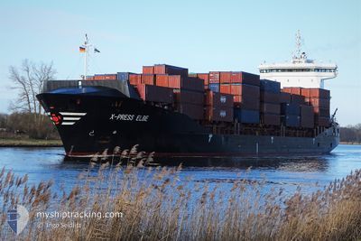
X-PRESS ELBE
Container Ship
Current Trip
| Time Travelled | 1 h, 5 mins |
|---|---|
| Remaining Time | 2 days |
| Distance Travelled | 6.62 nm |
| Remaining Distance | 390.06 nm |
| AVG Speed | 6.3 Knots |
| MAX Speed | 7 Knots |
| AVG Wind | 11.7 knots |
| MAX Wind | 13 knots |
| MIN Temp | 3.3°C / 37.94°F |
| MAX Temp | 3.6°C / 38.48°F |
| Draught | 8.4 m |
| Position Received | 3 m ago |
Current Position
| Longitude | 9.96735° |
|---|---|
| Latitude | 54.34281° |
| Status | Under way using engine |
| Speed | 3.9 Knots |
| Course | 260° |
| Area | Baltic Sea |
| Station | T-AIS |
| Position Received | 3 m ago |
Info
Information
The current position of X-PRESS ELBE is in Baltic Sea with coordinates 54.34281° / 9.96735° as reported on 2025-12-23 18:27 by AIS to our vessel tracker app. The vessel's current speed is 3.9 Knots and is heading at the port of ANTWERP. The estimated time of arrival as calculated by MyShipTracking vessel tracking app is 2025-12-26 07:01 LT
The vessel X-PRESS ELBE (IMO: 9483669, MMSI: 212018000) is a Container Ship that was built in 2010 ( 15 years old ). It's sailing under the flag of [CY] Cyprus.
In this page you can find informations about the vessels current position, last detected port calls, and current voyage information. If the vessels is not in coverage by AIS you will find the latest position.
The current position of X-PRESS ELBE is detected by our AIS receivers and we are not responsible for the reliability of the data. The last position was recorded while the vessel was in Coverage by the Ais receivers of our vessel tracking app.
The current draught of X-PRESS ELBE as reported by AIS is 8.4 meters
Weather
| Temperature | 3.6°C / 38.48°F |
|---|---|
| Wind Speed | 12 knots |
| Direction | 75° ENE |
| Pressure | 1030 hPa |
| Humidity | 85.7 % |
| Cloud Coverage | 16 % |
Featured Company
Last Port Calls
| Port | Arrival | Departure | Time In Port |
|---|---|---|---|
| 2025-12-23 16:41 | 2025-12-23 17:25 | 43 m | |
| 2025-12-22 02:27 | 2025-12-22 09:29 | 7 h | |
| 2025-12-20 04:46 | 2025-12-20 18:30 | 13 h | |
| 2025-12-18 21:27 | 2025-12-19 19:46 | 22 h | |
| 2025-12-16 03:13 | 2025-12-17 04:23 | 1 d | |
| 2025-12-13 01:04 | 2025-12-13 16:51 | 15 h | |
| 2025-12-11 18:38 | 2025-12-12 07:34 | 12 h | |
| 2025-12-10 06:59 | 2025-12-10 07:58 | 59 m | |
| 2025-12-08 21:40 | 2025-12-09 06:54 | 9 h | |
| 2025-12-07 04:49 | 2025-12-07 17:01 | 12 h |
Most Visited Ports (Last year)
| Port | Arrivals | |
|---|---|---|
| 34 | ||
| 10 | ||
| 10 | ||
| 9 | ||
| 8 | ||
| 8 |
Last Trips
| Origin | Departure | Destination | Arrival | Distance | |
|---|---|---|---|---|---|
| 2025-12-22 10:29 | 2025-12-23 17:41 | 357.47 nm | |||
| 2025-12-20 19:30 | 2025-12-22 03:27 | 439.00 nm | |||
| 2025-12-19 21:46 | 2025-12-20 05:46 | 128.77 nm | |||
| 2025-12-17 05:23 | 2025-12-18 23:27 | 490.30 nm | |||
| 2025-12-13 17:51 | 2025-12-16 04:13 | 672.48 nm | |||
| 2025-12-12 08:34 | 2025-12-13 02:04 | 99.23 nm | |||
| 2025-12-10 08:58 | 2025-12-11 19:38 | 419.27 nm | |||
| 2025-12-09 07:54 | 2025-12-10 07:59 | 355.82 nm | |||
| 2025-12-07 18:01 | 2025-12-08 22:40 | 437.68 nm | |||
| 2025-12-06 16:00 | 2025-12-07 05:49 | 128.93 nm |
Events
| Time | Event | Details | Position / Dest | Info |
|---|---|---|---|---|
| 2025-12-23 17:25 | PORT DEPARTURE |
|
54.36669 / 10.13434
BEANR VIA NOK
|
Speed: 4.4 kn Course: 287° |
| 2025-12-23 17:23 | START Moving |
54.36606 / 10.13851
[DE] KIEL
|
Speed: 3.1 kn Course: 285° |
|
| 2025-12-23 16:56 | STOP Moving |
54.36557 / 10.14241
[DE] KIEL
|
Speed: 0.1 kn Course: 283° |
|
| 2025-12-23 16:41 | PORT ARRIVAL |
|
54.36310 / 10.16422
[DE] KIEL
|
Speed: 6.5 kn Course: 243.7° |
| 2025-12-23 14:55 | Change Sea Area | German part of the Baltic Sea Danish part of the Baltic Sea |
54.56308 / 10.56023
Baltic Sea
BEANR VIA NOK
|
Speed: 11.4 kn Course: 246.8° |
| 2025-12-23 14:10 | Detected in Sea | Danish part of the Baltic Sea |
54.58405 / 10.80093
Baltic Sea
BEANR VIA NOK
|
Speed: 11.4 kn Course: 264.1° |
| 2025-12-23 12:26 | Change Sea Area | German part of the Baltic Sea Danish part of the Baltic Sea |
54.55262 / 11.34840
Baltic Sea
BEANR VIA NOK
|
Speed: 11.3 kn Course: 296° |
| 2025-12-23 09:52 | Change Sea Area | Danish part of the Baltic Sea German part of the Baltic Sea |
54.45489 / 12.16347
Baltic Sea
BEANR VIA NOK
|
Speed: 11.7 kn Course: 248.7° |
| 2025-12-23 09:44 | Change Sea Area | German part of the Baltic Sea Danish part of the Baltic Sea |
54.47414 / 12.18830
Baltic Sea
BEANR VIA NOK
|
Speed: 11.8 kn Course: 193.5° |
| 2025-12-23 08:22 | Detected in Sea | Danish part of the Baltic Sea |
54.67787 / 12.42634
Baltic Sea
BEANR VIA NOK
|
Speed: 11.5 kn Course: 236.4° |