
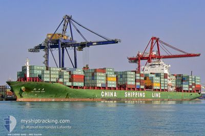
XIN CHONG QING
Container Ship
Current Trip
| Time Travelled | 12 days |
|---|---|
| Remaining Time | 1 day |
| Distance Travelled | 3847.13 nm |
| Remaining Distance | 371.27 nm |
| AVG Speed | 12.3 Knots |
| MAX Speed | 16.1 Knots |
| AVG Wind | 14.8 knots |
| MAX Wind | 22.9 knots |
| MIN Temp | 18.6°C / 65.48°F |
| MAX Temp | 27.9°C / 82.22°F |
| Draught | 11.7 m |
| Position Received | 1 h, 41 m ago |
Current Position
| Longitude | -10.75867° |
|---|---|
| Latitude | 31.63317° |
| Status | Under way using engine |
| Speed | 13.2 Knots |
| Course | 33° |
| Area | North Atlantic Ocean |
| Station | T-AIS |
| Position Received | 1 h, 41 m ago |
Information
The current position of XIN CHONG QING is in North Atlantic Ocean with coordinates 31.63317° / -10.75867° as reported on 2025-06-08 05:43 by AIS to our vessel tracker app. The vessel's current speed is 13.2 Knots and is heading at the port of ALGECIRAS. The estimated time of arrival as calculated by MyShipTracking vessel tracking app is 2025-06-09 11:25 LT
The vessel XIN CHONG QING (IMO: 9262118, MMSI: 413055000) is a Container Ship that was built in 2003 ( 22 years old ). It's sailing under the flag of [CN] China.
In this page you can find informations about the vessels current position, last detected port calls, and current voyage information. If the vessels is not in coverage by AIS you will find the latest position.
The current position of XIN CHONG QING is detected by our AIS receivers and we are not responsible for the reliability of the data. The last position was recorded while the vessel was in Coverage by the Ais receivers of our vessel tracking app.
The current draught of XIN CHONG QING as reported by AIS is 11.7 meters
Weather
| Temperature | 19.9°C / 67.82°F |
|---|---|
| Wind Speed | 7 knots |
| Direction | 22° NNE |
| Pressure | 1015.7 hPa |
| Humidity | 87.5 % |
| Cloud Coverage | 100 % |
Featured Company
Last Port Calls
| Port | Arrival | Departure | Time In Port |
|---|---|---|---|
| 2025-05-26 14:46 | 2025-05-26 14:51 | 5 m | |
| 2025-05-24 15:10 | 2025-05-25 18:03 | 1 d | |
| 2025-05-23 03:55 | 2025-05-23 18:57 | 15 h | |
| 2025-05-21 14:47 | 2025-05-22 04:56 | 14 h | |
| 2025-05-18 06:25 | 2025-05-18 22:55 | 16 h | |
| 2025-05-17 05:23 | 2025-05-17 15:55 | 10 h | |
| 2025-05-14 02:19 | 2025-05-14 19:39 | 17 h | |
| 2025-05-01 10:33 | 2025-05-01 23:55 | 13 h | |
| 2025-04-27 07:26 | 2025-04-30 05:33 | 2 d | |
| 2025-04-23 03:18 | 2025-04-23 16:50 | 13 h |
Most Visited Ports (Last year)
| Port | Arrivals | |
|---|---|---|
| 12 | ||
| 11 | ||
| 10 | ||
| 6 | ||
| 6 | ||
| 6 |
Last Trips
| Origin | Departure | Destination | Arrival | Distance | |
|---|---|---|---|---|---|
| 2025-05-25 15:03 | 2025-05-26 11:46 | 223.61 nm | |||
| 2025-05-23 15:57 | 2025-05-24 12:10 | 192.53 nm | |||
| 2025-05-22 01:56 | 2025-05-23 00:55 | 68.46 nm | |||
| 2025-05-18 19:55 | 2025-05-21 11:47 | 862.67 nm | |||
| 2025-05-17 12:55 | 2025-05-18 03:25 | 148.21 nm | |||
| 2025-05-14 16:39 | 2025-05-17 02:23 | 886.79 nm | |||
| 2025-05-02 01:55 | 2025-05-13 23:19 | 4416.96 nm | |||
| 2025-04-30 06:33 | 2025-05-01 12:33 | 322.00 nm | |||
| 2025-04-23 18:50 | 2025-04-27 08:26 | 1157.16 nm | |||
| 2025-04-18 19:29 | 2025-04-23 05:18 | 417.04 nm |
Events
| Time | Event | Details | Position / Dest | Info |
|---|---|---|---|---|
| 2025-06-08 05:48 | Status Changed | Default Under way using engine |
31.64850 / -10.74683
ESALG
|
Speed: 13.2 kn Course: 33° |
| 2025-06-08 05:43 | Change Sea Area | Moroccan part of the North Atlantic Ocean Spanish (Canary Islands) part of the North Atlantic Ocean |
31.63317 / -10.75867
North Atlantic Ocean
ESALG
|
Speed: 13.2 kn Course: 33° |
| 2025-06-08 05:43 | Status Changed | Under way using engine Default |
31.63317 / -10.75867
ESALG
|
Speed: 13.2 kn Course: 34° |
| 2025-06-08 05:43 | IN Coverage |
31.63317 / -10.75867
North Atlantic Ocean
ESALG
|
Speed: 13.2 kn Course: 33° |
|
| 2025-06-08 05:43 | OUT of Coverage |
31.63317 / -10.75867
North Atlantic Ocean
ESALG
|
Speed: 13.2 kn Course: 33° |
|
| 2025-06-07 12:51 | Status Changed | Default Under way using engine |
28.65550 / -13.00017
ESALG
|
Speed: 11.8 kn Course: 32° |
| 2025-06-07 12:43 | OUT of Coverage |
28.63267 / -13.01617
North Atlantic Ocean
ESALG
|
Speed: 11.8 kn Course: 32° |
|
| 2025-06-07 12:38 | Status Changed | Under way using engine Default |
28.61767 / -13.02683
ESALG
|
Speed: 11.9 kn Course: 32° |
| 2025-06-07 12:28 | Status Changed | Default Under way using engine |
28.58950 / -13.04650
ESALG
|
Speed: 11.9 kn Course: 32° |
| 2025-06-07 12:07 | Change Sea Area | Spanish (Canary Islands) part of the North Atlantic Ocean Moroccan part of the North Atlantic Ocean |
28.53000 / -13.08733
North Atlantic Ocean
ESALG
|
Speed: 12 kn Course: 31° |