

XUNLONG9
High speed craft

Current Trip
| Time Travelled | 3 h, 43 mins |
|---|---|
| Remaining Time | 2 h, 3 mins |
| Distance Travelled | 60.05 nm |
| Remaining Distance | --- |
| AVG Speed | 26.3 Knots |
| MAX Speed | 28.9 Knots |
| AVG Wind | 13.8 knots |
| MAX Wind | 18.9 knots |
| MIN Temp | 26.2°C / 79.16°F |
| MAX Temp | 27.5°C / 81.5°F |
| Draught | 1.3 m |
| Position Received | 44 m ago |
Current Position
| Longitude | 113.90681° |
|---|---|
| Latitude | 22.44939° |
| Status | Under way using engine |
| Speed | 27.7 Knots |
| Course | 30.1° |
| Area | South China Sea |
| Station | T-AIS |
| Position Received | 44 m ago |
Information
The current position of XUNLONG9 is in South China Sea with coordinates 22.44939° / 113.90681° as reported on 2025-05-28 05:12 by AIS to our vessel tracker app. The vessel's current speed is 27.7 Knots and is heading at the port of SHEKOU. The estimated time of arrival as calculated by MyShipTracking vessel tracking app is 2025-05-28 15:59 LT
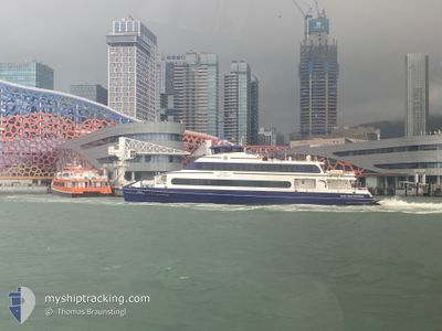
The vessel XUNLONG9 (IMO: 9876684, MMSI: 413217070) is a High speed craft It's sailing under the flag of [CN] China.
In this page you can find informations about the vessels current position, last detected port calls, and current voyage information. If the vessels is not in coverage by AIS you will find the latest position.
The current position of XUNLONG9 is detected by our AIS receivers and we are not responsible for the reliability of the data. The last position was recorded while the vessel was in Coverage by the Ais receivers of our vessel tracking app.
The current draught of XUNLONG9 as reported by AIS is 1.3 meters
Weather
| Temperature | 27.4°C / 81.32°F |
|---|---|
| Wind Speed | 9 knots |
| Direction | 104° ESE |
| Pressure | 1009.2 hPa |
| Humidity | 72.5 % |
| Cloud Coverage | 94 % |


Featured Company
Last Port Calls
| Port | Arrival | Departure | Time In Port |
|---|---|---|---|
| 2025-05-25 19:22 | 2025-05-28 10:13 | 2 d | |
| 2025-05-25 15:03 | 2025-05-25 16:03 | 59 m | |
| 2025-05-24 12:30 | 2025-05-25 08:14 | 19 h | |
| 2025-05-22 17:24 | 2025-05-24 09:12 | 1 d | |
| 2025-05-22 13:12 | 2025-05-22 14:02 | 49 m | |
| 2025-05-21 19:27 | 2025-05-22 10:05 | 14 h | |
| 2025-05-21 15:05 | 2025-05-21 16:04 | 59 m | |
| 2025-05-21 11:27 | 2025-05-21 12:10 | 43 m | |
| 2025-05-20 17:20 | 2025-05-21 08:04 | 14 h | |
| 2025-05-20 13:15 | 2025-05-20 14:02 | 46 m |
Most Visited Ports (Last year)
| Port | Arrivals | |
|---|---|---|
| 1026 | ||
| 221 | ||
| 147 | ||
| 140 |
Last Trips
| Origin | Departure | Destination | Arrival | Distance | |
|---|---|---|---|---|---|
| 2025-05-25 16:03 | 2025-05-25 19:22 | 62.34 nm | |||
| 2025-05-25 08:14 | 2025-05-25 15:03 | 120.52 nm | |||
| 2025-05-24 09:12 | 2025-05-24 12:30 | 60.51 nm | |||
| 2025-05-22 14:02 | 2025-05-22 17:24 | 62.49 nm | |||
| 2025-05-22 10:05 | 2025-05-22 13:12 | 61.00 nm | |||
| 2025-05-21 16:04 | 2025-05-21 19:27 | 61.54 nm | |||
| 2025-05-21 12:10 | 2025-05-21 15:05 | 60.38 nm | |||
| 2025-05-21 08:04 | 2025-05-21 11:27 | 60.83 nm | |||
| 2025-05-20 14:02 | 2025-05-20 17:20 | 63.55 nm | |||
| 2025-05-20 10:10 | 2025-05-20 13:15 | 62.71 nm |
Events
| Time | Event | Details | Position / Dest | Info |
|---|---|---|---|---|
| 2025-05-28 05:17 | Status Changed | Default Under way using engine |
22.47150 / 113.91213
SK-HQ34.9
|
Speed: 27.7 kn Course: 30.1° |
| 2025-05-28 04:46 | Status Changed | Under way using engine Default |
22.32029 / 113.76186
SK-HQ34.9
|
Speed: 22.7 kn Course: 10° |
| 2025-05-28 04:46 | IN Coverage |
22.32128 / 113.76344
South China Sea
|
Speed: 27.1 kn Course: 56.2° |
|
| 2025-05-28 03:59 | START Moving | 4.59 nm, South of MACAU |
22.11521 / 113.54778
SK-HQ34.9
|
Speed: 9.9 kn Course: 168° |
| 2025-05-28 03:34 | STOP Moving | 4.47 nm, South of MACAU |
22.11736 / 113.54677
SK-HQ34.9
|
Speed: Course: 355° |
| 2025-05-28 02:47 | Status Changed | Default Under way using engine |
22.23359 / 113.69605
SK-HQ34.9
|
Speed: 27.8 kn Course: 229.9° |
| 2025-05-28 02:35 | OUT of Coverage |
22.30858 / 113.73633
South China Sea
|
Speed: 27.8 kn Course: 229.9° |
|
| 2025-05-28 02:13 | Status Changed | Under way using engine Default |
22.41332 / 113.87880
SK-HQ34.9
|
Speed: 7.1 kn Course: 199° |
| 2025-05-28 02:13 | START Moving | 2.81 nm, South of CHIWAN |
22.41332 / 113.87880
SK-HQ34.9
|
Speed: 27.5 kn Course: 215° |
| 2025-05-28 02:13 | PORT DEPARTURE |
|
22.41332 / 113.87880
SK-HQ34.9
|
Speed: 7.1 kn Course: 199° |