
YAMAL IRBIS
General Cargo
Current Trip
| Time Travelled | 4 days |
|---|---|
| Remaining Time | --- |
| Distance Travelled | 1070.72 nm |
| Remaining Distance | --- |
| AVG Speed | 10.6 Knots |
| MAX Speed | 20.1 Knots |
| AVG Wind | 11.7 knots |
| MAX Wind | 21 knots |
| MIN Temp | 11.8°C / 53.24°F |
| MAX Temp | 16°C / 60.8°F |
| Draught | 5.8 m |
| Position Received | 4 h, 13 m ago |
Current Position
| Longitude | 14.59057° |
|---|---|
| Latitude | 36.46393° |
| Status | Under way using engine |
| Speed | 11.4 Knots |
| Course | 294.3° |
| Area | Mediterranean Sea - Eastern Basin |
| Station | T-AIS |
| Position Received | 4 h, 13 m ago |
Info
Information
The current position of YAMAL IRBIS is in Mediterranean Sea - Eastern Basin with coordinates 36.46393° / 14.59057° as reported on 2025-02-13 13:17 by AIS to our vessel tracker app. The vessel's current speed is 11.4 Knots and is heading at the port of MURMANSK. The estimated time of arrival as calculated by MyShipTracking vessel tracking app is 2025-03-01 07:00 LT
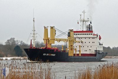
The vessel YAMAL IRBIS (IMO: 8502092, MMSI: 273375620) is a General Cargo that was built in 1998 ( 27 years old ). It's sailing under the flag of [RU] Russia.
In this page you can find informations about the vessels current position, last detected port calls, and current voyage information. If the vessels is not in coverage by AIS you will find the latest position.
The current position of YAMAL IRBIS is detected by our AIS receivers and we are not responsible for the reliability of the data. The last position was recorded while the vessel was in Coverage by the Ais receivers of our vessel tracking app.
The current draught of YAMAL IRBIS as reported by AIS is 5.8 meters
Weather
| Temperature | 15.5°C / 59.9°F |
|---|---|
| Wind Speed | 11 knots |
| Direction | 104° ESE |
| Pressure | 1015.5 hPa |
| Humidity | 85.7 % |
| Cloud Coverage | 100 % |
Featured Company
Last Trips
| Origin | Departure | Destination | Arrival | Distance | |
|---|---|---|---|---|---|
| 2025-01-01 00:52 | 2025-02-04 15:00 | 5660.79 nm | |||
| 2024-12-30 16:14 | 2024-12-30 18:28 | 24.46 nm | |||
| 2024-12-28 01:26 | 2024-12-30 11:43 | 110.31 nm | |||
| 2024-12-27 20:59 | 2024-12-27 23:29 | 10.67 nm | |||
| 2024-12-27 20:59 | 2024-12-27 15:48 | 10.67 nm |
Events
| Time | Event | Details | Position / Dest | Info |
|---|---|---|---|---|
| 2025-02-13 13:28 | Status Changed | Default Under way using engine |
36.47635 / 14.55113
RUMMK
|
Speed: 11.4 kn Course: 294.3° |
| 2025-02-13 13:17 | Change Sea Area | Italian part of the Mediterranean Sea - Eastern Basin Israeli part of the Mediterranean Sea - Eastern Basin |
36.46393 / 14.59057
Mediterranean Sea - Eastern Basin
RUMMK
|
Speed: 11.4 kn Course: 294.3° |
| 2025-02-13 13:17 | Status Changed | Under way using engine Default |
36.46393 / 14.59057
RUMMK
|
Speed: 11.3 kn Course: 295° |
| 2025-02-13 13:17 | OUT of Coverage |
36.46393 / 14.59057
Mediterranean Sea - Eastern Basin
RUMMK
|
Speed: 11.4 kn Course: 294.3° |
|
| 2025-02-13 13:05 | IN Coverage |
36.46393 / 14.59057
Mediterranean Sea - Eastern Basin
RUMMK
|
Speed: 11.4 kn Course: 294.3° |
|
| 2025-02-09 09:03 | Status Changed | Default Under way using engine |
31.90615 / 34.47768
RUMMK
|
Speed: 10.9 kn Course: 295° |
| 2025-02-09 08:55 | OUT of Coverage |
31.89488 / 34.50520
Mediterranean Sea - Eastern Basin
RUMMK
|
Speed: 10.9 kn Course: 295° |
|
| 2025-02-09 08:10 | Status Changed | Under way using engine Moored |
31.85396 / 34.63831
RUMMK
|
Speed: 6.4 kn Course: 325° |
| 2025-02-09 08:08 | PORT DEPARTURE |
|
31.85210 / 34.63923
RUMMK
|
Speed: 6.3 kn Course: 342° |
| 2025-02-09 08:03 | START Moving |
31.84514 / 34.64183
[IL] ASHDOD
|
Speed: 3.1 kn Course: 342° |