
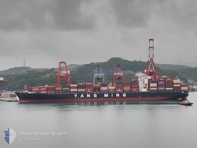
YM UNIFORMITY
Container Ship
Current Trip
TWKHH>TWKEL
| Time Travelled | 1 day |
|---|---|
| Remaining Time | --- |
| Distance Travelled | 332.23 nm |
| Remaining Distance | --- |
| AVG Speed | 10.9 Knots |
| MAX Speed | 19.5 Knots |
| AVG Wind | 21.1 knots |
| MAX Wind | 29 knots |
| MIN Temp | 7.6°C / 45.68°F |
| MAX Temp | 19.2°C / 66.56°F |
| Draught | 12.1 m |
| Position Received | 2 d ago |
Current Position
| Longitude | 121.12140° |
|---|---|
| Latitude | 25.17741° |
| Status | Under way using engine |
| Speed | 18.4 Knots |
| Course | 53.9° |
| Area | South China Sea |
| Station | T-AIS |
| Position Received | 2 d ago |
Info
Information
The current position of YM UNIFORMITY is in South China Sea with coordinates 25.17741° / 121.12140° as reported on 2026-01-04 03:01 by AIS to our vessel tracker app. The vessel's current speed is 18.4 Knots
The vessel YM UNIFORMITY (IMO: 9462691, MMSI: 416468000) is a Container Ship that was built in 2012 ( 14 years old ). It's sailing under the flag of [TW] Taiwan.
In this page you can find informations about the vessels current position, last detected port calls, and current voyage information. If the vessels is not in coverage by AIS you will find the latest position.
The current position of YM UNIFORMITY is detected by our AIS receivers and we are not responsible for the reliability of the data. The last position was recorded while the vessel was in Coverage by the Ais receivers of our vessel tracking app.
The current draught of YM UNIFORMITY as reported by AIS is 12.1 meters
Weather
| Temperature | 8.4°C / 47.12°F |
|---|---|
| Wind Speed | 23 knots |
| Direction | 333° NNW |
| Pressure | 1027.9 hPa |
| Humidity | 59.8 % |
| Cloud Coverage | 30 % |
Featured Company
Last Port Calls
| Port | Arrival | Departure | Time In Port |
|---|---|---|---|
| 2026-01-04 14:20 | 2026-01-05 07:48 | 17 h | |
| 2026-01-02 20:00 | 2026-01-03 13:53 | 17 h | |
| 2025-12-31 19:48 | 2026-01-01 22:40 | 1 d | |
| 2025-12-25 18:50 | 2025-12-27 12:28 | 1 d | |
| 2025-12-22 07:33 | 2025-12-23 05:29 | 21 h | |
| 2025-12-06 19:21 | 2025-12-08 03:53 | 1 d | |
| 2025-11-25 02:56 | 2025-12-01 19:24 | 6 d | |
| 2025-11-07 16:56 | 2025-11-08 15:08 | 22 h | |
| 2025-11-01 10:16 |
Last Trips
| Origin | Departure | Destination | Arrival | Distance | |
|---|---|---|---|---|---|
| 2026-01-03 13:53 | 2026-01-04 14:20 | 234.76 nm | |||
| 2026-01-01 22:40 | 2026-01-02 20:00 | 345.83 nm | |||
| 2025-12-27 12:28 | 2025-12-31 19:48 | 1217.51 nm | |||
| 2025-12-23 05:29 | 2025-12-25 18:50 | 900.46 nm | |||
| 2025-12-08 03:53 | 2025-12-22 07:33 | 4689.70 nm | |||
| 2025-12-01 19:24 | 2025-12-06 19:21 | 425.40 nm | |||
| 2025-11-08 15:08 | 2025-11-25 02:56 | 6582.31 nm | |||
| 2025-11-01 10:16 | 2025-11-07 16:56 | 1477.40 nm |
Events
| Time | Event | Details | Position / Dest | Info |
|---|---|---|---|---|
| 2026-01-06 03:01 | START Moving |
26.08039 / 122.93617
TWKHH>TWKEL
|
Speed: 4.1 kn Course: 321° |
|
| 2026-01-06 01:00 | STOP Moving |
26.09949 / 122.93295
TWKHH>TWKEL
|
Speed: 0.3 kn Course: 277° |
|
| 2026-01-04 23:48 | PORT DEPARTURE |
|
25.17530 / 121.75168
TWKHH>TWKEL
|
Speed: 9.7 kn Course: 338° |
| 2026-01-04 23:41 | START Moving |
25.15439 / 121.75417
[TW] KEELUNG
|
Speed: 3.3 kn Course: 356° |
|
| 2026-01-04 06:36 | STOP Moving |
25.14746 / 121.75362
[TW] KEELUNG
|
Speed: 0.1 kn Course: 171° |
|
| 2026-01-04 06:20 | PORT ARRIVAL |
|
25.15658 / 121.75425
[TW] KEELUNG
|
Speed: 7.7 kn Course: 160° |
| 2026-01-04 03:08 | Status Changed | Default Under way using engine |
25.19761 / 121.15636
TWKHH>TWKEL
|
Speed: 18.4 kn Course: 53.9° |
| 2026-01-04 03:01 | OUT of Coverage |
25.17741 / 121.12140
South China Sea
TWKHH>TWKEL
|
Speed: 18.4 kn Course: 53.9° |
|
| 2026-01-04 02:27 | Status Changed | Under way using engine Default |
25.10796 / 121.01546
TWKHH>TWKEL
|
Speed: 10.7 kn Course: 53° |
| 2026-01-04 02:17 | IN Coverage |
25.10796 / 121.01546
South China Sea
TWKHH>TWKEL
|
Speed: 10.7 kn Course: 52.4° |