
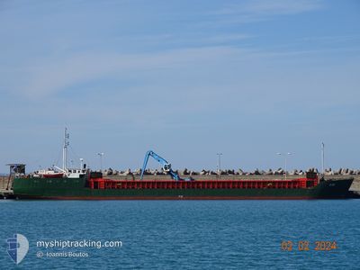
ZOE
General Cargo
Current Trip
| Time Travelled | 12 h, 2 mins |
|---|---|
| Remaining Time | 22 h, 42 mins |
| Distance Travelled | 71.82 nm |
| Remaining Distance | 185.53 nm |
| AVG Speed | 7.7 Knots |
| MAX Speed | 8.4 Knots |
| AVG Wind | 10.5 knots |
| MAX Wind | 14 knots |
| MIN Temp | 18°C / 64.4°F |
| MAX Temp | 22.8°C / 73.04°F |
| Draught | 3.7 m |
| Position Received | 2 h, 44 m ago |
Current Position
| Longitude | 24.55120° |
|---|---|
| Latitude | 37.94911° |
| Status | Under way using engine |
| Speed | 7.8 Knots |
| Course | 28.6° |
| Area | Aegean Sea |
| Station | T-AIS |
| Position Received | 2 h, 44 m ago |
Information
The current position of ZOE is in Aegean Sea with coordinates 37.94911° / 24.55120° as reported on 2025-05-17 13:48 by AIS to our vessel tracker app. The vessel's current speed is 7.8 Knots and is heading at the port of THESSALONIKI. The estimated time of arrival as calculated by MyShipTracking vessel tracking app is 2025-05-18 18:15 LT
The vessel ZOE (IMO: 7822483, MMSI: 240246000) is a General Cargo that was built in 1979 ( 46 years old ). It's sailing under the flag of [GR] Greece.
In this page you can find informations about the vessels current position, last detected port calls, and current voyage information. If the vessels is not in coverage by AIS you will find the latest position.
The current position of ZOE is detected by our AIS receivers and we are not responsible for the reliability of the data. The last position was recorded while the vessel was in Coverage by the Ais receivers of our vessel tracking app.
The current draught of ZOE as reported by AIS is 3.7 meters
Weather
| Temperature | 17.1°C / 62.78°F |
|---|---|
| Wind Speed | 9 knots |
| Direction | 82° E |
| Pressure | 1012.8 hPa |
| Humidity | 84.4 % |
| Cloud Coverage | 4 % |
Featured Company
Last Port Calls
| Port | Arrival | Departure | Time In Port |
|---|---|---|---|
| 2025-05-13 12:21 | 2025-05-17 07:31 | 3 d | |
| 2025-05-07 11:42 | 2025-05-12 12:02 | 5 d | |
| 2025-04-17 11:27 | 2025-05-03 07:32 | 15 d | |
| 2025-04-14 12:18 | 2025-04-16 11:26 | 1 d | |
| 2025-04-04 05:08 | 2025-04-12 16:16 | 8 d | |
| 2025-03-31 09:14 | 2025-04-02 19:10 | 2 d | |
| 2025-03-21 23:00 | 2025-03-29 05:06 | 7 d | |
| 2025-03-15 08:26 | 2025-03-20 11:37 | 5 d | |
| 2025-03-08 07:21 | 2025-03-13 17:28 | 5 d | |
| 2025-03-03 08:57 | 2025-03-06 12:37 | 3 d |
Most Visited Ports (Last year)
| Port | Arrivals | |
|---|---|---|
| 24 | ||
| 16 | ||
| 9 | ||
| 8 | ||
| 2 | ||
| 1 |
Last Trips
| Origin | Departure | Destination | Arrival | Distance | |
|---|---|---|---|---|---|
| 2025-05-12 12:02 | 2025-05-13 12:21 | 191.31 nm | |||
| 2025-05-03 07:32 | 2025-05-07 11:42 | 196.91 nm | |||
| 2025-04-16 11:26 | 2025-04-17 11:27 | 191.94 nm | |||
| 2025-04-12 16:16 | 2025-04-14 12:18 | 288.56 nm | |||
| 2025-04-02 19:10 | 2025-04-04 05:08 | 279.26 nm | |||
| 2025-03-29 05:06 | 2025-03-31 09:14 | 280.38 nm | |||
| 2025-03-20 11:37 | 2025-03-21 23:00 | 283.00 nm | |||
| 2025-03-13 17:28 | 2025-03-15 08:26 | 281.42 nm | |||
| 2025-03-06 12:37 | 2025-03-08 07:21 | 280.32 nm | |||
| 2025-03-01 17:37 | 2025-03-03 08:57 | 313.59 nm |
Events
| Time | Event | Details | Position / Dest | Info |
|---|---|---|---|---|
| 2025-05-17 13:53 | Status Changed | Default Under way using engine |
37.95773 / 24.55715
GRSKG
|
Speed: 7.8 kn Course: 28.6° |
| 2025-05-17 13:48 | OUT of Coverage |
37.94911 / 24.55120
Aegean Sea
GRSKG
|
Speed: 7.8 kn Course: 28.6° |
|
| 2025-05-17 11:59 | ETA Changed | 2025/05/18 15:00 2025/05/18 17:00 |
37.79516 / 24.33350
GRSKG
|
Speed: 8.1 kn Course: 51.2° |
| 2025-05-17 11:45 | ETA Changed | 2025/05/18 17:00 2025/05/18 18:00 |
37.77535 / 24.30154
GRSKG
|
Speed: 8.3 kn Course: 52.7° |
| 2025-05-17 09:48 | Draught Changed | 3.7 3 |
37.63514 / 24.03518
GRSKG
|
Speed: 7.9 kn Course: 88.4° |
| 2025-05-17 09:48 | ETA Changed | 2025/05/18 18:00 |
37.63514 / 24.03518
GRSKG
|
Speed: 7.9 kn Course: 88.4° |
| 2025-05-17 09:38 | Status Changed | Under way using engine Default |
37.63550 / 24.00602
GRSKG
|
Speed: 8 kn Course: 91° |
| 2025-05-17 09:38 | IN Coverage |
37.63533 / 24.01161
Aegean Sea
|
Speed: 8 kn Course: 92° |
|
| 2025-05-17 08:39 | Status Changed | Default Under way using engine |
37.64716 / 23.84265
GRSKG
|
Speed: 7.6 kn Course: 95° |
| 2025-05-17 08:27 | OUT of Coverage |
37.64892 / 23.81227
Aegean Sea
|
Speed: 7.6 kn Course: 95° |