

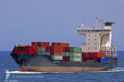
ADMIRAL STAR
Container Ship

Current Trip
| Time Travelled | 1 day |
|---|---|
| Remaining Time | 15 h, 48 mins |
| Distance Travelled | 438.10 nm |
| Remaining Distance | 241.47 nm |
| AVG Speed | 14.2 Knots |
| MAX Speed | 15 Knots |
| AVG Wind | 5.9 knots |
| MAX Wind | 14 knots |
| MIN Temp | 13.1°C / 55.58°F |
| MAX Temp | 16.9°C / 62.42°F |
| Dybgang | 8.5 m |
| Position Modtaget | 1 h, 30 m siden |
Current Position
| Longitude | 27.42433° |
|---|---|
| Latitude | 36.02050° |
| Status | Under way using engine |
| Fart | 14.4 Knots |
| Kurs | 313° |
| Område | Aegean Sea |
| Station | T-AIS |
| Position Modtaget | 1 h, 30 m siden |
Information
The current position of ADMIRAL STAR is in Aegean Sea with coordinates 36.02050° / 27.42433° as reported on 2025-03-06 03:05 by AIS to our vessel tracker app. The vessel's current speed is 14.4 Knots and is heading at the port of ALIAGA. The estimated time of arrival as calculated by MyShipTracking vessel tracking app is 2025-03-06 20:24 LT
The vessel ADMIRAL STAR (IMO: 9360972, MMSI: 636021459) is a Container Ship that was built in 2006 ( 19 år gamle ). It's sailing under the flag of [LR] Liberia.
In this page you can find informations about the vessels current position, last detected port calls, and current voyage information. If the vessels is not in coverage by AIS you will find the latest position.
The current position of ADMIRAL STAR is detected by our AIS receivers and we are not responsible for the reliability of the data. The last position was recorded while the vessel was in Coverage by the Ais receivers of our vessel tracking app.
The current draught of ADMIRAL STAR as reported by AIS is 8.5 meters
Weather
| Temperature | 16.1°C / 60.98°F |
|---|---|
| Wind Speed | 14 knots |
| Direction | 348° NNW |
| Pressure | 1021.7 hPa |
| Humidity | 69.5 % |
| Cloud Coverage | 28 % |


Featured Company
Last Port Calls
| Port | Arrival | Departure | Time In Port |
|---|---|---|---|
| 2025-03-03 20:54 | 2025-03-04 20:29 | 23 h | |
| 2025-03-01 06:04 | 2025-03-01 13:49 | 7 h | |
| 2025-02-26 21:33 | 2025-02-27 02:02 | 4 h | |
| 2025-02-26 07:47 | 2025-02-26 15:40 | 7 h | |
| 2025-02-23 11:17 | |||
| 2025-02-14 23:00 | 2025-02-15 13:42 | 14 h | |
| 2025-02-10 18:25 | 2025-02-11 15:59 | 21 h | |
| 2025-02-08 15:33 | 2025-02-08 20:53 | 5 h | |
| 2025-02-07 13:56 | 2025-02-07 22:20 | 8 h | |
| 2025-02-07 01:22 | 2025-02-07 09:02 | 7 h |
Most Visited Ports (Last year)
| Port | Arrivals | |
|---|---|---|
| 28 | ||
| 25 | ||
| 18 | ||
| 16 | ||
| 14 | ||
| 10 |
Last Trips
| Origin | Departure | Destination | Arrival | Distance | |
|---|---|---|---|---|---|
| 2025-03-01 15:49 | 2025-03-03 22:54 | 275.14 nm | |||
| 2025-02-27 05:02 | 2025-03-01 08:04 | 774.58 nm | |||
| 2025-02-26 18:40 | 2025-02-27 00:33 | 73.12 nm | |||
| 2025-02-23 14:17 | 2025-02-26 10:47 | 588.81 nm | |||
| 2025-02-11 17:59 | 2025-02-15 01:00 | 278.43 nm | |||
| 2025-02-08 23:53 | 2025-02-10 20:25 | 681.97 nm | |||
| 2025-02-08 01:20 | 2025-02-08 18:33 | 258.83 nm | |||
| 2025-02-07 12:02 | 2025-02-07 16:56 | 57.98 nm | |||
| 2025-02-06 21:42 | 2025-02-07 04:22 | 72.62 nm | |||
| 2025-01-30 22:57 | 2025-02-06 16:26 | 1369.79 nm |
Events
| Tid | Hændelsen | Detaljer | Position / Dest | Info |
|---|---|---|---|---|
| 2025-03-06 03:05 | Udenfor Dækning |
36.02050 / 27.42433
Aegean Sea
TRALI
|
Fart: 14.4 kn Kurs: 313° |
|
| 2025-03-06 02:13 | Fundet i havområde | Greek part of the Aegean Sea |
35.88817 / 27.61733
Aegean Sea
TRALI
|
Fart: 14.2 kn Kurs: 311° |
| 2025-03-05 22:40 | Fundet i havområde | Greek part of the Mediterranean Sea - Eastern Basin |
35.41600 / 28.45350
Mediterranean Sea - Eastern Basin
TRALI
|
Fart: 14.4 kn Kurs: 305° |
| 2025-03-05 22:39 | Indenfor Dækning |
35.41600 / 28.45350
Mediterranean Sea - Eastern Basin
TRALI
|
Fart: 14.4 kn Kurs: 305° |
|
| 2025-03-04 21:13 | Status er ændret | Default Under way using engine |
31.89400 / 34.45133
TRALI
|
Fart: 14.8 kn Kurs: 287° |
| 2025-03-04 21:10 | Udenfor Dækning |
31.89017 / 34.46466
Mediterranean Sea - Eastern Basin
TRALI
|
Fart: 14.8 kn Kurs: 287° |
|
| 2025-03-04 20:48 | ETA er ændret | 2025/03/06 19:00 2025/03/06 18:00 |
31.86500 / 34.56650
TRALI
|
Fart: 15 kn Kurs: 283° |
| 2025-03-04 20:41 | ETA er ændret | 2025/03/06 18:00 2025/03/06 20:00 |
31.85967 / 34.59900
TRALI
|
Fart: 14.7 kn Kurs: 273° |
| 2025-03-04 20:29 | Afsejlet fra sidste havn |
|
31.85067 / 34.64083
TRALI
|
Fart: 9.1 kn Kurs: 356° |
| 2025-03-04 20:17 | START Sejllads |
31.83350 / 34.64333
[IL] ASHDOD
|
Fart: 4.1 kn Kurs: 312° |