
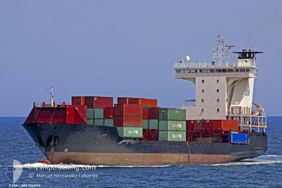
ADMIRAL STAR
Container Ship
Current Trip
| Time Travelled | 1 day |
|---|---|
| Remaining Time | 22 h, 10 mins |
| Distance Travelled | 426.41 nm |
| Remaining Distance | 321.09 nm |
| AVG Speed | 13.9 Noeuds |
| MAX Speed | 15.7 Noeuds |
| AVG Wind | 5.4 knots |
| MAX Wind | 12.3 knots |
| MIN Temp | 7.7°C / 45.86°F |
| MAX Temp | 15.2°C / 59.36°F |
| Tirant d eau | 8.5 m |
| Position reçue | 17 h, 24 m depuis |
Current Position
| Longitude | 29.29400° |
|---|---|
| Latitude | 41.28433° |
| Etat | Under way using engine |
| Vitesse | 11.2 Noeuds |
| Parcours | 75° |
| Zone | Black Sea |
| Station | T-AIS |
| Position reçue | 17 h, 24 m depuis |
Info
Information
The current position of ADMIRAL STAR is in Black Sea with coordinates 41.28433° / 29.29400° as reported on 2025-01-31 16:38 by AIS to our vessel tracker app. The vessel's current speed is 11.2 Noeuds and is heading at the port of NOVOROSSIYSK. The estimated time of arrival as calculated by MyShipTracking vessel tracking app is 2025-02-02 08:12 LT
The vessel ADMIRAL STAR (IMO: 9360972, MMSI: 636021459) is a Container Ship that was built in 2006 ( 19 Age ). It's sailing under the flag of [LR] Liberia.
In this page you can find informations about the vessels current position, last detected port calls, and current voyage information. If the vessels is not in coverage by AIS you will find the latest position.
The current position of ADMIRAL STAR is detected by our AIS receivers and we are not responsible for the reliability of the data. The last position was recorded while the vessel was in Coverage by the Ais receivers of our vessel tracking app.
The current draught of ADMIRAL STAR as reported by AIS is 8.5 meters
Weather
| Temperature | 10.6°C / 51.08°F |
|---|---|
| Wind Speed | 5 knots |
| Direction | 272° W |
| Pressure | 1026.3 hPa |
| Humidity | 72 % |
| Cloud Coverage | 100 % |
Featured Company
Last Port Calls
| Port | Arrival | Departure | Time In Port |
|---|---|---|---|
| 2025-01-30 10:09 | 2025-01-30 19:57 | 9 h | |
| 2025-01-28 00:13 | 2025-01-28 12:05 | 11 h | |
| 2025-01-26 17:58 | 2025-01-27 05:37 | 11 h | |
| 2025-01-23 13:58 | 2025-01-23 21:46 | 7 h | |
| 2025-01-22 13:47 | 2025-01-22 21:26 | 7 h | |
| 2025-01-13 13:12 | 2025-01-14 06:13 | 17 h | |
| 2025-01-10 05:14 | 2025-01-10 16:36 | 11 h | |
| 2025-01-08 14:54 | 2025-01-09 08:06 | 17 h | |
| 2025-01-05 10:05 | 2025-01-06 10:49 | 1 d | |
| 2024-12-31 20:50 | 2025-01-01 12:16 | 15 h |
Most Visited Ports (Last year)
| Port | Arrivals | |
|---|---|---|
| 27 | ||
| 24 | ||
| 19 | ||
| 16 | ||
| 13 | ||
| 10 |
Last Trips
| Origin | Departure | Destination | Arrival | Distance | |
|---|---|---|---|---|---|
| 2025-01-28 14:05 | 2025-01-30 13:09 | 682.92 nm | |||
| 2025-01-27 07:37 | 2025-01-28 02:13 | 264.01 nm | |||
| 2025-01-24 00:46 | 2025-01-26 19:58 | 726.37 nm | |||
| 2025-01-23 00:26 | 2025-01-23 16:58 | 48.82 nm | |||
| 2025-01-14 09:13 | 2025-01-22 16:47 | 830.39 nm | |||
| 2025-01-10 18:36 | 2025-01-13 16:12 | 730.78 nm | |||
| 2025-01-09 10:06 | 2025-01-10 07:14 | 267.66 nm | |||
| 2025-01-06 12:49 | 2025-01-08 16:54 | 272.30 nm | |||
| 2025-01-01 15:16 | 2025-01-05 12:05 | 790.06 nm | |||
| 2024-12-29 13:06 | 2024-12-31 23:50 | 582.60 nm |
Events
| Heure | Evenement | Détails | Position/ Destination | Info |
|---|---|---|---|---|
| 2025-01-31 16:46 | Etat Changé | Default Under way using engine |
41.29100 / 29.32700
RUNVS
|
Vitesse: 11.2 kn Parcours: 75° |
| 2025-01-31 16:38 | Hors de la zone couverte |
41.28433 / 29.29400
Black Sea
RUNVS
|
Vitesse: 11.2 kn Parcours: 75° |
|
| 2025-01-31 16:00 | Changement de zone | Turkish part of the Black Sea Turkish part of the Sea of Marmara |
41.23284 / 29.14517
Black Sea
RUNVS
|
Vitesse: 12.7 kn Parcours: 39° |
| 2025-01-31 15:22 | Etat Changé | Under way using engine Default |
41.13766 / 29.06950
RUNVS
|
Vitesse: 12.8 kn Parcours: 324° |
| 2025-01-31 15:21 | Etat Changé | Default Under way using engine |
41.13483 / 29.07217
RUNVS
|
Vitesse: 3.2 kn Parcours: 323° |
| 2025-01-31 12:49 | Etat Changé | Under way using engine Default |
40.83250 / 28.63183
RUNVS
|
Vitesse: 15.4 kn Parcours: 79° |
| 2025-01-31 12:49 | Dans la zone couverte |
40.83250 / 28.63183
Sea of Marmara
RUNVS
|
Vitesse: 14.8 kn Parcours: 78° |
|
| 2025-01-31 10:46 | Etat Changé | Default Under way using engine |
40.76150 / 27.95350
RUNVS
|
Vitesse: 14.9 kn Parcours: 82° |
| 2025-01-31 10:39 | Hors de la zone couverte |
40.75750 / 27.91500
Sea of Marmara
RUNVS
|
Vitesse: 14.9 kn Parcours: 82° |
|
| 2025-01-31 08:48 | Etat Changé | Under way using engine Default |
40.63133 / 27.34250
RUNVS
|
Vitesse: 14.8 kn Parcours: 66° |