

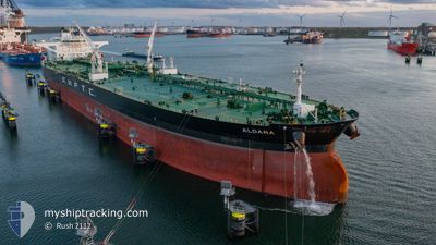
ALDANA
Tanker

Current Trip
| Time Travelled | 31 days |
|---|---|
| Remaining Time | 3 days |
| Distance Travelled | 8555.44 nm |
| Remaining Distance | 1325.24 nm |
| AVG Speed | 11.6 Knots |
| MAX Speed | 11.6 Knots |
| AVG Wind | 11.6 knots |
| MAX Wind | 24 knots |
| MIN Temp | 19.7°C / 67.46°F |
| MAX Temp | 36°C / 96.8°F |
| Dybgang | 16.1 m |
| Position Modtaget | 18 h, 44 m siden |
Current Position
| Longitude | 26.66414° |
|---|---|
| Latitude | 33.34739° |
| Status | Under way using engine |
| Fart | 13.7 Knots |
| Kurs | 286.7° |
| Område | Mediterranean Sea - Eastern Basin |
| Station | T-AIS |
| Position Modtaget | 18 h, 44 m siden |
Information
The current position of ALDANA is in Mediterranean Sea - Eastern Basin with coordinates 33.34739° / 26.66414° as reported on 2025-05-28 18:08 by AIS to our vessel tracker app. The vessel's current speed is 13.7 Knots and is heading at the port of FOS. The estimated time of arrival as calculated by MyShipTracking vessel tracking app is 2025-06-01 21:03 LT
The vessel ALDANA (IMO: 9809368, MMSI: 372616000) is a Tanker It's sailing under the flag of [PA] Panama.
In this page you can find informations about the vessels current position, last detected port calls, and current voyage information. If the vessels is not in coverage by AIS you will find the latest position.
The current position of ALDANA is detected by our AIS receivers and we are not responsible for the reliability of the data. The last position was recorded while the vessel was in Coverage by the Ais receivers of our vessel tracking app.
The current draught of ALDANA as reported by AIS is 16.1 meters
Weather
| Temperature | 20.2°C / 68.36°F |
|---|---|
| Wind Speed | 15 knots |
| Direction | 282° WNW |
| Pressure | 1014.3 hPa |
| Humidity | 85.1 % |
| Cloud Coverage | 85 % |


Featured Company
Last Port Calls
| Port | Arrival | Departure | Time In Port |
|---|---|---|---|
| 2025-05-27 08:17 | 2025-05-27 17:22 | 9 h | |
| 2025-04-25 09:54 | 2025-04-28 07:06 | 2 d |
Most Visited Ports (Last year)
| Port | Arrivals | |
|---|---|---|
| 3 | ||
| 2 | ||
| 2 | ||
| 2 | ||
| 1 | ||
| 1 |
Last Trips
| Origin | Departure | Destination | Arrival | Distance | |
|---|---|---|---|---|---|
| 2025-04-28 07:06 | 2025-05-27 08:17 | 7914.63 nm |
Events
| Tid | Hændelsen | Detaljer | Position / Dest | Info |
|---|---|---|---|---|
| 2025-05-28 18:11 | Status er ændret | Default Under way using engine |
33.35125 / 26.64889
FOS
|
Fart: 13.7 kn Kurs: 286.7° |
| 2025-05-28 18:08 | Udenfor Dækning |
33.34739 / 26.66414
Mediterranean Sea - Eastern Basin
FOS
|
Fart: 13.7 kn Kurs: 286.7° |
|
| 2025-05-28 18:03 | Ændre havområde | Greek part of the Mediterranean Sea - Eastern Basin Egyptian part of the Mediterranean Sea - Eastern Basin |
33.34181 / 26.68668
Mediterranean Sea - Eastern Basin
FOS
|
Fart: 13.7 kn Kurs: 286.4° |
| 2025-05-28 18:02 | Status er ændret | Under way using engine Default |
33.34089 / 26.69033
FOS
|
Fart: 13.8 kn Kurs: 288° |
| 2025-05-28 17:51 | Indenfor Dækning |
33.34181 / 26.68668
Mediterranean Sea - Eastern Basin
FOS
|
Fart: 13.7 kn Kurs: 286.4° |
|
| 2025-05-28 14:41 | Status er ændret | Default Under way using engine |
33.13410 / 27.54882
FOS
|
Fart: 13.3 kn Kurs: 284.6° |
| 2025-05-28 14:34 | Udenfor Dækning |
33.12716 / 27.57952
Mediterranean Sea - Eastern Basin
FOS
|
Fart: 13.3 kn Kurs: 284.6° |
|
| 2025-05-28 14:01 | Status er ændret | Under way using engine Default |
33.09637 / 27.71858
FOS
|
Fart: 13.1 kn Kurs: 285° |
| 2025-05-28 13:48 | Status er ændret | Default Under way using engine |
33.08369 / 27.77387
FOS
|
Fart: 13.2 kn Kurs: 286.1° |
| 2025-05-28 13:42 | Status er ændret | Under way using engine Default |
33.07715 / 27.79972
FOS
|
Fart: 13.2 kn Kurs: 291° |