
ARCTIC
Replenishment Vessel
Current Trip
| Trip Time | --- |
|---|---|
| Trip Distance | --- |
| AVG Speed | --- |
| MAX Speed | --- |
| Dybgang | --- |
| AVG Wind | --- |
| MAX Wind | --- |
| MIN Temp | --- |
| MAX Temp | --- |
| Position Modtaget | 1 d siden |
Current Position
| Longitude | 24.10978° |
|---|---|
| Latitude | 35.50473° |
| Status | Under way using engine |
| Fart | |
| Kurs | 137° |
| Område | Aegean Sea |
| Station | T-AIS |
| Position Modtaget | 1 d siden |
Info
Information
The current position of ARCTIC is in Aegean Sea with coordinates 35.50473° / 24.10978° as reported on 2025-02-13 07:17 by AIS to our vessel tracker app. The vessel's current speed is 0 Knots and is currently inside the port of SOUDA.
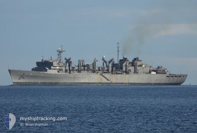
The vessel ARCTIC (IMO: 8644034, MMSI: 338995000) is a Replenishment Vessel that was built in 1992 ( 33 år gamle ). It's sailing under the flag of [US] USA.
In this page you can find informations about the vessels current position, last detected port calls, and current voyage information. If the vessels is not in coverage by AIS you will find the latest position.
The current position of ARCTIC is detected by our AIS receivers and we are not responsible for the reliability of the data. The last position was recorded while the vessel was in Coverage by the Ais receivers of our vessel tracking app.
The current draught of ARCTIC as reported by AIS is 11 meters
Weather
| Temperature | 9.3°C / 48.74°F |
|---|---|
| Wind Speed | 4 knots |
| Direction | 111° ESE |
| Pressure | 1027.4 hPa |
| Humidity | 62.3 % |
| Cloud Coverage | 82 % |
Featured Company
Last Port Calls
| Port | Arrival | Departure | Time In Port |
|---|---|---|---|
| 2025-02-13 08:03 | |||
| 2025-02-08 09:05 | |||
| 2025-02-05 06:38 | 2025-02-05 15:29 | 8 h | |
| 2025-01-05 10:14 | |||
| 2024-12-29 16:24 | |||
| 2024-12-23 09:21 | 2024-12-25 08:54 | 1 d | |
| 2024-12-17 06:24 | 2024-12-17 15:33 | 9 h | |
| 2024-12-11 09:44 | |||
| 2024-12-07 11:02 |
Events
| Tid | Hændelsen | Detaljer | Position / Dest | Info |
|---|---|---|---|---|
| 2025-02-13 07:17 | Udenfor Dækning |
35.50473 / 24.10978
Aegean Sea
[GR] SOUDA
|
Fart: Kurs: 52.4° |
|
| 2025-02-13 06:39 | STOP Sejllads |
35.50462 / 24.10940
[GR] SOUDA
|
Fart: 0.2 kn Kurs: 120° |
|
| 2025-02-13 06:03 | Skibe i havn |
|
35.48831 / 24.11549
[GR] SOUDA
|
Fart: 4.6 kn Kurs: 283° |
| 2025-02-13 05:13 | Ændre havområde | Greek part of the Aegean Sea Egyptian part of the Gulf of Suez |
35.49124 / 24.21864
Aegean Sea
|
Fart: 8.3 kn Kurs: 251.1° |
| 2025-02-13 05:13 | Indenfor Dækning |
35.49124 / 24.21864
Aegean Sea
|
Fart: 8.3 kn Kurs: 251.1° |
|
| 2025-02-08 08:44 | STOP Sejllads |
37.23640 / 15.19979
[IT] AUGUSTA
|
Fart: 0.3 kn Kurs: 43° |
|
| 2025-02-08 08:05 | Skibe i havn |
|
37.19667 / 15.22993
[IT] AUGUSTA
|
Fart: 10.6 kn Kurs: 271° |
| 2025-02-05 13:29 | Afsejlet fra sidste havn |
|
31.23552 / 32.34817
|
Fart: 12.1 kn Kurs: 13° |
| 2025-02-05 06:04 | Status er ændret | Default Under way using engine |
30.14660 / 32.56985
[EG] SUEZ CANAL
|
Fart: 8.8 kn Kurs: 358° |
| 2025-02-05 05:50 | Udenfor Dækning |
30.11207 / 32.57064
Gulf of Suez
[EG] SUEZ CANAL
|
Fart: 8.8 kn Kurs: 358.3° |