
ATLANTIC SEA
Cargo A
Current Trip
| Time Travelled | 14 h, 43 mins |
|---|---|
| Remaining Time | 1 day |
| Distance Travelled | 253.64 nm |
| Remaining Distance | 738.32 nm |
| AVG Speed | 15 Knots |
| MAX Speed | 21.5 Knots |
| AVG Wind | 8.7 knots |
| MAX Wind | 16.7 knots |
| MIN Temp | 5.3°C / 41.54°F |
| MAX Temp | 8.5°C / 47.3°F |
| Dybgang | 8.5 m |
| Position Modtaget | 2 h, 29 m siden |
Current Position
| Longitude | -6.00031° |
|---|---|
| Latitude | 51.26250° |
| Status | Under way using engine |
| Fart | 18.6 Knots |
| Kurs | 180.6° |
| Område | Celtic Sea |
| Station | T-AIS |
| Position Modtaget | 2 h, 29 m siden |
Info
Information
The current position of ATLANTIC SEA is in Celtic Sea with coordinates 51.26250° / -6.00031° as reported on 2025-03-03 12:03 by AIS to our vessel tracker app. The vessel's current speed is 18.6 Knots and is heading at the port of HAMBURG. The estimated time of arrival as calculated by MyShipTracking vessel tracking app is 2025-03-05 06:13 LT
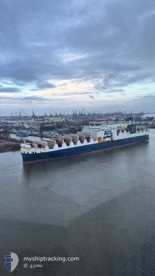
The vessel ATLANTIC SEA (IMO: 9670597, MMSI: 215800000) is a Cargo A It's sailing under the flag of [MT] Malta.
In this page you can find informations about the vessels current position, last detected port calls, and current voyage information. If the vessels is not in coverage by AIS you will find the latest position.
The current position of ATLANTIC SEA is detected by our AIS receivers and we are not responsible for the reliability of the data. The last position was recorded while the vessel was in Coverage by the Ais receivers of our vessel tracking app.
The current draught of ATLANTIC SEA as reported by AIS is 8.5 meters
Weather
| Temperature | 7.9°C / 46.22°F |
|---|---|
| Wind Speed | 6 knots |
| Direction | 87° E |
| Pressure | 1028.9 hPa |
| Humidity | 64.3 % |
| Cloud Coverage | 12 % |
Featured Company
Last Port Calls
| Port | Arrival | Departure | Time In Port |
|---|---|---|---|
| 2025-02-28 22:07 | 2025-03-02 23:49 | 2 d | |
| 2025-02-21 20:37 | 2025-02-22 05:31 | 8 h | |
| 2025-02-19 10:18 | 2025-02-19 18:28 | 8 h | |
| 2025-02-15 21:10 | 2025-02-18 00:17 | 2 d | |
| 2025-02-15 11:38 | 2025-02-15 20:57 | 9 h | |
| 2025-02-12 18:34 | 2025-02-14 03:02 | 1 d | |
| 2025-02-10 19:39 | 2025-02-11 05:28 | 9 h | |
| 2025-02-01 23:04 | 2025-02-03 01:54 | 1 d | |
| 2025-01-29 18:56 | 2025-01-31 01:39 | 1 d | |
| 2025-01-27 18:46 | 2025-01-28 16:19 | 21 h |
Last Trips
| Origin | Departure | Destination | Arrival | Distance | |
|---|---|---|---|---|---|
| 2025-02-22 01:31 | 2025-02-28 22:07 | 2543.38 nm | |||
| 2025-02-19 13:28 | 2025-02-21 16:37 | 776.19 nm | |||
| 2025-02-17 19:17 | 2025-02-19 05:18 | 213.08 nm | |||
| 2025-02-15 15:57 | 2025-02-15 16:10 | 0.16 nm | |||
| 2025-02-13 22:02 | 2025-02-15 06:38 | 416.90 nm | |||
| 2025-02-11 01:28 | 2025-02-12 13:34 | 585.23 nm | |||
| 2025-02-03 01:54 | 2025-02-10 15:39 | 2682.71 nm | |||
| 2025-01-31 02:39 | 2025-02-01 23:04 | 703.28 nm | |||
| 2025-01-28 17:19 | 2025-01-29 19:56 | 401.22 nm | |||
| 2025-01-25 07:30 | 2025-01-27 19:46 | 1003.83 nm |
Events
| Tid | Hændelsen | Detaljer | Position / Dest | Info |
|---|---|---|---|---|
| 2025-03-03 12:08 | Status er ændret | Default Under way using engine |
51.23659 / -6.00089
GBLIV > DEHAM
|
Fart: 18.6 kn Kurs: 180.6° |
| 2025-03-03 12:03 | Udenfor Dækning |
51.26250 / -6.00031
Celtic Sea
GBLIV > DEHAM
|
Fart: 18.6 kn Kurs: 180.6° |
|
| 2025-03-03 11:58 | Ændre havområde | United Kingdom part of the Celtic Sea United Kingdom part of the Irish Sea and St. George's Channel |
51.28687 / -5.99998
Celtic Sea
GBLIV > DEHAM
|
Fart: 18.5 kn Kurs: 178.9° |
| 2025-03-03 11:58 | Status er ændret | Under way using engine Default |
51.28885 / -6.00004
GBLIV > DEHAM
|
Fart: 18.4 kn Kurs: 179° |
| 2025-03-03 11:46 | Indenfor Dækning |
51.28687 / -5.99998
Celtic Sea
GBLIV > DEHAM
|
Fart: 18.5 kn Kurs: 178.9° |
|
| 2025-03-03 06:20 | Status er ændret | Default Under way using engine |
52.80510 / -5.29690
GBLIV > DEHAM
|
Fart: 20.3 kn Kurs: 200.2° |
| 2025-03-03 06:13 | Udenfor Dækning |
52.84245 / -5.27433
Irish Sea and St. George's Channel
GBLIV > DEHAM
|
Fart: 20.3 kn Kurs: 200.2° |
|
| 2025-03-03 06:12 | Status er ændret | Under way using engine Default |
52.84307 / -5.27395
GBLIV > DEHAM
|
Fart: 20.3 kn Kurs: 200° |
| 2025-03-03 06:08 | Status er ændret | Default Under way using engine |
52.86914 / -5.25822
GBLIV > DEHAM
|
Fart: 20.6 kn Kurs: 201.4° |
| 2025-03-03 05:33 | Status er ændret | Under way using engine Default |
53.05518 / -5.13724
GBLIV > DEHAM
|
Fart: 20.6 kn Kurs: 202° |