

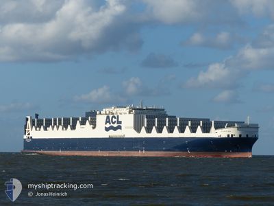
ATLANTIC SEA
Cargo A
Current Trip
| Time Travelled | 1 day |
|---|---|
| Remaining Time | 56 mins |
| Distance Travelled | 764.70 nm |
| Remaining Distance | 14.62 nm |
| AVG Speed | 15.1 Noeuds |
| MAX Speed | 18.4 Noeuds |
| AVG Wind | 8.1 knots |
| MAX Wind | 16.6 knots |
| MIN Temp | 10.5°C / 50.9°F |
| MAX Temp | 27.5°C / 81.5°F |
| Tirant d eau | 9 m |
| Position reçue | Maintenant |
Current Position
| Longitude | -63.42372° |
|---|---|
| Latitude | 44.42019° |
| Etat | Under way using engine |
| Vitesse | 9.7 Noeuds |
| Parcours | 329.3° |
| Zone | North Atlantic Ocean |
| Station | T-AIS |
| Position reçue | Maintenant |
Information
The current position of ATLANTIC SEA is in North Atlantic Ocean with coordinates 44.42019° / -63.42372° as reported on 2025-06-08 18:22 by AIS to our vessel tracker app. The vessel's current speed is 9.7 Noeuds and is heading at the port of HALIFAX. The estimated time of arrival as calculated by MyShipTracking vessel tracking app is 2025-06-08 16:19 LT
The vessel ATLANTIC SEA (IMO: 9670597, MMSI: 215800000) is a Cargo A It's sailing under the flag of [MT] Malta.
In this page you can find informations about the vessels current position, last detected port calls, and current voyage information. If the vessels is not in coverage by AIS you will find the latest position.
The current position of ATLANTIC SEA is detected by our AIS receivers and we are not responsible for the reliability of the data. The last position was recorded while the vessel was in Coverage by the Ais receivers of our vessel tracking app.
The current draught of ATLANTIC SEA as reported by AIS is 9 meters
Weather
| Temperature | 16.9°C / 62.42°F |
|---|---|
| Wind Speed | 11 knots |
| Direction | 348° NNW |
| Pressure | 1009.5 hPa |
| Humidity | 49.6 % |
| Cloud Coverage | 42 % |
Featured Company
Last Port Calls
| Port | Arrival | Departure | Time In Port |
|---|---|---|---|
| 2025-06-06 07:26 | 2025-06-06 16:00 | 8 h | |
| 2025-06-04 16:38 | 2025-06-05 20:36 | 1 d | |
| 2025-06-04 03:45 | 2025-06-04 16:22 | 12 h | |
| 2025-06-01 09:21 | 2025-06-03 01:13 | 1 d | |
| 2025-05-29 15:35 | 2025-05-30 01:36 | 10 h | |
| 2025-05-20 15:06 | 2025-05-22 06:05 | 1 d | |
| 2025-05-16 22:36 | 2025-05-18 19:06 | 1 d | |
| 2025-05-13 23:00 | 2025-05-15 17:08 | 1 d | |
| 2025-05-05 05:31 | 2025-05-05 17:38 | 12 h | |
| 2025-05-02 03:47 | 2025-05-02 16:00 | 12 h |
Last Trips
| Origin | Departure | Destination | Arrival | Distance | |
|---|---|---|---|---|---|
| 2025-06-05 20:36 | 2025-06-06 07:26 | 162.40 nm | |||
| 2025-06-04 16:22 | 2025-06-04 16:38 | 0.48 nm | |||
| 2025-06-03 01:13 | 2025-06-04 03:45 | 420.44 nm | |||
| 2025-05-30 01:36 | 2025-06-01 09:21 | 644.00 nm | |||
| 2025-05-22 06:05 | 2025-05-29 15:35 | 2801.55 nm | |||
| 2025-05-18 19:06 | 2025-05-20 15:06 | 706.48 nm | |||
| 2025-05-15 17:08 | 2025-05-16 22:36 | 402.39 nm | |||
| 2025-05-05 17:38 | 2025-05-13 23:00 | 3326.95 nm | |||
| 2025-05-02 16:00 | 2025-05-05 05:31 | 782.49 nm | |||
| 2025-05-01 16:58 | 2025-05-02 03:47 | 160.81 nm |
Events
| Heure | Evenement | Détails | Position/ Destination | Info |
|---|---|---|---|---|
| 2025-06-08 17:44 | Changement d'ETA | 2025/06/08 19:00 2025/06/08 18:00 |
44.30680 / -63.43887
USORF > CAHAL
|
Vitesse: 13.7 kn Parcours: 40.5° |
| 2025-06-08 17:34 | Etat Changé | Under way using engine Default |
44.27924 / -63.47445
USORF > CAHAL
|
Vitesse: 13.5 kn Parcours: 45° |
| 2025-06-08 17:20 | Etat Changé | Default Under way using engine |
44.24057 / -63.51866
USORF > CAHAL
|
Vitesse: 13.5 kn Parcours: 35° |
| 2025-06-08 17:03 | Detecté en mer | Canadian part of the North Atlantic Ocean |
44.18910 / -63.57117
North Atlantic Ocean
USORF > CAHAL
|
Vitesse: 13.4 kn Parcours: 35.6° |
| 2025-06-08 17:03 | Etat Changé | Under way using engine Default |
44.18910 / -63.57117
USORF > CAHAL
|
Vitesse: 13 kn Parcours: 37° |
| 2025-06-08 17:03 | Dans la zone couverte |
44.18910 / -63.57117
North Atlantic Ocean
USORF > CAHAL
|
Vitesse: 13.4 kn Parcours: 35.6° |
|
| 2025-06-06 21:20 | Etat Changé | Default Under way using engine |
36.88601 / -75.90349
USORF > CAHAL
|
Vitesse: 15.1 kn Parcours: 133.7° |
| 2025-06-06 21:14 | Hors de la zone couverte |
36.90351 / -75.92568
North Atlantic Ocean
USORF > CAHAL
|
Vitesse: 15.1 kn Parcours: 133.7° |
|
| 2025-06-06 20:00 | PORT DE DEPART |
|
37.00570 / -76.26763
USORF > CAHAL
|
Vitesse: 13.3 kn Parcours: 78° |
| 2025-06-06 19:46 | Tirant d'eau modifié | 9 9.4 |
36.98191 / -76.32061
[US] NORFOLK
|
Vitesse: 12 kn Parcours: 45° |