
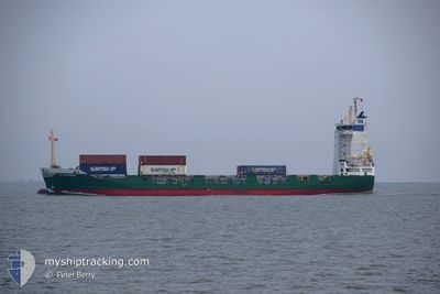
BF CARTAGENA
Container Ship
Current Trip
KYGEK
| Time Travelled | 2 days |
|---|---|
| Remaining Time | --- |
| Distance Travelled | 670.06 nm |
| Remaining Distance | --- |
| AVG Speed | 12.6 Knots |
| MAX Speed | 15.7 Knots |
| AVG Wind | 14 knots |
| MAX Wind | 16.6 knots |
| MIN Temp | 23.9°C / 75.02°F |
| MAX Temp | 27.8°C / 82.04°F |
| Dybgang | 5.9 m |
| Position Modtaget | 1 d siden |
Current Position
| Longitude | -80.63914° |
|---|---|
| Latitude | 24.64989° |
| Status | Under way using engine |
| Fart | 13.1 Knots |
| Kurs | 239° |
| Område | North Atlantic Ocean |
| Station | T-AIS |
| Position Modtaget | 1 d siden |
Info
Information
The current position of BF CARTAGENA is in North Atlantic Ocean with coordinates 24.64989° / -80.63914° as reported on 2025-02-11 08:00 by AIS to our vessel tracker app. The vessel's current speed is 13.1 Knots
The vessel BF CARTAGENA (IMO: 9123817, MMSI: 209207000) is a Container Ship that was built in 1995 ( 30 år gamle ). It's sailing under the flag of [CY] Cyprus.
In this page you can find informations about the vessels current position, last detected port calls, and current voyage information. If the vessels is not in coverage by AIS you will find the latest position.
The current position of BF CARTAGENA is detected by our AIS receivers and we are not responsible for the reliability of the data. The last position was recorded while the vessel was in Coverage by the Ais receivers of our vessel tracking app.
The current draught of BF CARTAGENA as reported by AIS is 5.9 meters
Weather
| Temperature | 26.6°C / 79.88°F |
|---|---|
| Wind Speed | 16 knots |
| Direction | 104° ESE |
| Pressure | 1016.2 hPa |
| Humidity | 75.9 % |
| Cloud Coverage | 2 % |
Featured Company
Last Port Calls
| Port | Arrival | Departure | Time In Port |
|---|---|---|---|
| 2025-02-10 12:00 | 2025-02-10 23:36 | 11 h | |
| 2025-02-03 11:47 | 2025-02-03 22:03 | 10 h | |
| 2025-01-27 11:47 | 2025-01-27 22:02 | 10 h | |
| 2025-01-20 11:59 | 2025-01-20 23:48 | 11 h | |
| 2025-01-13 17:45 | 2025-01-13 23:42 | 5 h | |
| 2025-01-10 12:57 | 2025-01-10 23:32 | 10 h | |
| 2024-12-05 22:03 | 2024-12-21 01:33 | 15 d | |
| 2024-12-05 13:52 | 2024-12-05 14:44 | 51 m | |
| 2024-12-03 13:03 | 2024-12-03 18:40 | 5 h | |
| 2024-12-02 22:10 | 2024-12-02 22:16 | 6 m |
Most Visited Ports (Last year)
| Port | Arrivals | |
|---|---|---|
| 28 | ||
| 24 | ||
| 22 | ||
| 20 | ||
| 20 | ||
| 16 |
Last Trips
| Origin | Departure | Destination | Arrival | Distance | |
|---|---|---|---|---|---|
| 2025-02-03 17:03 | 2025-02-10 07:00 | 1331.53 nm | |||
| 2025-01-27 17:02 | 2025-02-03 06:47 | 1383.23 nm | |||
| 2025-01-20 18:48 | 2025-01-27 06:47 | 1440.91 nm | |||
| 2025-01-13 18:42 | 2025-01-20 06:59 | 1422.49 nm | |||
| 2025-01-10 18:32 | 2025-01-13 12:45 | 14.37 nm | |||
| 2024-12-21 02:33 | 2025-01-10 07:57 | 5611.06 nm | |||
| 2024-12-05 15:44 | 2024-12-05 23:03 | 82.45 nm | |||
| 2024-12-03 19:40 | 2024-12-05 14:52 | 254.42 nm | |||
| 2024-12-02 23:16 | 2024-12-03 14:03 | 184.06 nm | |||
| 2024-12-02 06:02 | 2024-12-02 23:10 | 132.42 nm |
Events
| Tid | Hændelsen | Detaljer | Position / Dest | Info |
|---|---|---|---|---|
| 2025-02-13 06:27 | STOP Sejllads |
19.29507 / -81.38461
KYGEK
|
Fart: Kurs: 90° |
|
| 2025-02-13 05:35 | START Sejllads |
19.31322 / -81.46186
KYGEK
|
Fart: 10.7 kn Kurs: 105° |
|
| 2025-02-13 03:39 | STOP Sejllads |
19.32934 / -81.45313
KYGEK
|
Fart: 0.3 kn Kurs: 70° |
|
| 2025-02-13 03:07 | START Sejllads |
19.29723 / -81.40177
KYGEK
|
Fart: 4.6 kn Kurs: 277° |
|
| 2025-02-13 02:43 | STOP Sejllads |
19.29345 / -81.40205
KYGEK
|
Fart: 0.3 kn Kurs: 31° |
|
| 2025-02-11 08:06 | Status er ændret | Default Under way using engine |
24.63843 / -80.66096
KYGEK
|
Fart: 13.1 kn Kurs: 239° |
| 2025-02-11 08:00 | Udenfor Dækning |
24.64989 / -80.63914
North Atlantic Ocean
KYGEK
|
Fart: 13.1 kn Kurs: 239° |
|
| 2025-02-11 04:53 | Status er ændret | Under way using engine Default |
25.11998 / -80.13216
KYGEK
|
Fart: 12.5 kn Kurs: 206° |
| 2025-02-11 04:09 | Status er ændret | Default Under way using engine |
25.25293 / -80.05121
KYGEK
|
Fart: 11.6 kn Kurs: 201.1° |
| 2025-02-11 00:12 | Status er ændret | Under way using engine Default |
26.02928 / -80.03086
KYGEK
|
Fart: 12.5 kn Kurs: 164° |