
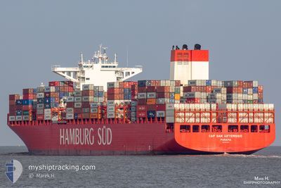
CAP SAN ARTEMISSIO
Container Ship
Current Trip
| Time Travelled | 3 days |
|---|---|
| Remaining Time | 6 h, 44 mins |
| Distance Travelled | 1343.50 nm |
| Remaining Distance | 112.60 nm |
| AVG Speed | 16.1 Knots |
| MAX Speed | 20.8 Knots |
| AVG Wind | 12.2 knots |
| MAX Wind | 24 knots |
| MIN Temp | 5.6°C / 42.08°F |
| MAX Temp | 16.1°C / 60.98°F |
| Dybgang | 13.2 m |
| Position Modtaget | 6 h, 39 m siden |
Current Position
| Longitude | -8.59276° |
|---|---|
| Latitude | 36.39166° |
| Status | At anchor |
| Fart | 10.1 Knots |
| Kurs | 104.5° |
| Område | North Atlantic Ocean |
| Station | T-AIS |
| Position Modtaget | 6 h, 39 m siden |
Info
Information
The current position of CAP SAN ARTEMISSIO is in North Atlantic Ocean with coordinates 36.39166° / -8.59276° as reported on 2025-02-02 15:03 by AIS to our vessel tracker app. The vessel's current speed is 10.1 Knots and is heading at the port of TANGER MED. The estimated time of arrival as calculated by MyShipTracking vessel tracking app is 2025-02-03 04:26 LT
The vessel CAP SAN ARTEMISSIO (IMO: 9633939, MMSI: 352358000) is a Container Ship that was built in 2014 ( 11 år gamle ). It's sailing under the flag of [PA] Panama.
In this page you can find informations about the vessels current position, last detected port calls, and current voyage information. If the vessels is not in coverage by AIS you will find the latest position.
The current position of CAP SAN ARTEMISSIO is detected by our AIS receivers and we are not responsible for the reliability of the data. The last position was recorded while the vessel was in Coverage by the Ais receivers of our vessel tracking app.
The current draught of CAP SAN ARTEMISSIO as reported by AIS is 13.2 meters
Weather
| Temperature | 15.6°C / 60.08°F |
|---|---|
| Wind Speed | 10 knots |
| Direction | 296° WNW |
| Pressure | 1021.6 hPa |
| Humidity | 79.3 % |
| Cloud Coverage | 12 % |
Featured Company
Last Port Calls
| Port | Arrival | Departure | Time In Port |
|---|---|---|---|
| 2025-01-29 05:29 | 2025-01-30 13:08 | 1 d | |
| 2025-01-23 19:19 | 2025-01-24 21:53 | 1 d | |
| 2025-01-21 14:47 | 2025-01-22 21:30 | 1 d | |
| 2025-01-18 19:52 | 2025-01-20 02:53 | 1 d | |
| 2024-12-30 00:05 | 2025-01-01 20:17 | 2 d | |
| 2024-12-27 10:40 | 2024-12-28 05:12 | 18 h | |
| 2024-12-22 08:45 | 2024-12-23 18:41 | 1 d | |
| 2024-12-20 02:10 | 2024-12-21 19:20 | 1 d | |
| 2024-12-16 16:02 | 2024-12-17 09:23 | 17 h | |
| 2024-12-14 23:40 | 2024-12-16 03:05 | 1 d |
Most Visited Ports (Last year)
| Port | Arrivals | |
|---|---|---|
| 10 | ||
| 7 | ||
| 6 | ||
| 5 | ||
| 5 | ||
| 5 |
Last Trips
| Origin | Departure | Destination | Arrival | Distance | |
|---|---|---|---|---|---|
| 2025-01-24 22:53 | 2025-01-29 06:29 | 604.89 nm | |||
| 2025-01-22 22:30 | 2025-01-23 20:19 | 179.20 nm | |||
| 2025-01-20 03:53 | 2025-01-21 15:47 | 318.99 nm | |||
| 2025-01-01 17:17 | 2025-01-18 20:52 | 5827.78 nm | |||
| 2024-12-28 02:12 | 2024-12-29 21:05 | 204.31 nm | |||
| 2024-12-23 15:41 | 2024-12-27 07:40 | 833.26 nm | |||
| 2024-12-21 16:20 | 2024-12-22 05:45 | 143.50 nm | |||
| 2024-12-17 06:23 | 2024-12-19 23:10 | 915.23 nm | |||
| 2024-12-16 00:05 | 2024-12-16 13:02 | 172.45 nm | |||
| 2024-12-01 05:58 | 2024-12-14 20:40 | 4499.50 nm |
Events
| Tid | Hændelsen | Detaljer | Position / Dest | Info |
|---|---|---|---|---|
| 2025-02-02 15:11 | Status er ændret | Default At anchor |
36.39847 / -8.55917
MA PTM
|
Fart: 10.1 kn Kurs: 104.5° |
| 2025-02-02 15:03 | Status er ændret | At anchor Under way using engine |
36.39166 / -8.59276
MA PTM
|
Fart: 11.7 kn Kurs: 103.7° |
| 2025-02-02 15:03 | Udenfor Dækning |
36.39166 / -8.59276
North Atlantic Ocean
MA PTM
|
Fart: 10.1 kn Kurs: 104.5° |
|
| 2025-02-02 14:56 | Status er ændret | Under way using engine Default |
36.41078 / -8.62078
MA PTM
|
Fart: 11.6 kn Kurs: 104° |
| 2025-02-02 14:27 | Status er ændret | Default Under way using engine |
36.43430 / -8.72943
MA PTM
|
Fart: 11.6 kn Kurs: 106.3° |
| 2025-02-02 14:26 | Status er ændret | Under way using engine Default |
36.43500 / -8.73259
MA PTM
|
Fart: 11.7 kn Kurs: 105° |
| 2025-02-02 14:19 | Status er ændret | Default Under way using engine |
36.44134 / -8.76102
MA PTM
|
Fart: 11.6 kn Kurs: 105.7° |
| 2025-02-02 14:12 | Status er ændret | Under way using engine Default |
36.44703 / -8.78803
MA PTM
|
Fart: 11.6 kn Kurs: 104° |
| 2025-02-02 14:11 | Status er ændret | Default Under way using engine |
36.44777 / -8.79184
MA PTM
|
Fart: 11.6 kn Kurs: 103.7° |
| 2025-02-02 13:28 | Status er ændret | Under way using engine Default |
36.48208 / -8.95654
MA PTM
|
Fart: 11.5 kn Kurs: 106° |