
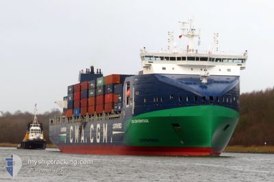
CMA CGM ERMITAGE
Cargo B
Current Trip
| Time Travelled | 2 days |
|---|---|
| Remaining Time | 18 h, 56 mins |
| Distance Travelled | 649.03 nm |
| Remaining Distance | 240.00 nm |
| AVG Speed | 13.5 Knots |
| MAX Speed | 15.7 Knots |
| AVG Wind | 19.6 knots |
| MAX Wind | 24 knots |
| MIN Temp | 0.4°C / 32.72°F |
| MAX Temp | 3.2°C / 37.76°F |
| Dybgang | 10.1 m |
| Position Modtaget | 1 m siden |
Current Position
| Longitude | 8.21906° |
|---|---|
| Latitude | 57.14668° |
| Status | Under way using engine |
| Fart | 12.5 Knots |
| Kurs | 211.4° |
| Område | North Sea |
| Station | T-AIS |
| Position Modtaget | 1 m siden |
Info
Information
The current position of CMA CGM ERMITAGE is in North Sea with coordinates 57.14668° / 8.21906° as reported on 2025-02-11 09:32 by AIS to our vessel tracker app. The vessel's current speed is 12.5 Knots and is heading at the port of BREMERHAVEN. The estimated time of arrival as calculated by MyShipTracking vessel tracking app is 2025-02-12 05:29 LT
The vessel CMA CGM ERMITAGE (IMO: 9961295, MMSI: 256800000) is a Cargo B It's sailing under the flag of [MT] Malta.
In this page you can find informations about the vessels current position, last detected port calls, and current voyage information. If the vessels is not in coverage by AIS you will find the latest position.
The current position of CMA CGM ERMITAGE is detected by our AIS receivers and we are not responsible for the reliability of the data. The last position was recorded while the vessel was in Coverage by the Ais receivers of our vessel tracking app.
The current draught of CMA CGM ERMITAGE as reported by AIS is 10.1 meters
Weather
| Temperature | 2.2°C / 35.96°F |
|---|---|
| Wind Speed | 23 knots |
| Direction | 94° E |
| Pressure | 1036.4 hPa |
| Humidity | 78 % |
| Cloud Coverage | 19 % |
Featured Company
Last Port Calls
| Port | Arrival | Departure | Time In Port |
|---|---|---|---|
| 2025-02-08 03:31 | 2025-02-09 09:46 | 1 d | |
| 2025-02-06 05:18 | 2025-02-06 18:06 | 12 h | |
| 2025-02-05 03:11 | 2025-02-06 01:13 | 22 h | |
| 2025-01-31 14:23 | 2025-01-31 14:27 | 4 m | |
| 2025-01-28 13:34 | 2025-01-30 23:01 | 2 d | |
| 2025-01-27 05:05 | 2025-01-28 02:28 | 21 h | |
| 2025-01-23 08:46 | 2025-01-24 12:34 | 1 d | |
| 2025-01-18 01:48 | 2025-01-18 19:05 | 17 h | |
| 2025-01-17 05:08 | 2025-01-17 21:12 | 16 h | |
| 2025-01-11 00:24 | 2025-01-13 15:03 | 2 d |
Last Trips
| Origin | Departure | Destination | Arrival | Distance | |
|---|---|---|---|---|---|
| 2025-02-06 18:06 | 2025-02-08 03:31 | 426.28 nm | |||
| 2025-02-06 01:13 | 2025-02-06 05:18 | 47.61 nm | |||
| 2025-01-31 14:27 | 2025-02-05 03:11 | 771.63 nm | |||
| 2025-01-30 23:01 | 2025-01-31 14:23 | 89.17 nm | |||
| 2025-01-28 02:28 | 2025-01-28 13:34 | 125.83 nm | |||
| 2025-01-24 12:34 | 2025-01-27 05:05 | 891.38 nm | |||
| 2025-01-18 19:05 | 2025-01-23 08:46 | 562.26 nm | |||
| 2025-01-17 21:12 | 2025-01-18 01:48 | 48.20 nm | |||
| 2025-01-13 15:03 | 2025-01-17 05:08 | 1216.46 nm | |||
| 2025-01-10 12:53 | 2025-01-11 00:24 | 126.56 nm |
Events
| Tid | Hændelsen | Detaljer | Position / Dest | Info |
|---|---|---|---|---|
| 2025-02-11 08:53 | Ændre havområde | Danish part of the North Sea Danish part of the Skaggerak |
57.26346 / 8.34605
North Sea
PLGDN > DEBRV
|
Fart: 12.2 kn Kurs: 210° |
| 2025-02-11 01:02 | Fundet i havområde | Danish part of the Skaggerak |
57.80036 / 10.92734
Skaggerak
PLGDN > DEBRV
|
Fart: 12.5 kn Kurs: 317.9° |
| 2025-02-10 23:53 | Fundet i havområde | Danish part of the Kattegat |
57.62714 / 11.22675
Kattegat
PLGDN > DEBRV
|
Fart: 12.4 kn Kurs: 318.3° |
| 2025-02-10 20:49 | Ændre havområde | Swedish part of the Kattegat Danish part of the Kattegat |
57.06195 / 11.70849
Kattegat
PLGDN > DEBRV
|
Fart: 12.5 kn Kurs: 340.3° |
| 2025-02-10 08:46 | Ændre havområde | Danish part of the Kattegat Danish part of the Baltic Sea |
54.74783 / 10.84645
Kattegat
PLGDN > DEBRV
|
Fart: 14.4 kn Kurs: 13.7° |
| 2025-02-10 08:01 | Ændre havområde | Danish part of the Baltic Sea German part of the Baltic Sea |
54.64227 / 11.04680
Baltic Sea
PLGDN > DEBRV
|
Fart: 15.1 kn Kurs: 303.6° |
| 2025-02-10 07:16 | Fundet i havområde | German part of the Baltic Sea |
54.55768 / 11.34090
Baltic Sea
PLGDN > DEBRV
|
Fart: 15 kn Kurs: 299.1° |
| 2025-02-10 05:13 | Ændre havområde | Danish part of the Baltic Sea German part of the Baltic Sea |
54.42808 / 12.12408
Baltic Sea
PLGDN > DEBRV
|
Fart: 13.8 kn Kurs: 269.9° |
| 2025-02-10 04:49 | Ændre havområde | German part of the Baltic Sea Danish part of the Baltic Sea |
54.49376 / 12.21801
Baltic Sea
PLGDN > DEBRV
|
Fart: 14.2 kn Kurs: 196.5° |
| 2025-02-10 04:01 | Ændre havområde | Danish part of the Baltic Sea German part of the Baltic Sea |
54.64140 / 12.38597
Baltic Sea
PLGDN > DEBRV
|
Fart: 14.3 kn Kurs: 235.8° |