
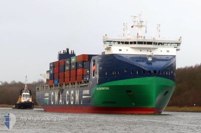
CMA CGM ERMITAGE
Cargo
Current Trip
| Time Travelled | 11 h, 29 mins |
|---|---|
| Remaining Time | 18 h, 35 mins |
| Distance Travelled | 125.74 nm |
| Remaining Distance | 298.27 nm |
| AVG Speed | 13.9 Knopen |
| MAX Speed | 14.6 Knopen |
| AVG Wind | 10.2 knots |
| MAX Wind | 12.7 knots |
| MIN Temp | 1°C / 33.8°F |
| MAX Temp | 3°C / 37.4°F |
| Diepgang | 9.7 M |
| Positie ontvangen | 2 h, 23 m geleden |
Current Position
| Lengtegraad | 21.46207° |
|---|---|
| Breedtegraat | 59.05356° |
| Status | Under way using engine |
| Snelheid | 14.4 Knopen |
| Koers | 211.7° |
| Gebied | Baltic Sea |
| Station | T-AIS |
| Positie ontvangen | 2 h, 23 m geleden |
Info
Information
The current position of CMA CGM ERMITAGE is in Baltic Sea with coordinates 59.05356° / 21.46207° as reported on 2025-02-07 01:11 by AIS to our vessel tracker app. The vessel's current speed is 14.4 Knopen and is heading at the port of GDANSK. The estimated time of arrival as calculated by MyShipTracking vessel tracking app is 2025-02-07 22:10 LT
The vessel CMA CGM ERMITAGE (IMO: 9961295, MMSI: 256800000) is a Cargo It's sailing under the flag of [MT] Malta.
In this page you can find informations about the vessels current position, last detected port calls, and current voyage information. If the vessels is not in coverage by AIS you will find the latest position.
The current position of CMA CGM ERMITAGE is detected by our AIS receivers and we are not responsible for the reliability of the data. The last position was recorded while the vessel was in Coverage by the Ais receivers of our vessel tracking app.
The current draught of CMA CGM ERMITAGE as reported by AIS is 9.7 meters
Weather
| Temperature | 2.4°C / 36.32°F |
|---|---|
| Wind Speed | 9 knots |
| Direction | 87° E |
| Pressure | 1048.4 hPa |
| Humidity | 78.4 % |
| Cloud Coverage | 100 % |
Featured Company
Last Port Calls
| Port | Arrival | Departure | Time In Port |
|---|---|---|---|
| 2025-02-06 03:18 | 2025-02-06 16:06 | 12 h | |
| 2025-02-05 01:11 | 2025-02-05 23:13 | 22 h | |
| 2025-01-31 13:23 | 2025-01-31 13:27 | 4 m | |
| 2025-01-28 12:34 | 2025-01-30 22:01 | 2 d | |
| 2025-01-27 04:05 | 2025-01-28 01:28 | 21 h | |
| 2025-01-23 07:46 | 2025-01-24 11:34 | 1 d | |
| 2025-01-17 23:48 | 2025-01-18 17:05 | 17 h | |
| 2025-01-17 03:08 | 2025-01-17 19:12 | 16 h | |
| 2025-01-10 23:24 | 2025-01-13 14:03 | 2 d | |
| 2025-01-09 13:46 | 2025-01-10 11:53 | 22 h |
Last Trips
| Origin | Departure | Destination | Arrival | Distance | |
|---|---|---|---|---|---|
| 2025-02-06 01:13 | 2025-02-06 05:18 | 47.61 nm | |||
| 2025-01-31 14:27 | 2025-02-05 03:11 | 771.63 nm | |||
| 2025-01-30 23:01 | 2025-01-31 14:23 | 89.17 nm | |||
| 2025-01-28 02:28 | 2025-01-28 13:34 | 125.83 nm | |||
| 2025-01-24 12:34 | 2025-01-27 05:05 | 891.38 nm | |||
| 2025-01-18 19:05 | 2025-01-23 08:46 | 562.26 nm | |||
| 2025-01-17 21:12 | 2025-01-18 01:48 | 48.20 nm | |||
| 2025-01-13 15:03 | 2025-01-17 05:08 | 1216.46 nm | |||
| 2025-01-10 12:53 | 2025-01-11 00:24 | 126.56 nm | |||
| 2025-01-06 16:21 | 2025-01-09 14:46 | 893.16 nm |
Events
| Tijd | Evenement | Details | Positie / Bestemming | Info |
|---|---|---|---|---|
| 2025-02-07 01:11 | Buitenbereik |
59.05356 / 21.46207
Baltic Sea
EEMUU > PLGDN
|
Snelheid: 14.4 kn Koers: 211.7° |
|
| 2025-02-07 01:11 | Wijzig zee gebeid | Estonian part of the Baltic Sea Finnish part of the Baltic Sea |
59.05521 / 21.46404
Baltic Sea
EEMUU > PLGDN
|
Snelheid: 14.4 kn Koers: 211.5° |
| 2025-02-07 01:11 | Binnenbereik |
59.05521 / 21.46404
Baltic Sea
EEMUU > PLGDN
|
Snelheid: 14.4 kn Koers: 211.5° |
|
| 2025-02-06 22:54 | Buitenbereik |
59.40642 / 22.24210
Baltic Sea
EEMUU > PLGDN
|
Snelheid: 14.3 kn Koers: 233° |
|
| 2025-02-06 20:53 | Gevonden in zee | Finnish part of the Baltic Sea |
59.60287 / 23.09098
Baltic Sea
EEMUU > PLGDN
|
Snelheid: 14.3 kn Koers: 254.7° |
| 2025-02-06 17:52 | Wijzig zee gebeid | Finnish part of the Gulf of Finland Estonian part of the Gulf of Finland |
59.76414 / 24.46647
Gulf of Finland
EEMUU > PLGDN
|
Snelheid: 13.5 kn Koers: 265.5° |
| 2025-02-06 16:06 | Vertrekhaven |
|
59.50319 / 24.96911
EEMUU > PLGDN
|
Snelheid: 4.5 kn Koers: 20° |
| 2025-02-06 16:04 | Start beweging |
59.49911 / 24.96635
[EE] MUUGA
|
Snelheid: 4.4 kn Koers: 20° |
|
| 2025-02-06 15:51 | Status Changed | Under way using engine Moored |
59.49238 / 24.96473
[EE] MUUGA
|
Snelheid: Koers: 312° |
| 2025-02-06 15:41 | Binnenbereik |
59.49247 / 24.96510
Gulf of Finland
[EE] MUUGA
|
Snelheid: Koers: 311.9° |