
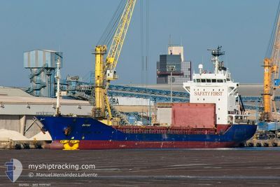
DUYGU
Container Ship
Current Trip
| Time Travelled | 3 days |
|---|---|
| Remaining Time | --- |
| Distance Travelled | 530.74 nm |
| Remaining Distance | --- |
| AVG Speed | 8.1 Knots |
| MAX Speed | 11.6 Knots |
| AVG Wind | 15.1 knots |
| MAX Wind | 27 knots |
| MIN Temp | 9.2°C / 48.56°F |
| MAX Temp | 13.3°C / 55.94°F |
| Dybgang | 7 m |
| Position Modtaget | 2 d siden |
Current Position
| Longitude | -5.14728° |
|---|---|
| Latitude | 49.83054° |
| Status | Under way using engine |
| Fart | 8.1 Knots |
| Kurs | 227.7° |
| Område | English Channel |
| Station | T-AIS |
| Position Modtaget | 2 d siden |
Info
Information
The current position of DUYGU is in English Channel with coordinates 49.83054° / -5.14728° as reported on 2025-02-04 01:44 by AIS to our vessel tracker app. The vessel's current speed is 8.1 Knots and is heading at the port of ABU QIR. The estimated time of arrival as calculated by MyShipTracking vessel tracking app is 2025-02-15 19:00 LT
The vessel DUYGU (IMO: 9199787, MMSI: 577165000) is a Container Ship that was built in 2000 ( 25 år gamle ). It's sailing under the flag of [VU] Vanuatu.
In this page you can find informations about the vessels current position, last detected port calls, and current voyage information. If the vessels is not in coverage by AIS you will find the latest position.
The current position of DUYGU is detected by our AIS receivers and we are not responsible for the reliability of the data. The last position was recorded while the vessel was in Coverage by the Ais receivers of our vessel tracking app.
The current draught of DUYGU as reported by AIS is 7 meters
Weather
| Temperature | 13.3°C / 55.94°F |
|---|---|
| Wind Speed | 9 knots |
| Direction | 179° S |
| Pressure | 1028.7 hPa |
| Humidity | 67.5 % |
| Cloud Coverage | 100 % |
Featured Company
Last Port Calls
| Port | Arrival | Departure | Time In Port |
|---|---|---|---|
| 2025-02-01 18:54 | 2025-02-02 17:40 | 22 h | |
| 2025-01-28 13:59 | 2025-01-30 02:45 | 1 d | |
| 2025-01-24 12:07 | 2025-01-25 19:52 | 1 d | |
| 2025-01-14 06:34 | 2025-01-17 02:39 | 2 d | |
| 2025-01-06 06:27 | 2025-01-06 12:40 | 6 h | |
| 2024-12-28 08:30 | 2025-01-03 16:54 | 6 d | |
| 2024-12-07 22:48 | 2024-12-12 22:33 | 4 d | |
| 2024-12-02 15:44 |
Last Trips
| Origin | Departure | Destination | Arrival | Distance | |
|---|---|---|---|---|---|
| 2025-01-30 02:45 | 2025-02-01 18:54 | 653.28 nm | |||
| 2025-01-25 19:52 | 2025-01-28 13:59 | 275.55 nm | |||
| 2025-01-17 03:39 | 2025-01-24 12:07 | 1592.84 nm | |||
| 2025-01-06 13:40 | 2025-01-14 07:34 | 257.67 nm | |||
| 2025-01-03 17:54 | 2025-01-06 07:27 | 619.87 nm | |||
| 2024-12-12 23:33 | 2024-12-28 09:30 | 1802.50 nm | |||
| 2024-12-02 17:44 | 2024-12-07 23:48 | 1172.80 nm |
Events
| Tid | Hændelsen | Detaljer | Position / Dest | Info |
|---|---|---|---|---|
| 2025-02-04 01:51 | Status er ændret | Default Under way using engine |
49.81853 / -5.15938
EGAKI
|
Fart: 8.1 kn Kurs: 227.7° |
| 2025-02-04 01:44 | Udenfor Dækning |
49.83054 / -5.14728
English Channel
EGAKI
|
Fart: 8.1 kn Kurs: 227.7° |
|
| 2025-02-03 21:32 | Status er ændret | Under way using engine Default |
50.32864 / -4.64178
EGAKI
|
Fart: 4.8 kn Kurs: 203° |
| 2025-02-03 21:31 | Status er ændret | Default Under way using engine |
50.32973 / -4.64100
EGAKI
|
Fart: 4 kn Kurs: 230° |
| 2025-02-03 21:25 | Dybgangen er ændret | 7 5.5 |
50.33535 / -4.63183
EGAKI
|
Fart: 3.8 kn Kurs: 206° |
| 2025-02-03 21:25 | Destination er ændret | EGAKI GBFOY |
50.33535 / -4.63183
EGAKI
|
Fart: 3.8 kn Kurs: 206° |
| 2025-02-03 21:25 | ETA er ændret | 2025/02/15 19:00 2025/02/02 19:00 |
50.33535 / -4.63183
EGAKI
|
Fart: 3.8 kn Kurs: 206° |
| 2025-02-03 21:25 | Status er ændret | Under way using engine Default |
50.33547 / -4.63180
GBFOY
|
Fart: 3.8 kn Kurs: 189° |
| 2025-02-03 21:19 | Status er ændret | Default Under way using engine |
50.34107 / -4.63220
GBFOY
|
Fart: 2.2 kn Kurs: 98° |
| 2025-02-03 21:19 | START Sejllads | 0.49 nm, North of FOWEY |
50.34107 / -4.63220
GBFOY
|
Fart: 3.5 kn Kurs: 169° |