
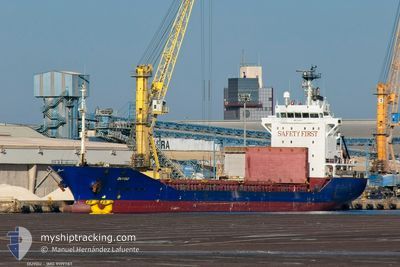
DUYGU
Container Ship
Current Trip
| Time Travelled | 11 h, 21 mins |
|---|---|
| Remaining Time | --- |
| Distance Travelled | 24.43 nm |
| Remaining Distance | --- |
| AVG Speed | 7.9 Knopen |
| MAX Speed | 11 Knopen |
| AVG Wind | 12.1 knots |
| MAX Wind | 15.5 knots |
| MIN Temp | 9.2°C / 48.56°F |
| MAX Temp | 9.6°C / 49.28°F |
| Diepgang | 5.5 M |
| Positie ontvangen | 14 m geleden |
Current Position
| Lengtegraad | -4.63694° |
|---|---|
| Breedtegraat | 50.34636° |
| Status | Moored |
| Snelheid | |
| Koers | 120° |
| Gebied | English Channel |
| Station | T-AIS |
| Positie ontvangen | 14 m geleden |
Info
Information
The current position of DUYGU is in English Channel with coordinates 50.34636° / -4.63694° as reported on 2025-02-03 04:47 by AIS to our vessel tracker app. The vessel's current speed is 0 Knopen
The vessel DUYGU (IMO: 9199787, MMSI: 577165000) is a Container Ship that was built in 2000 ( 25 Jaar oud ). It's sailing under the flag of [VU] Vanuatu.
In this page you can find informations about the vessels current position, last detected port calls, and current voyage information. If the vessels is not in coverage by AIS you will find the latest position.
The current position of DUYGU is detected by our AIS receivers and we are not responsible for the reliability of the data. The last position was recorded while the vessel was in Coverage by the Ais receivers of our vessel tracking app.
The current draught of DUYGU as reported by AIS is 5.5 meters
Weather
| Temperature | 9.2°C / 48.56°F |
|---|---|
| Wind Speed | 7 knots |
| Direction | 298° WNW |
| Pressure | 1022.2 hPa |
| Humidity | 93.8 % |
| Cloud Coverage | 100 % |
Featured Company
Last Port Calls
| Port | Arrival | Departure | Time In Port |
|---|---|---|---|
| 2025-02-01 18:54 | 2025-02-02 17:40 | 22 h | |
| 2025-01-28 13:59 | 2025-01-30 02:45 | 1 d | |
| 2025-01-24 12:07 | 2025-01-25 19:52 | 1 d | |
| 2025-01-14 06:34 | 2025-01-17 02:39 | 2 d | |
| 2025-01-06 06:27 | 2025-01-06 12:40 | 6 h | |
| 2024-12-28 08:30 | 2025-01-03 16:54 | 6 d | |
| 2024-12-07 22:48 | 2024-12-12 22:33 | 4 d | |
| 2024-12-02 15:44 |
Last Trips
| Origin | Departure | Destination | Arrival | Distance | |
|---|---|---|---|---|---|
| 2025-01-30 02:45 | 2025-02-01 18:54 | 653.28 nm | |||
| 2025-01-25 19:52 | 2025-01-28 13:59 | 275.55 nm | |||
| 2025-01-17 03:39 | 2025-01-24 12:07 | 1592.84 nm | |||
| 2025-01-06 13:40 | 2025-01-14 07:34 | 257.67 nm | |||
| 2025-01-03 17:54 | 2025-01-06 07:27 | 619.87 nm | |||
| 2024-12-12 23:33 | 2024-12-28 09:30 | 1802.50 nm | |||
| 2024-12-02 17:44 | 2024-12-07 23:48 | 1172.80 nm |
Events
| Tijd | Evenement | Details | Positie / Bestemming | Info |
|---|---|---|---|---|
| 2025-02-03 04:53 | Status Changed | Default Moored |
50.34638 / -4.63694
GBFOY
|
Snelheid: Koers: 120° |
| 2025-02-03 04:46 | Status Changed | Moored Default |
50.34637 / -4.63692
GBFOY
|
Snelheid: Koers: 120° |
| 2025-02-03 04:23 | Status Changed | Default Moored |
50.34639 / -4.63696
GBFOY
|
Snelheid: Koers: 120° |
| 2025-02-03 02:41 | Status Changed | Moored Default |
50.34636 / -4.63697
GBFOY
|
Snelheid: Koers: 120° |
| 2025-02-03 02:39 | Status Changed | Default Moored |
50.34638 / -4.63699
GBFOY
|
Snelheid: Koers: 120° |
| 2025-02-03 02:34 | Status Changed | Moored Default |
50.34634 / -4.63697
GBFOY
|
Snelheid: Koers: 120° |
| 2025-02-03 02:26 | Status Changed | Default Moored |
50.34635 / -4.63694
GBFOY
|
Snelheid: Koers: 120° |
| 2025-02-03 02:20 | Status Changed | Moored Default |
50.34636 / -4.63695
GBFOY
|
Snelheid: Koers: 120° |
| 2025-02-03 02:06 | Status Changed | Default Moored |
50.34636 / -4.63694
GBFOY
|
Snelheid: Koers: 120° |
| 2025-02-03 01:35 | Status Changed | Moored Default |
50.34635 / -4.63695
GBFOY
|
Snelheid: Koers: 120° |