

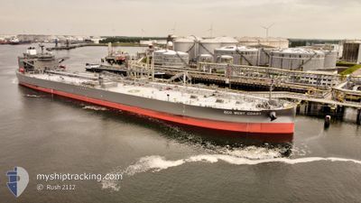
ECO WEST COAST
Tanker
Current Trip
| Time Travelled | 9 days |
|---|---|
| Remaining Time | --- |
| Distance Travelled | 1470.25 nm |
| Remaining Distance | --- |
| AVG Speed | 10.3 Knots |
| MAX Speed | 13.7 Knots |
| AVG Wind | 9.2 knots |
| MAX Wind | 18 knots |
| MIN Temp | 18.8°C / 65.84°F |
| MAX Temp | 23.5°C / 74.3°F |
| Dybgang | 9.3 m |
| Position Modtaget | 3 d siden |
Current Position
| Longitude | -5.53134° |
|---|---|
| Latitude | 35.98236° |
| Status | Under way using engine |
| Fart | 9.3 Knots |
| Kurs | 245.6° |
| Område | Strait of Gibraltar |
| Station | T-AIS |
| Position Modtaget | 3 d siden |
Information
The current position of ECO WEST COAST is in Strait of Gibraltar with coordinates 35.98236° / -5.53134° as reported on 2025-06-08 03:37 by AIS to our vessel tracker app. The vessel's current speed is 9.3 Knots and is heading at the port of BONNY. The estimated time of arrival as calculated by MyShipTracking vessel tracking app is 2025-06-19 15:00 LT
The vessel ECO WEST COAST (IMO: 9902811, MMSI: 538009213) is a Tanker It's sailing under the flag of [MH] Marshall Is.
In this page you can find informations about the vessels current position, last detected port calls, and current voyage information. If the vessels is not in coverage by AIS you will find the latest position.
The current position of ECO WEST COAST is detected by our AIS receivers and we are not responsible for the reliability of the data. The last position was recorded while the vessel was in Coverage by the Ais receivers of our vessel tracking app.
The current draught of ECO WEST COAST as reported by AIS is 9.3 meters
Weather
| Temperature | 20°C / 68°F |
|---|---|
| Wind Speed | 16 knots |
| Direction | 5° N |
| Pressure | 1016.8 hPa |
| Humidity | 81.3 % |
| Cloud Coverage | --- |
Featured Company
Events
| Tid | Hændelsen | Detaljer | Position / Dest | Info |
|---|---|---|---|---|
| 2025-06-08 03:37 | Udenfor Dækning |
35.98236 / -5.53134
Strait of Gibraltar
NG BON
|
Fart: 9.3 kn Kurs: 245.6° |
|
| 2025-06-08 02:40 | Ændre havområde | Spanish part of the Strait of Gibraltar Gibraltarian part of the Strait of Gibraltar |
36.06911 / -5.38004
Strait of Gibraltar
NG BON
|
Fart: 12.5 kn Kurs: 204.8° |
| 2025-06-08 02:23 | START Sejllads | 2.5 nm, South of GIBRALTAR |
36.10571 / -5.36106
NG BON
|
Fart: 3.1 kn Kurs: 262° |
| 2025-06-08 02:17 | Status er ændret | Under way using engine At anchor |
36.10421 / -5.36044
NG BON
|
Fart: 0.2 kn Kurs: 353° |
| 2025-06-07 23:48 | Dybgangen er ændret | 9.3 0 |
36.10643 / -5.36440
NG BON
|
Fart: Kurs: 85° |
| 2025-06-07 23:48 | Status er ændret | At anchor Default |
36.10643 / -5.36440
|
Fart: 0.5 kn Kurs: 86° |
| 2025-06-07 23:30 | STOP Sejllads | 2.41 nm, South of GIBRALTAR |
36.10733 / -5.36455
|
Fart: 0.3 kn Kurs: 94° |
| 2025-06-07 23:30 | START Sejllads | 2.41 nm, South of GIBRALTAR |
36.10727 / -5.36454
|
Fart: 5.3 kn Kurs: 352.1° |
| 2025-06-07 20:12 | Indenfor Dækning |
36.10850 / -5.36306
Strait of Gibraltar
|
Fart: 0.1 kn Kurs: 225.9° |
|
| 2025-06-07 20:11 | Dybgangen er ændret | 0 9.3 |
36.10768 / -5.35895
|
Fart: 0.2 kn Kurs: 256° |