
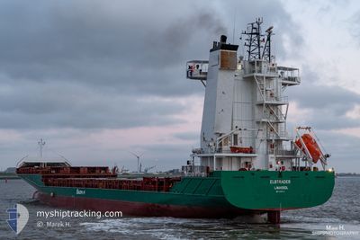
ELBTRADER
Container Ship
Current Trip
| Time Travelled | 1 day |
|---|---|
| Remaining Time | 1 day |
| Distance Travelled | 285.71 nm |
| Remaining Distance | 426.55 nm |
| AVG Speed | 7 Knots |
| MAX Speed | 16 Knots |
| AVG Wind | 30.8 knots |
| MAX Wind | 37.8 knots |
| MIN Temp | 10.3°C / 50.54°F |
| MAX Temp | 12.3°C / 54.14°F |
| Dybgang | 7.3 m |
| Position Modtaget | 5 h, 12 m siden |
Current Position
| Longitude | -5.96232° |
|---|---|
| Latitude | 51.41728° |
| Status | Under way using engine |
| Fart | 11.7 Knots |
| Kurs | 186° |
| Område | Celtic Sea |
| Station | T-AIS |
| Position Modtaget | 5 h, 12 m siden |
Info
Information
The current position of ELBTRADER is in Celtic Sea with coordinates 51.41728° / -5.96232° as reported on 2025-12-15 03:48 by AIS to our vessel tracker app. The vessel's current speed is 11.7 Knots and is heading at the port of ANTWERP. The estimated time of arrival as calculated by MyShipTracking vessel tracking app is 2025-12-16 16:07 LT
The vessel ELBTRADER (IMO: 9388534, MMSI: 212937000) is a Container Ship that was built in 2008 ( 17 år gamle ). It's sailing under the flag of [CY] Cyprus.
In this page you can find informations about the vessels current position, last detected port calls, and current voyage information. If the vessels is not in coverage by AIS you will find the latest position.
The current position of ELBTRADER is detected by our AIS receivers and we are not responsible for the reliability of the data. The last position was recorded while the vessel was in Coverage by the Ais receivers of our vessel tracking app.
The current draught of ELBTRADER as reported by AIS is 7.3 meters
Weather
| Temperature | 10.8°C / 51.44°F |
|---|---|
| Wind Speed | 2 knots |
| Direction | 298° WNW |
| Pressure | 1000.5 hPa |
| Humidity | 94.5 % |
| Cloud Coverage | 100 % |
Featured Company
Last Port Calls
| Port | Arrival | Departure | Time In Port |
|---|---|---|---|
| 2025-12-11 13:56 | 2025-12-13 23:53 | 2 d | |
| 2025-12-08 02:15 | 2025-12-09 09:28 | 1 d | |
| 2025-12-03 10:14 | 2025-12-05 04:22 | 1 d | |
| 2025-11-29 03:10 | 2025-11-30 19:23 | 1 d | |
| 2025-11-24 22:39 | 2025-11-26 21:38 | 1 d | |
| 2025-11-23 04:16 | 2025-11-24 14:16 | 1 d | |
| 2025-11-20 17:39 | 2025-11-21 01:56 | 8 h | |
| 2025-11-16 04:43 | 2025-11-20 06:28 | 4 d | |
| 2025-11-12 07:34 | 2025-11-14 00:23 | 1 d | |
| 2025-11-08 11:23 | 2025-11-10 03:21 | 1 d |
Most Visited Ports (Last year)
| Port | Arrivals | |
|---|---|---|
| 40 | ||
| 39 | ||
| 13 | ||
| 3 | ||
| 1 |
Last Trips
| Origin | Departure | Destination | Arrival | Distance | |
|---|---|---|---|---|---|
| 2025-12-09 10:28 | 2025-12-11 13:56 | 728.06 nm | |||
| 2025-12-05 04:22 | 2025-12-08 03:15 | 915.26 nm | |||
| 2025-11-30 20:23 | 2025-12-03 10:14 | 724.76 nm | |||
| 2025-11-26 21:38 | 2025-11-29 04:10 | 733.74 nm | |||
| 2025-11-24 14:16 | 2025-11-24 22:39 | 108.67 nm | |||
| 2025-11-21 02:56 | 2025-11-23 04:16 | 656.23 nm | |||
| 2025-11-20 07:28 | 2025-11-20 18:39 | 118.82 nm | |||
| 2025-11-14 00:23 | 2025-11-16 05:43 | 731.71 nm | |||
| 2025-11-10 04:21 | 2025-11-12 07:34 | 724.18 nm | |||
| 2025-11-05 16:40 | 2025-11-08 12:23 | 789.45 nm |
Events
| Tid | Hændelsen | Detaljer | Position / Dest | Info |
|---|---|---|---|---|
| 2025-12-15 03:56 | Status er ændret | Default Under way using engine |
51.39066 / -5.96556
BEANR
|
Fart: 11.7 kn Kurs: 186° |
| 2025-12-15 03:48 | Ændre havområde | United Kingdom part of the Celtic Sea Irish part of the Celtic Sea |
51.41728 / -5.96232
Celtic Sea
BEANR
|
Fart: 11.7 kn Kurs: 186° |
| 2025-12-15 03:48 | Status er ændret | Under way using engine Default |
51.41728 / -5.96232
BEANR
|
Fart: 11.3 kn Kurs: 182° |
| 2025-12-15 03:48 | Udenfor Dækning |
51.41728 / -5.96232
Celtic Sea
BEANR
|
Fart: 11.7 kn Kurs: 186° |
|
| 2025-12-15 03:43 | Indenfor Dækning |
51.41728 / -5.96232
Celtic Sea
BEANR
|
Fart: 11.7 kn Kurs: 186° |
|
| 2025-12-15 00:05 | Status er ændret | Default Under way using engine |
51.94781 / -5.89145
BEANR
|
Fart: 6.7 kn Kurs: 188.2° |
| 2025-12-14 23:51 | Fundet i havområde | Irish part of the Celtic Sea |
51.97319 / -5.88154
Celtic Sea
BEANR
|
Fart: 6.7 kn Kurs: 188.2° |
| 2025-12-14 23:51 | Status er ændret | Under way using engine Default |
51.97319 / -5.88154
BEANR
|
Fart: 6.6 kn Kurs: 188° |
| 2025-12-14 23:51 | Indenfor Dækning |
51.97319 / -5.88154
Celtic Sea
BEANR
|
Fart: 6.7 kn Kurs: 188.2° |
|
| 2025-12-14 23:51 | Udenfor Dækning |
51.97319 / -5.88154
Celtic Sea
BEANR
|
Fart: 6.7 kn Kurs: 188.2° |