
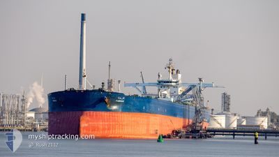
FARHAH
Crude Oil Tanker
Current Trip
| Time Travelled | 20 days |
|---|---|
| Remaining Time | 3 days |
| Distance Travelled | 5496.90 nm |
| Remaining Distance | 1065.36 nm |
| AVG Speed | 12 Knots |
| MAX Speed | 14.8 Knots |
| AVG Wind | 12.3 knots |
| MAX Wind | 32 knots |
| MIN Temp | 17.9°C / 64.22°F |
| MAX Temp | 29.4°C / 84.92°F |
| Dybgang | 21.3 m |
| Position Modtaget | 22 h, 26 m siden |
Current Position
| Longitude | 18.12590° |
|---|---|
| Latitude | -34.83465° |
| Status | Under way using engine |
| Fart | 12.1 Knots |
| Kurs | 296.5° |
| Område | South Atlantic Ocean |
| Station | T-AIS |
| Position Modtaget | 22 h, 26 m siden |
Info
Information
The current position of FARHAH is in South Atlantic Ocean with coordinates -34.83465° / 18.12590° as reported on 2025-02-09 06:40 by AIS to our vessel tracker app. The vessel's current speed is 12.1 Knots and is heading at the port of DURBAN. The estimated time of arrival as calculated by MyShipTracking vessel tracking app is 2025-02-13 23:29 LT
The vessel FARHAH (IMO: 9484742, MMSI: 403537000) is a Crude Oil Tanker that was built in 2010 ( 15 år gamle ). It's sailing under the flag of [SA] Saudi Arabia.
In this page you can find informations about the vessels current position, last detected port calls, and current voyage information. If the vessels is not in coverage by AIS you will find the latest position.
The current position of FARHAH is detected by our AIS receivers and we are not responsible for the reliability of the data. The last position was recorded while the vessel was in Coverage by the Ais receivers of our vessel tracking app.
The current draught of FARHAH as reported by AIS is 21.3 meters
Weather
| Temperature | 18.1°C / 64.58°F |
|---|---|
| Wind Speed | 19 knots |
| Direction | 149° SSE |
| Pressure | 1019.8 hPa |
| Humidity | 69.6 % |
| Cloud Coverage | --- |
Featured Company
Last Port Calls
| Port | Arrival | Departure | Time In Port |
|---|---|---|---|
| 2025-01-19 14:39 | 2025-01-20 22:44 | 1 d | |
| 2024-12-05 04:22 | 2024-12-07 06:22 | 2 d |
Most Visited Ports (Last year)
| Port | Arrivals | |
|---|---|---|
| 5 | ||
| 4 | ||
| 1 | ||
| 1 | ||
| 1 | ||
| 1 |
Last Trips
| Origin | Departure | Destination | Arrival | Distance | |
|---|---|---|---|---|---|
| 2024-12-07 14:22 | 2025-01-19 17:39 | 8376.75 nm | |||
| 2024-09-22 02:39 | 2024-12-05 12:22 | 9074.55 nm |
Events
| Tid | Hændelsen | Detaljer | Position / Dest | Info |
|---|---|---|---|---|
| 2025-02-09 06:46 | Status er ændret | Default Under way using engine |
-34.82619 / 18.10446
DURBAN
|
Fart: 12.1 kn Kurs: 296.5° |
| 2025-02-09 06:40 | Udenfor Dækning |
-34.83465 / 18.12590
South Atlantic Ocean
|
Fart: 12.1 kn Kurs: 296.5° |
|
| 2025-02-09 06:39 | Fundet i havområde | South African part of the South Atlantic Ocean |
-34.83619 / 18.12967
South Atlantic Ocean
|
Fart: 12 kn Kurs: 293.4° |
| 2025-02-09 06:39 | Status er ændret | Under way using engine Default |
-34.83619 / 18.12967
DURBAN
|
Fart: 12 kn Kurs: 292° |
| 2025-02-09 06:31 | Indenfor Dækning |
-34.83619 / 18.12967
South Atlantic Ocean
|
Fart: 12 kn Kurs: 293.4° |
|
| 2025-02-06 17:27 | Status er ændret | Default Under way using engine |
-30.47666 / 30.96393
DURBAN
|
Fart: 11.7 kn Kurs: 194.6° |
| 2025-02-06 17:20 | Udenfor Dækning |
-30.45282 / 30.97129
Indian Ocean
|
Fart: 11.7 kn Kurs: 194.6° |
|
| 2025-02-06 13:56 | START Sejllads | 5.88 nm, East of DURBAN |
-29.84449 / 31.13141
DURBAN
|
Fart: 3.1 kn Kurs: 183° |
| 2025-02-06 13:03 | STOP Sejllads | 6.52 nm, East of DURBAN |
-29.84535 / 31.14477
DURBAN
|
Fart: 0.3 kn Kurs: 262° |
| 2025-02-06 09:08 | Status er ændret | Under way using engine Default |
-29.53542 / 31.76896
DURBAN
|
Fart: 12.3 kn Kurs: 236° |