
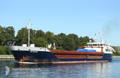
FRI RIVER
General Cargo
Current Trip
| Time Travelled | 1 day |
|---|---|
| Remaining Time | 3 days |
| Distance Travelled | 347.26 nm |
| Remaining Distance | 845.76 nm |
| AVG Speed | 9.4 Knots |
| MAX Speed | 14.7 Knots |
| AVG Wind | 15.7 knots |
| MAX Wind | 30 knots |
| MIN Temp | -1.6°C / 29.12°F |
| MAX Temp | 5.6°C / 42.08°F |
| Dybgang | 5.2 m |
| Position Modtaget | 1 m siden |
Current Position
| Longitude | 1.64165° |
|---|---|
| Latitude | 51.17398° |
| Status | Under way using engine |
| Fart | 10.7 Knots |
| Kurs | 229.6° |
| Område | North Sea |
| Station | T-AIS |
| Position Modtaget | 1 m siden |
Info
Information
The current position of FRI RIVER is in North Sea with coordinates 51.17398° / 1.64165° as reported on 2026-01-04 17:13 by AIS to our vessel tracker app. The vessel's current speed is 10.7 Knots and is heading at the port of LEIXOES. The estimated time of arrival as calculated by MyShipTracking vessel tracking app is 2026-01-08 11:32 LT
The vessel FRI RIVER (IMO: 9224104, MMSI: 311000758) is a General Cargo that was built in 2000 ( 26 år gamle ). It's sailing under the flag of [BS] Bahamas.
In this page you can find informations about the vessels current position, last detected port calls, and current voyage information. If the vessels is not in coverage by AIS you will find the latest position.
The current position of FRI RIVER is detected by our AIS receivers and we are not responsible for the reliability of the data. The last position was recorded while the vessel was in Coverage by the Ais receivers of our vessel tracking app.
The current draught of FRI RIVER as reported by AIS is 5.2 meters
Weather
| Temperature | 3.6°C / 38.48°F |
|---|---|
| Wind Speed | 17 knots |
| Direction | 288° WNW |
| Pressure | 1011.9 hPa |
| Humidity | 62.3 % |
| Cloud Coverage | 2 % |
Featured Company
Last Port Calls
| Port | Arrival | Departure | Time In Port |
|---|---|---|---|
| 2026-01-02 01:10 | 2026-01-03 02:09 | 1 d | |
| 2025-12-26 21:38 | 2025-12-29 16:30 | 2 d | |
| 2025-12-20 10:53 | 2025-12-23 16:04 | 3 d | |
| 2025-12-19 01:12 | 2025-12-20 08:41 | 1 d | |
| 2025-12-13 00:32 | 2025-12-13 23:48 | 23 h | |
| 2025-12-07 13:07 | 2025-12-09 02:47 | 1 d | |
| 2025-12-02 23:48 | 2025-12-03 23:24 | 23 h | |
| 2025-12-02 13:27 | 2025-12-02 23:07 | 9 h | |
| 2025-11-27 15:18 | 2025-11-28 20:56 | 1 d | |
| 2025-11-22 10:55 | 2025-11-23 08:09 | 21 h |
Last Trips
| Origin | Departure | Destination | Arrival | Distance | |
|---|---|---|---|---|---|
| 2025-12-29 16:30 | 2026-01-02 01:10 | 813.86 nm | |||
| 2025-12-23 16:04 | 2025-12-26 21:38 | 819.78 nm | |||
| 2025-12-20 08:41 | 2025-12-20 10:53 | 27.45 nm | |||
| 2025-12-13 23:48 | 2025-12-19 01:12 | 564.92 nm | |||
| 2025-12-09 02:47 | 2025-12-13 00:32 | 790.45 nm | |||
| 2025-12-03 23:24 | 2025-12-07 13:07 | 838.51 nm | |||
| 2025-12-02 23:07 | 2025-12-02 23:48 | 6.67 nm | |||
| 2025-11-28 20:56 | 2025-12-02 13:27 | 966.06 nm | |||
| 2025-11-23 08:09 | 2025-11-27 15:18 | 970.33 nm | |||
| 2025-11-22 10:12 | 2025-11-22 10:55 | 7.84 nm |
Events
| Tid | Hændelsen | Detaljer | Position / Dest | Info |
|---|---|---|---|---|
| 2026-01-04 14:51 | Status er ændret | Under way using engine Default |
51.47130 / 1.96096
PTLEI
|
Fart: 8 kn Kurs: 224° |
| 2026-01-04 14:49 | Status er ændret | Default Under way using engine |
51.47410 / 1.96570
PTLEI
|
Fart: 8 kn Kurs: 227.6° |
| 2026-01-04 14:42 | Fundet i havområde | United Kingdom part of the North Sea |
51.48528 / 1.98408
North Sea
PTLEI
|
Fart: 8 kn Kurs: 227.6° |
| 2026-01-04 14:42 | Status er ændret | Under way using engine Default |
51.48528 / 1.98408
PTLEI
|
Fart: 8 kn Kurs: 225° |
| 2026-01-04 14:41 | Indenfor Dækning |
51.48528 / 1.98408
North Sea
PTLEI
|
Fart: 8 kn Kurs: 227.6° |
|
| 2026-01-03 23:44 | Status er ændret | Default Under way using engine |
53.09498 / 4.22680
PTLEI
|
Fart: 9.6 kn Kurs: 228.9° |
| 2026-01-03 23:39 | Udenfor Dækning |
53.10555 / 4.24670
North Sea
PTLEI
|
Fart: 9.6 kn Kurs: 228.9° |
|
| 2026-01-03 23:32 | Status er ændret | Under way using engine Default |
53.11722 / 4.26857
PTLEI
|
Fart: 10.1 kn Kurs: 227° |
| 2026-01-03 23:21 | Status er ændret | Default Under way using engine |
53.13902 / 4.30927
PTLEI
|
Fart: 9.9 kn Kurs: 228.7° |
| 2026-01-03 23:09 | Status er ændret | Under way using engine Default |
53.16055 / 4.34877
PTLEI
|
Fart: 9.4 kn Kurs: 226° |