

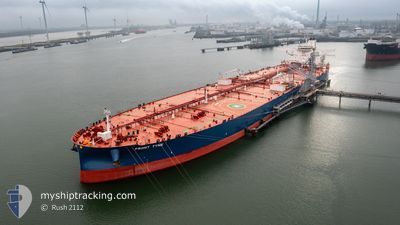
FRONT TYNE
Tanker

Current Trip
| Time Travelled | 33 days |
|---|---|
| Remaining Time | 4 days |
| Distance Travelled | 7505.11 nm |
| Remaining Distance | 2044.16 nm |
| AVG Speed | 11.6 Knots |
| MAX Speed | 15.4 Knots |
| AVG Wind | 10.5 knots |
| MAX Wind | 25 knots |
| MIN Temp | 12.1°C / 53.78°F |
| MAX Temp | 30.9°C / 87.62°F |
| Dybgang | 11.2 m |
| Position Modtaget | 2 d siden |
Current Position
| Longitude | 76.38176° |
|---|---|
| Latitude | 8.15315° |
| Status | Under way using engine |
| Fart | 12.8 Knots |
| Kurs | 327° |
| Område | Laccadive Sea |
| Station | T-AIS |
| Position Modtaget | 2 d siden |
Information
The current position of FRONT TYNE is in Laccadive Sea with coordinates 8.15315° / 76.38176° as reported on 2025-06-08 16:05 by AIS to our vessel tracker app. The vessel's current speed is 12.8 Knots and is heading at the port of RAS TANURA. The estimated time of arrival as calculated by MyShipTracking vessel tracking app is 2025-06-15 13:51 LT
The vessel FRONT TYNE (IMO: 9933676, MMSI: 538010238) is a Tanker It's sailing under the flag of [MH] Marshall Is.
In this page you can find informations about the vessels current position, last detected port calls, and current voyage information. If the vessels is not in coverage by AIS you will find the latest position.
The current position of FRONT TYNE is detected by our AIS receivers and we are not responsible for the reliability of the data. The last position was recorded while the vessel was in Coverage by the Ais receivers of our vessel tracking app.
The current draught of FRONT TYNE as reported by AIS is 11.2 meters
Weather
| Temperature | 29.3°C / 84.74°F |
|---|---|
| Wind Speed | 17 knots |
| Direction | 300° WNW |
| Pressure | 1007.7 hPa |
| Humidity | 72.9 % |
| Cloud Coverage | 21 % |


Featured Company
Last Port Calls
| Port | Arrival | Departure | Time In Port |
|---|---|---|---|
| 2025-05-06 03:59 | 2025-05-08 06:57 | 2 d | |
| 2025-04-19 00:26 | 2025-04-19 20:05 | 19 h | |
| 2025-04-11 03:33 | 2025-04-11 22:25 | 18 h |
Most Visited Ports (Last year)
| Port | Arrivals | |
|---|---|---|
| 2 | ||
| 1 | ||
| 1 |
Last Trips
| Origin | Departure | Destination | Arrival | Distance | |
|---|---|---|---|---|---|
| 2025-04-19 20:05 | 2025-05-06 03:59 | 3879.17 nm | |||
| 2025-04-11 22:25 | 2025-04-19 00:26 | 23.75 nm |
Events
| Tid | Hændelsen | Detaljer | Position / Dest | Info |
|---|---|---|---|---|
| 2025-06-08 16:12 | Status er ændret | Default Under way using engine |
8.17379 / 76.36826
SARTA
|
Fart: 12.8 kn Kurs: 327° |
| 2025-06-08 16:05 | Udenfor Dækning |
8.15315 / 76.38176
Laccadive Sea
SARTA
|
Fart: 12.8 kn Kurs: 327° |
|
| 2025-06-08 16:05 | Status er ændret | Under way using engine Default |
8.15269 / 76.38205
SARTA
|
Fart: 13 kn Kurs: 327° |
| 2025-06-08 15:55 | Status er ændret | Default Under way using engine |
8.12202 / 76.40230
SARTA
|
Fart: 13 kn Kurs: 326.5° |
| 2025-06-08 13:39 | Status er ændret | Under way using engine Default |
7.73216 / 76.68439
SARTA
|
Fart: 12.5 kn Kurs: 304° |
| 2025-06-08 13:25 | Status er ændret | Default Under way using engine |
7.70402 / 76.72669
SARTA
|
Fart: 12.5 kn Kurs: 303.4° |
| 2025-06-08 07:05 | Status er ændret | Under way using engine Default |
6.97011 / 77.87468
SARTA
|
Fart: 12.7 kn Kurs: 301° |
| 2025-06-08 06:59 | Status er ændret | Default Under way using engine |
6.95863 / 77.89351
SARTA
|
Fart: 12.6 kn Kurs: 301° |
| 2025-06-08 06:36 | Status er ændret | Under way using engine Default |
6.91570 / 77.96408
SARTA
|
Fart: 12.6 kn Kurs: 304° |
| 2025-06-08 06:32 | Status er ændret | Default Under way using engine |
6.90796 / 77.97592
SARTA
|
Fart: 12.6 kn Kurs: 303.7° |