

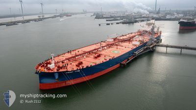
FRONT TYNE
Tanker

Current Trip
| Time Travelled | --- |
|---|---|
| Remaining Time | 6 h, 28 mins |
| Distance Travelled | 13977.20 nm |
| Remaining Distance | 80.55 nm |
| AVG Speed | 11.8 Knopen |
| MAX Speed | 17.4 Knopen |
| AVG Wind | 13.9 knots |
| MAX Wind | 32.8 knots |
| MIN Temp | 14.3°C / 57.74°F |
| MAX Temp | 30.6°C / 87.08°F |
| Diepgang | 10.6 M |
| Positie ontvangen | 1 m geleden |
Current Position
| Lengtegraad | 51.29167° |
|---|---|
| Breedtegraat | 27.09894° |
| Status | Under way using engine |
| Snelheid | 11.7 Knopen |
| Koers | 274.4° |
| Gebied | Persian Gulf |
| Station | T-AIS |
| Positie ontvangen | 1 m geleden |
Information
The current position of FRONT TYNE is in Persian Gulf with coordinates 27.09894° / 51.29167° as reported on 2025-04-10 14:19 by AIS to our vessel tracker app. The vessel's current speed is 11.7 Knopen and is heading at the port of RAS TANURA. The estimated time of arrival as calculated by MyShipTracking vessel tracking app is 2025-04-10 20:49 LT
The vessel FRONT TYNE (IMO: 9933676, MMSI: 538010238) is a Tanker It's sailing under the flag of [MH] Marshall Is.
In this page you can find informations about the vessels current position, last detected port calls, and current voyage information. If the vessels is not in coverage by AIS you will find the latest position.
The current position of FRONT TYNE is detected by our AIS receivers and we are not responsible for the reliability of the data. The last position was recorded while the vessel was in Coverage by the Ais receivers of our vessel tracking app.
The current draught of FRONT TYNE as reported by AIS is 10.6 meters
Weather
| Temperature | 25.1°C / 77.18°F |
|---|---|
| Wind Speed | 10 knots |
| Direction | 85° E |
| Pressure | 1004.2 hPa |
| Humidity | 76.5 % |
| Cloud Coverage | 5 % |


Featured Company
Last Port Calls
Last Trips
| Origin | Departure | Destination | Arrival | Distance |
|---|
Events
| Tijd | Evenement | Details | Positie / Bestemming | Info |
|---|---|---|---|---|
| 2025-04-10 12:34 | Status Changed | Under way using engine Default |
27.07032 / 51.68497
RAS TANURAH
|
Snelheid: 12.1 kn Koers: 273° |
| 2025-04-10 12:14 | Status Changed | Default Under way using engine |
27.06656 / 51.75957
RAS TANURAH
|
Snelheid: 12.3 kn Koers: 274° |
| 2025-04-10 04:54 | Binnenbereik |
26.33553 / 53.04558
Persian Gulf
|
Snelheid: 12.9 kn Koers: 307.8° |
|
| 2025-04-10 04:53 | Status Changed | Under way using engine Default |
26.33186 / 53.05085
RAS TANURAH
|
Snelheid: 12.7 kn Koers: 307° |
| 2025-04-10 01:10 | Status Changed | Default Under way using engine |
25.85023 / 53.58503
RAS TANURAH
|
Snelheid: 12.6 kn Koers: 260° |
| 2025-04-10 01:09 | Buitenbereik |
25.85055 / 53.58702
Persian Gulf
|
Snelheid: 12.6 kn Koers: 260° |
|
| 2025-04-10 01:04 | Status Changed | Under way using engine Default |
25.85366 / 53.60677
RAS TANURAH
|
Snelheid: 12.6 kn Koers: 261° |
| 2025-04-10 00:54 | Binnenbereik |
25.85366 / 53.60677
Persian Gulf
|
Snelheid: 12.6 kn Koers: 260.2° |
|
| 2025-04-09 23:50 | Status Changed | Default Under way using engine |
25.88718 / 53.89995
RAS TANURAH
|
Snelheid: 12.9 kn Koers: 263.3° |
| 2025-04-09 23:44 | Buitenbereik |
25.88960 / 53.92438
Persian Gulf
|
Snelheid: 12.9 kn Koers: 263.3° |