
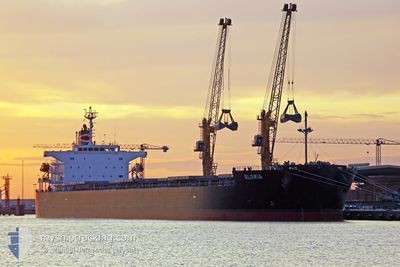
GLORIA
Bulk Carrier
Current Trip
ES SCI
| Time Travelled | 2 days |
|---|---|
| Remaining Time | --- |
| Distance Travelled | 237.55 nm |
| Remaining Distance | --- |
| AVG Speed | 10 Knots |
| MAX Speed | 11.1 Knots |
| AVG Wind | 14.4 knots |
| MAX Wind | 22 knots |
| MIN Temp | 10.7°C / 51.26°F |
| MAX Temp | 13.7°C / 56.66°F |
| Dybgang | 12.3 m |
| Position Modtaget | 7 d siden |
Current Position
| Longitude | -8.83785° |
|---|---|
| Latitude | 43.71335° |
| Status | Under way using engine |
| Fart | 9.1 Knots |
| Kurs | 65° |
| Område | North Atlantic Ocean |
| Station | T-AIS |
| Position Modtaget | 7 d siden |
Info
Information
The current position of GLORIA is in North Atlantic Ocean with coordinates 43.71335° / -8.83785° as reported on 2025-03-04 13:32 by AIS to our vessel tracker app. The vessel's current speed is 9.1 Knots
The vessel GLORIA (IMO: 9313307, MMSI: 636017692) is a Bulk Carrier that was built in 2011 ( 14 år gamle ). It's sailing under the flag of [LR] Liberia.
In this page you can find informations about the vessels current position, last detected port calls, and current voyage information. If the vessels is not in coverage by AIS you will find the latest position.
The current position of GLORIA is detected by our AIS receivers and we are not responsible for the reliability of the data. The last position was recorded while the vessel was in Coverage by the Ais receivers of our vessel tracking app.
The current draught of GLORIA as reported by AIS is 12.3 meters
Weather
| Temperature | 12.8°C / 55.04°F |
|---|---|
| Wind Speed | 13 knots |
| Direction | 338° NNW |
| Pressure | 1007.2 hPa |
| Humidity | 76.7 % |
| Cloud Coverage | 17 % |
Featured Company
Last Port Calls
| Port | Arrival | Departure | Time In Port |
|---|---|---|---|
| 2025-03-06 10:40 | 2025-03-09 09:58 | 2 d | |
| 2025-02-19 23:54 | 2025-02-22 01:55 | 2 d | |
| 2025-02-10 13:24 | 2025-02-13 18:53 | 3 d | |
| 2025-01-12 22:24 | 2025-01-16 14:20 | 3 d |
Most Visited Ports (Last year)
| Port | Arrivals | |
|---|---|---|
| 2 | ||
| 2 | ||
| 2 | ||
| 2 | ||
| 1 | ||
| 1 |
Last Trips
| Origin | Departure | Destination | Arrival | Distance | |
|---|---|---|---|---|---|
| 2025-02-22 01:55 | 2025-03-06 10:40 | 2373.81 nm | |||
| 2025-02-13 18:53 | 2025-02-19 23:54 | 1704.78 nm | |||
| 2025-01-16 14:20 | 2025-02-10 13:24 | 3642.25 nm | |||
| 2024-12-19 15:20 | 2025-01-12 22:24 | 3838.77 nm |
Events
| Tid | Hændelsen | Detaljer | Position / Dest | Info |
|---|---|---|---|---|
| 2025-03-09 08:58 | Afsejlet fra sidste havn |
|
43.73311 / -7.44454
ES SCI
|
Fart: 3.1 kn Kurs: 61° |
| 2025-03-09 08:46 | START Sejllads |
43.71368 / -7.46197
[ES] SAN CIPRIAN
|
Fart: 3.1 kn Kurs: 61° |
|
| 2025-03-06 09:40 | Skibe i havn |
|
43.70881 / -7.46158
[ES] SAN CIPRIAN
|
Fart: 1.8 kn Kurs: 337° |
| 2025-03-06 05:35 | START Sejllads | 5.3 nm, North East of SAN CIPRIAN |
43.78175 / -7.38692
ES SCI
|
Fart: 6.4 kn Kurs: 199° |
| 2025-03-05 08:38 | STOP Sejllads | 9.72 nm, North of SAN CIPRIAN |
43.86359 / -7.38028
ES SCI
|
Fart: 0.3 kn Kurs: 42° |
| 2025-03-04 13:38 | Status er ændret | Default Under way using engine |
43.72142 / -8.81779
ES SCI
|
Fart: 9.1 kn Kurs: 65° |
| 2025-03-04 13:32 | Udenfor Dækning |
43.71335 / -8.83785
North Atlantic Ocean
|
Fart: 9.1 kn Kurs: 65° |
|
| 2025-03-04 12:16 | Status er ændret | Under way using engine Default |
43.61435 / -9.06517
ES SCI
|
Fart: 8.8 kn Kurs: 62° |
| 2025-03-04 12:09 | Status er ændret | Default Under way using engine |
43.60600 / -9.08642
ES SCI
|
Fart: 8.6 kn Kurs: 61.7° |
| 2025-03-04 11:57 | Status er ændret | Under way using engine Default |
43.59202 / -9.12193
ES SCI
|
Fart: 8.8 kn Kurs: 61° |