
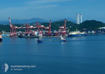
GLORY STAR
Cargo
Current Trip
CN YZH
| Time Travelled | 16 days |
|---|---|
| Remaining Time | --- |
| Distance Travelled | 1811.23 nm |
| Remaining Distance | --- |
| AVG Speed | 8.7 Knots |
| MAX Speed | 12.6 Knots |
| AVG Wind | 11.8 knots |
| MAX Wind | 33.8 knots |
| MIN Temp | -5.7°C / 21.74°F |
| MAX Temp | 11°C / 51.8°F |
| Dybgang | 5 m |
| Position Modtaget | 16 d siden |
Current Position
| Longitude | 140.14878° |
|---|---|
| Latitude | 41.12330° |
| Status | Under way using engine |
| Fart | 8.8 Knots |
| Kurs | 209.1° |
| Område | Japan Sea |
| Station | T-AIS |
| Position Modtaget | 16 d siden |
Info
Information
The current position of GLORY STAR is in Japan Sea with coordinates 41.12330° / 140.14878° as reported on 2025-01-23 13:51 by AIS to our vessel tracker app. The vessel's current speed is 8.8 Knots
The vessel GLORY STAR (IMO: 8590166, MMSI: 352001482) is a Cargo It's sailing under the flag of [PA] Panama.
In this page you can find informations about the vessels current position, last detected port calls, and current voyage information. If the vessels is not in coverage by AIS you will find the latest position.
The current position of GLORY STAR is detected by our AIS receivers and we are not responsible for the reliability of the data. The last position was recorded while the vessel was in Coverage by the Ais receivers of our vessel tracking app.
The current draught of GLORY STAR as reported by AIS is 5 meters
Weather
| Temperature | 2.7°C / 36.86°F |
|---|---|
| Wind Speed | 15 knots |
| Direction | 329° NNW |
| Pressure | 1033.1 hPa |
| Humidity | 57.8 % |
| Cloud Coverage | 100 % |
Featured Company
Last Trips
| Origin | Departure | Destination | Arrival | Distance | |
|---|---|---|---|---|---|
| 2025-01-07 23:21 | 2025-01-20 06:47 | 1444.93 nm | |||
| 2025-01-03 17:08 | 2025-01-05 15:09 | 393.09 nm | |||
| 2024-12-17 20:57 | 2025-01-02 22:04 | 1791.72 nm | |||
| 2024-12-03 16:52 | 2024-12-14 10:28 | 2189.88 nm |
Events
| Tid | Hændelsen | Detaljer | Position / Dest | Info |
|---|---|---|---|---|
| 2025-02-08 06:09 | START Sejllads | 4.73 nm, East of TAICANG |
31.63578 / 121.28207
CN YZH
|
Fart: 3.8 kn Kurs: 240° |
| 2025-02-06 15:11 | STOP Sejllads | 4.87 nm, East of TAICANG |
31.63655 / 121.28547
CN YZH
|
Fart: Kurs: 308° |
| 2025-02-06 04:09 | START Sejllads | 1.54 nm, North West of GAOGANG |
32.30395 / 119.82915
CN YZH
|
Fart: 6.6 kn Kurs: 145° |
| 2025-02-05 08:40 | STOP Sejllads | 1.93 nm, North West of GAOGANG |
32.31198 / 119.82748
CN YZH
|
Fart: 0.1 kn Kurs: 313° |
| 2025-02-05 06:57 | START Sejllads | 1.08 nm, North West of TAIXING |
32.14967 / 119.90528
CN YZH
|
Fart: 4.8 kn Kurs: 11° |
| 2025-02-04 10:44 | STOP Sejllads | 1.03 nm, North West of TAIXING |
32.14640 / 119.90152
CN YZH
|
Fart: 0.3 kn Kurs: 354° |
| 2025-02-04 09:01 | START Sejllads | 6.09 nm, West of GAOGANG |
32.32078 / 119.73980
CN YZH
|
Fart: 10.8 kn Kurs: 65° |
| 2025-02-03 08:16 | STOP Sejllads | 6.54 nm, West of GAOGANG |
32.32078 / 119.73053
CN YZH
|
Fart: 0.2 kn Kurs: 226° |
| 2025-01-30 10:29 | START Sejllads | 2.21 nm, South of MIHONOSEKI |
35.52403 / 133.31824
CN YZH
|
Fart: 3.9 kn Kurs: 54° |