
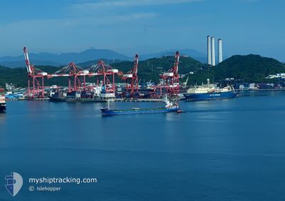
GLORY STAR
Cargo
Current Trip
CN YZH
| Time Travelled | 9 days |
|---|---|
| Remaining Time | --- |
| Distance Travelled | 1162.85 nm |
| Remaining Distance | --- |
| AVG Speed | 8.5 Knots |
| MAX Speed | 11.8 Knots |
| AVG Wind | 12.3 knots |
| MAX Wind | 33.8 knots |
| MIN Temp | 1.8°C / 35.24°F |
| MAX Temp | 11°C / 51.8°F |
| Draught | 5 m |
| Position Received | 9 d ago |
Current Position
| Longitude | 140.14878° |
|---|---|
| Latitude | 41.12330° |
| Status | Under way using engine |
| Speed | 8.8 Knots |
| Course | 209.1° |
| Area | Japan Sea |
| Station | T-AIS |
| Position Received | 9 d ago |
Info
Information
The current position of GLORY STAR is in Japan Sea with coordinates 41.12330° / 140.14878° as reported on 2025-01-23 13:51 by AIS to our vessel tracker app. The vessel's current speed is 8.8 Knots
The vessel GLORY STAR (IMO: 8590166, MMSI: 352001482) is a Cargo It's sailing under the flag of [PA] Panama.
In this page you can find informations about the vessels current position, last detected port calls, and current voyage information. If the vessels is not in coverage by AIS you will find the latest position.
The current position of GLORY STAR is detected by our AIS receivers and we are not responsible for the reliability of the data. The last position was recorded while the vessel was in Coverage by the Ais receivers of our vessel tracking app.
The current draught of GLORY STAR as reported by AIS is 5 meters
Weather
| Temperature | 9.7°C / 49.46°F |
|---|---|
| Wind Speed | 26 knots |
| Direction | 37° NE |
| Pressure | 1016 hPa |
| Humidity | 84.5 % |
| Cloud Coverage | 100 % |
Featured Company
Last Trips
| Origin | Departure | Destination | Arrival | Distance | |
|---|---|---|---|---|---|
| 2025-01-07 23:21 | 2025-01-20 06:47 | 1444.93 nm | |||
| 2025-01-03 17:08 | 2025-01-05 15:09 | 393.09 nm | |||
| 2024-12-17 20:57 | 2025-01-02 22:04 | 1791.72 nm | |||
| 2024-12-03 16:52 | 2024-12-14 10:28 | 2189.88 nm |
Events
| Time | Event | Details | Position / Dest | Info |
|---|---|---|---|---|
| 2025-01-30 10:29 | START Moving | 2.21 nm, South of MIHONOSEKI |
35.52403 / 133.31824
CN YZH
|
Speed: 3.9 kn Course: 54° |
| 2025-01-27 22:17 | STOP Moving | 1.99 nm, South of MIHONOSEKI |
35.52785 / 133.31827
CN YZH
|
Speed: 0.1 kn Course: 217° |
| 2025-01-26 00:33 | START Moving | 8.34 nm, East of NANAO |
37.07829 / 137.14681
CN YZH
|
Speed: 4.3 kn Course: 43° |
| 2025-01-25 23:07 | STOP Moving | 8.88 nm, East of NANAO |
37.06708 / 137.15874
CN YZH
|
Speed: 0.3 kn Course: 48° |
| 2025-01-25 16:17 | START Moving | 11.43 nm, East of JORO |
36.99225 / 137.27234
CN YZH
|
Speed: 5.2 kn Course: 348° |
| 2025-01-25 03:13 | STOP Moving | 12.17 nm, East of NANAO |
37.09003 / 137.22557
CN YZH
|
Speed: 0.3 kn Course: 230° |
| 2025-01-23 13:57 | Status Changed | Default Under way using engine |
41.11155 / 140.13988
CN YZH
|
Speed: 8.8 kn Course: 209.1° |
| 2025-01-23 13:51 | OUT of Coverage |
41.12330 / 140.14878
Japan Sea
CN YZH
|
Speed: 8.8 kn Course: 209.1° |
|
| 2025-01-23 13:45 | Status Changed | Under way using engine Default |
41.13720 / 140.16013
CN YZH
|
Speed: 8.2 kn Course: 210° |
| 2025-01-23 13:24 | Status Changed | Default Under way using engine |
41.17717 / 140.18912
CN YZH
|
Speed: 7.8 kn Course: 210.5° |