
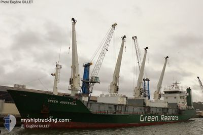
GREEN AUSTEVOLL
Reefer
Current Trip
| Time Travelled | 8 h, 36 mins |
|---|---|
| Remaining Time | 5 days |
| Distance Travelled | 86.08 nm |
| Remaining Distance | 1694.06 nm |
| AVG Speed | 11.7 Knots |
| MAX Speed | 13.1 Knots |
| AVG Wind | 17.2 knots |
| MAX Wind | 23 knots |
| MIN Temp | 1.9°C / 35.42°F |
| MAX Temp | 4°C / 39.2°F |
| Dybgang | 7.4 m |
| Position Modtaget | 34 m siden |
Current Position
| Longitude | 2.43133° |
|---|---|
| Latitude | 51.79353° |
| Status | Under way using engine |
| Fart | 11.4 Knots |
| Kurs | 224° |
| Område | North Sea |
| Station | T-AIS |
| Position Modtaget | 34 m siden |
Info
Information
The current position of GREEN AUSTEVOLL is in North Sea with coordinates 51.79353° / 2.43133° as reported on 2025-02-11 10:42 by AIS to our vessel tracker app. The vessel's current speed is 11.4 Knots and is heading at the port of LAS PALMAS. The estimated time of arrival as calculated by MyShipTracking vessel tracking app is 2025-02-17 02:21 LT
The vessel GREEN AUSTEVOLL (IMO: 8819299, MMSI: 311043800) is a Reefer that was built in 1991 ( 34 år gamle ). It's sailing under the flag of [BS] Bahamas.
In this page you can find informations about the vessels current position, last detected port calls, and current voyage information. If the vessels is not in coverage by AIS you will find the latest position.
The current position of GREEN AUSTEVOLL is detected by our AIS receivers and we are not responsible for the reliability of the data. The last position was recorded while the vessel was in Coverage by the Ais receivers of our vessel tracking app.
The current draught of GREEN AUSTEVOLL as reported by AIS is 7.4 meters
Weather
| Temperature | 5.3°C / 41.54°F |
|---|---|
| Wind Speed | 6 knots |
| Direction | 331° NNW |
| Pressure | 1016.7 hPa |
| Humidity | 85.2 % |
| Cloud Coverage | 100 % |
Featured Company
Last Port Calls
| Port | Arrival | Departure | Time In Port |
|---|---|---|---|
| 2025-02-05 23:52 | 2025-02-11 02:41 | 5 d | |
| 2025-01-20 13:56 | 2025-01-25 00:49 | 4 d | |
| 2025-01-05 16:51 | 2025-01-09 16:44 | 3 d | |
| 2024-12-24 22:20 | 2024-12-28 20:52 | 3 d | |
| 2024-12-02 22:04 | 2024-12-06 22:28 | 4 d |
Most Visited Ports (Last year)
| Port | Arrivals | |
|---|---|---|
| 6 | ||
| 3 | ||
| 3 | ||
| 1 | ||
| 1 | ||
| 1 |
Last Trips
| Origin | Departure | Destination | Arrival | Distance | |
|---|---|---|---|---|---|
| 2025-01-25 01:49 | 2025-02-06 00:52 | 1882.29 nm | |||
| 2025-01-09 17:44 | 2025-01-20 14:56 | 1790.00 nm | |||
| 2024-12-28 21:52 | 2025-01-05 17:51 | 1803.89 nm | |||
| 2024-12-06 23:28 | 2024-12-24 23:20 | 1804.19 nm | |||
| 2024-11-26 11:28 | 2024-12-02 23:04 | 1287.85 nm |
Events
| Tid | Hændelsen | Detaljer | Position / Dest | Info |
|---|---|---|---|---|
| 2025-02-11 10:49 | Status er ændret | Default Under way using engine |
51.77879 / 2.40735
ESLPA
|
Fart: 11.4 kn Kurs: 224° |
| 2025-02-11 10:42 | Ændre havområde | United Kingdom part of the North Sea Dutch part of the North Sea |
51.79353 / 2.43133
North Sea
ESLPA
|
Fart: 11.4 kn Kurs: 224° |
| 2025-02-11 10:42 | Status er ændret | Under way using engine Default |
51.79353 / 2.43133
ESLPA
|
Fart: 11.7 kn Kurs: 224° |
| 2025-02-11 10:05 | Status er ændret | Default Under way using engine |
51.88405 / 2.56677
ESLPA
|
Fart: 12.3 kn Kurs: 221.6° |
| 2025-02-11 09:43 | Status er ændret | Under way using engine Default |
51.94063 / 2.64759
ESLPA
|
Fart: 12.7 kn Kurs: 221° |
| 2025-02-11 09:39 | Status er ændret | Default Under way using engine |
51.94988 / 2.66074
ESLPA
|
Fart: 12.7 kn Kurs: 219.9° |
| 2025-02-11 09:36 | Status er ændret | Under way using engine Default |
51.95900 / 2.67381
ESLPA
|
Fart: 12.8 kn Kurs: 221° |
| 2025-02-11 09:36 | Indenfor Dækning |
51.95900 / 2.67381
North Sea
ESLPA
|
Fart: 12.7 kn Kurs: 219.9° |
|
| 2025-02-11 04:47 | Status er ændret | Default Under way using engine |
52.51818 / 3.93309
ESLPA
|
Fart: 11.6 kn Kurs: 268.9° |
| 2025-02-11 04:42 | Udenfor Dækning |
52.51837 / 3.95955
North Sea
ESLPA
|
Fart: 11.6 kn Kurs: 268.9° |