
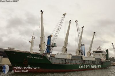
GREEN AUSTEVOLL
Reefer
Current Trip
| Trip Time | 11 days |
|---|---|
| Trip Distance | 1882.29 nm |
| AVG Speed | 9.1 Knots |
| MAX Speed | 15.5 Knots |
| Draught | 5.2 m |
| AVG Wind | 15.8 knots |
| MAX Wind | 37 knots |
| MIN Temp | 5.5°C / 41.9°F |
| MAX Temp | 18.7°C / 65.66°F |
| Position Received | 2 m ago |
Current Position
| Longitude | 4.58466° |
|---|---|
| Latitude | 52.45730° |
| Status | Moored |
| Speed | |
| Course | 122° |
| Area | North Sea |
| Station | T-AIS |
| Position Received | 2 m ago |
Info
Information
The current position of GREEN AUSTEVOLL is in North Sea with coordinates 52.45730° / 4.58466° as reported on 2025-02-06 09:57 by AIS to our vessel tracker app. The vessel's current speed is 0 Knots and is currently inside the port of IJMUIDEN.
The vessel GREEN AUSTEVOLL (IMO: 8819299, MMSI: 311043800) is a Reefer that was built in 1991 ( 34 years old ). It's sailing under the flag of [BS] Bahamas.
In this page you can find informations about the vessels current position, last detected port calls, and current voyage information. If the vessels is not in coverage by AIS you will find the latest position.
The current position of GREEN AUSTEVOLL is detected by our AIS receivers and we are not responsible for the reliability of the data. The last position was recorded while the vessel was in Coverage by the Ais receivers of our vessel tracking app.
The current draught of GREEN AUSTEVOLL as reported by AIS is 5.2 meters
Weather
| Temperature | 4.7°C / 40.46°F |
|---|---|
| Wind Speed | 11 knots |
| Direction | 45° NE |
| Pressure | 1042.9 hPa |
| Humidity | 92.5 % |
| Cloud Coverage | --- |
Featured Company
Last Port Calls
| Port | Arrival | Departure | Time In Port |
|---|---|---|---|
| 2025-02-05 23:52 | |||
| 2025-01-20 13:56 | 2025-01-25 00:49 | 4 d | |
| 2025-01-05 16:51 | 2025-01-09 16:44 | 3 d | |
| 2024-12-24 22:20 | 2024-12-28 20:52 | 3 d | |
| 2024-12-02 22:04 | 2024-12-06 22:28 | 4 d |
Most Visited Ports (Last year)
| Port | Arrivals | |
|---|---|---|
| 6 | ||
| 3 | ||
| 3 | ||
| 1 | ||
| 1 | ||
| 1 |
Last Trips
| Origin | Departure | Destination | Arrival | Distance | |
|---|---|---|---|---|---|
| 2025-01-25 01:49 | 2025-02-06 00:52 | 1882.29 nm | |||
| 2025-01-09 17:44 | 2025-01-20 14:56 | 1790.00 nm | |||
| 2024-12-28 21:52 | 2025-01-05 17:51 | 1803.89 nm | |||
| 2024-12-06 23:28 | 2024-12-24 23:20 | 1804.19 nm | |||
| 2024-11-26 11:28 | 2024-12-02 23:04 | 1287.85 nm |
Events
| Time | Event | Details | Position / Dest | Info |
|---|---|---|---|---|
| 2025-02-06 00:13 | Status Changed | Moored Under way using engine |
52.45732 / 4.58466
[NL] IJMUIDEN
|
Speed: Course: 122° |
| 2025-02-06 00:06 | STOP Moving |
52.45737 / 4.58463
[NL] IJMUIDEN
|
Speed: 0.3 kn Course: 120° |
|
| 2025-02-05 23:52 | PORT ARRIVAL |
|
52.46680 / 4.58432
[NL] IJMUIDEN
|
Speed: 5.1 kn Course: 138.9° |
| 2025-02-05 21:32 | START Moving | 18.13 nm, West of IJMUIDEN |
52.45663 / 4.09391
NLIJM
|
Speed: 5.5 kn Course: 354.7° |
| 2025-02-05 21:28 | Status Changed | Under way using engine Default |
52.45484 / 4.09712
NLIJM
|
Speed: 0.2 kn Course: 234° |
| 2025-02-05 21:21 | Status Changed | Default At anchor |
52.45593 / 4.09933
NLIJM
|
Speed: Course: 230° |
| 2025-02-05 21:18 | Status Changed | At anchor Default |
52.45602 / 4.09950
NLIJM
|
Speed: 0.1 kn Course: 225° |
| 2025-02-05 21:00 | Status Changed | Default At anchor |
52.45611 / 4.09939
NLIJM
|
Speed: 0.1 kn Course: 227° |
| 2025-02-05 20:21 | Status Changed | At anchor Default |
52.45629 / 4.09895
NLIJM
|
Speed: Course: 216° |
| 2025-02-05 20:15 | Status Changed | Default At anchor |
52.45629 / 4.09906
NLIJM
|
Speed: Course: 213° |