
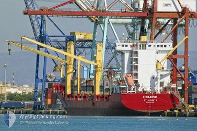
HELENE
Container Ship
Current Trip
| Trip Time | 3 days |
|---|---|
| Trip Distance | 729.99 nm |
| AVG Speed | 5.2 Knots |
| MAX Speed | 5.2 Knots |
| Dybgang | 8.8 m |
| AVG Wind | 7.3 knots |
| MAX Wind | 20.3 knots |
| MIN Temp | 11.8°C / 53.24°F |
| MAX Temp | 16.7°C / 62.06°F |
| Position Modtaget | 3 d siden |
Current Position
| Longitude | 8.67196° |
|---|---|
| Latitude | 41.23461° |
| Status | Under way using engine |
| Fart | 11.8 Knots |
| Kurs | 259.1° |
| Område | Mediterranean Sea - Western Basin |
| Station | T-AIS |
| Position Modtaget | 3 d siden |
Info
Information
The current position of HELENE is in Mediterranean Sea - Western Basin with coordinates 41.23461° / 8.67196° as reported on 2025-02-27 15:11 by AIS to our vessel tracker app. The vessel's current speed is 11.8 Knots and is currently inside the port of ALGER.
The vessel HELENE (IMO: 9362956, MMSI: 304157000) is a Container Ship that was built in 2007 ( 18 år gamle ). It's sailing under the flag of [AG] Antigua Barbuda.
In this page you can find informations about the vessels current position, last detected port calls, and current voyage information. If the vessels is not in coverage by AIS you will find the latest position.
The current position of HELENE is detected by our AIS receivers and we are not responsible for the reliability of the data. The last position was recorded while the vessel was in Coverage by the Ais receivers of our vessel tracking app.
The current draught of HELENE as reported by AIS is 8.8 meters
Weather
| Temperature | 21.8°C / 71.24°F |
|---|---|
| Wind Speed | 3 knots |
| Direction | 127° SE |
| Pressure | 1015.8 hPa |
| Humidity | 42.3 % |
| Cloud Coverage | 100 % |
Featured Company
Last Port Calls
| Port | Arrival | Departure | Time In Port |
|---|---|---|---|
| 2025-02-28 23:20 | |||
| 2025-02-24 21:07 | 2025-02-25 17:18 | 20 h | |
| 2025-02-16 23:57 | 2025-02-22 01:34 | 5 d | |
| 2025-02-10 00:04 | 2025-02-10 16:51 | 16 h | |
| 2025-02-08 19:24 | 2025-02-09 00:16 | 4 h | |
| 2025-02-01 18:50 | 2025-02-07 07:33 | 5 d | |
| 2025-01-19 17:15 | 2025-01-20 12:39 | 19 h | |
| 2025-01-11 11:21 | 2025-01-16 06:59 | 4 d | |
| 2025-01-07 08:32 | 2025-01-07 20:04 | 11 h |
Most Visited Ports (Last year)
| Port | Arrivals | |
|---|---|---|
| 12 | ||
| 8 | ||
| 6 | ||
| 5 | ||
| 5 | ||
| 5 |
Last Trips
| Origin | Departure | Destination | Arrival | Distance | |
|---|---|---|---|---|---|
| 2025-02-25 18:18 | 2025-03-01 00:20 | 729.99 nm | |||
| 2025-02-22 02:34 | 2025-02-24 22:07 | 802.06 nm | |||
| 2025-02-10 17:51 | 2025-02-17 00:57 | 349.73 nm | |||
| 2025-02-09 01:16 | 2025-02-10 01:04 | 77.48 nm | |||
| 2025-02-07 08:33 | 2025-02-08 20:24 | 448.93 nm | |||
| 2025-01-20 13:39 | 2025-02-01 19:50 | 1000.19 nm | |||
| 2025-01-16 07:59 | 2025-01-19 18:15 | 591.10 nm | |||
| 2025-01-07 21:04 | 2025-01-11 12:21 | 713.72 nm | |||
| 2024-12-29 23:36 | 2025-01-07 09:32 | 610.24 nm |
Events
| Tid | Hændelsen | Detaljer | Position / Dest | Info |
|---|---|---|---|---|
| 2025-02-28 23:46 | STOP Sejllads |
36.76486 / 3.06700
[DZ] ALGER
|
Fart: Kurs: 321° |
|
| 2025-02-28 23:20 | Skibe i havn |
|
36.76328 / 3.07451
[DZ] ALGER
|
Fart: 5 kn Kurs: 200° |
| 2025-02-27 15:11 | Udenfor Dækning |
41.23461 / 8.67196
Mediterranean Sea - Western Basin
DZALG
|
Fart: 11.8 kn Kurs: 259.1° |
|
| 2025-02-27 14:15 | Ændre havområde | Italian part of the Mediterranean Sea - Western Basin French part of the Tyrrhenian Sea |
41.27083 / 8.90658
Mediterranean Sea - Western Basin
DZALG
|
Fart: 10.9 kn Kurs: 261° |
| 2025-02-27 14:15 | Indenfor Dækning |
41.27083 / 8.90658
Mediterranean Sea - Western Basin
DZALG
|
Fart: 10.9 kn Kurs: 261° |
|
| 2025-02-27 11:27 | Udenfor Dækning |
41.47344 / 9.53821
Tyrrhenian Sea
DZALG
|
Fart: 12.1 kn Kurs: 226.7° |
|
| 2025-02-27 09:06 | Status er ændret | Under way using engine Default |
41.70217 / 9.72253
DZALG
|
Fart: 4.9 kn Kurs: 189° |
| 2025-02-27 09:05 | Status er ændret | Default Under way using engine |
41.70309 / 9.72257
DZALG
|
Fart: 4.8 kn Kurs: 198° |
| 2025-02-26 02:33 | ETA er ændret | 2025/02/28 22:30 2025/02/25 22:00 |
42.58693 / 9.72443
DZALG
|
Fart: 13.2 kn Kurs: 169.3° |
| 2025-02-26 01:08 | Fundet i havområde | French part of the Tyrrhenian Sea |
42.89227 / 9.62111
Tyrrhenian Sea
DZALG
|
Fart: 13 kn Kurs: 166.3° |