
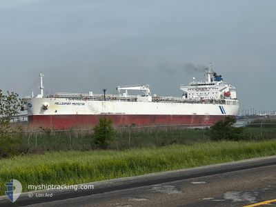
HELLESPONT PROTECTOR
Crude Oil Tanker
Current Trip
| Trip Time | 3 h, 36 mins |
|---|---|
| Trip Distance | 30.43 nm |
| AVG Speed | 9 Knots |
| MAX Speed | 11.2 Knots |
| Dybgang | 11.1 m |
| AVG Wind | 6.5 knots |
| MAX Wind | 8.7 knots |
| MIN Temp | 12.9°C / 55.22°F |
| MAX Temp | 18°C / 64.4°F |
| Position Modtaget | 1 d siden |
Current Position
| Longitude | -90.30458° |
|---|---|
| Latitude | 29.95290° |
| Status | At anchor |
| Fart | |
| Kurs | 211° |
| Område | Gulf of Mexico |
| Station | T-AIS |
| Position Modtaget | 1 d siden |
Info
Information
The current position of HELLESPONT PROTECTOR is in Gulf of Mexico with coordinates 29.95290° / -90.30458° as reported on 2026-01-01 07:50 by AIS to our vessel tracker app. The vessel's current speed is 0 Knots and is currently inside the port of CONVENT.
The vessel HELLESPONT PROTECTOR (IMO: 9351452, MMSI: 232012083) is a Crude Oil Tanker that was built in 2007 ( 19 år gamle ). It's sailing under the flag of [GB] United Kingdom.
In this page you can find informations about the vessels current position, last detected port calls, and current voyage information. If the vessels is not in coverage by AIS you will find the latest position.
The current position of HELLESPONT PROTECTOR is detected by our AIS receivers and we are not responsible for the reliability of the data. The last position was recorded while the vessel was in Coverage by the Ais receivers of our vessel tracking app.
The current draught of HELLESPONT PROTECTOR as reported by AIS is 11.1 meters
Weather
| Temperature | 20.7°C / 69.26°F |
|---|---|
| Wind Speed | 10 knots |
| Direction | 227° SW |
| Pressure | 1009.7 hPa |
| Humidity | 90.4 % |
| Cloud Coverage | 52 % |
Featured Company
Last Port Calls
| Port | Arrival | Departure | Time In Port |
|---|---|---|---|
| 2026-01-02 09:02 | |||
| 2025-12-28 13:41 | 2026-01-02 05:26 | 4 d | |
| 2025-12-12 20:34 | 2025-12-14 11:20 | 1 d | |
| 2025-12-04 13:25 | 2025-12-06 21:23 | 2 d | |
| 2025-11-30 18:59 | 2025-12-02 03:04 | 1 d | |
| 2025-11-19 14:49 | 2025-11-24 14:18 | 4 d | |
| 2025-11-12 21:45 | 2025-11-12 22:08 | 23 m | |
| 2025-11-05 21:53 | 2025-11-07 22:35 | 2 d |
Most Visited Ports (Last year)
| Port | Arrivals | |
|---|---|---|
| 3 | ||
| 3 | ||
| 2 | ||
| 1 | ||
| 1 | ||
| 1 |
Last Trips
| Origin | Departure | Destination | Arrival | Distance | |
|---|---|---|---|---|---|
| 2026-01-02 05:26 | 2026-01-02 09:02 | 30.43 nm | |||
| 2025-12-14 11:20 | 2025-12-28 13:41 | 1080.92 nm | |||
| 2025-12-06 21:23 | 2025-12-12 20:34 | 939.76 nm | |||
| 2025-12-02 03:04 | 2025-12-04 13:25 | 85.40 nm | |||
| 2025-11-24 14:18 | 2025-11-30 18:59 | 714.68 nm | |||
| 2025-11-12 22:08 | 2025-11-19 14:49 | 753.12 nm | |||
| 2025-11-07 22:35 | 2025-11-12 21:45 | 746.47 nm | |||
| 2025-09-18 17:52 | 2025-11-05 21:53 | 1206.69 nm |
Events
| Tid | Hændelsen | Detaljer | Position / Dest | Info |
|---|---|---|---|---|
| 2026-01-02 15:02 | STOP Sejllads |
30.00262 / -90.83488
[US] CONVENT
|
Fart: 0.1 kn Kurs: 343° |
|
| 2026-01-02 15:02 | Skibe i havn |
|
30.00262 / -90.83488
[US] CONVENT
|
Fart: 8.3 kn Kurs: 333° |
| 2026-01-02 11:26 | Afsejlet fra sidste havn |
|
29.94980 / -90.38970
USGRY
|
Fart: 10.1 kn Kurs: 301° |
| 2026-01-02 10:55 | START Sejllads |
29.94857 / -90.30755
[US] NEW ORLEANS
|
Fart: 3.6 kn Kurs: 219° |
|
| 2026-01-01 07:53 | Status er ændret | Default At anchor |
29.95287 / -90.30456
[US] NEW ORLEANS
|
Fart: Kurs: 211° |
| 2026-01-01 07:50 | Status er ændret | At anchor Default |
29.95290 / -90.30458
[US] NEW ORLEANS
|
Fart: Kurs: 211° |
| 2026-01-01 07:11 | ETA er ændret | 2026/12/28 08:00 2025/12/28 08:00 |
29.95298 / -90.30455
[US] NEW ORLEANS
|
Fart: Kurs: 212° |
| 2026-01-01 06:29 | Status er ændret | Default At anchor |
29.95288 / -90.30454
[US] NEW ORLEANS
|
Fart: Kurs: 214° |
| 2026-01-01 06:23 | Status er ændret | At anchor Default |
29.95287 / -90.30453
[US] NEW ORLEANS
|
Fart: Kurs: 213° |
| 2026-01-01 06:23 | Udenfor Dækning |
29.95287 / -90.30453
Gulf of Mexico
[US] NEW ORLEANS
|
Fart: Kurs: 152° |