
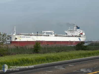
HELLESPONT PROTECTOR
Crude Oil Tanker
Current Trip
MXPAJ
| Time Travelled | 2 days |
|---|---|
| Remaining Time | --- |
| Distance Travelled | 663.04 nm |
| Remaining Distance | --- |
| AVG Speed | 12.3 Knots |
| MAX Speed | 13.9 Knots |
| AVG Wind | 11.6 knots |
| MAX Wind | 20 knots |
| MIN Temp | 17.3°C / 63.14°F |
| MAX Temp | 26.7°C / 80.06°F |
| Draught | 6.7 m |
| Position Received | 9 h, 45 m ago |
Current Position
| Longitude | -94.49790° |
|---|---|
| Latitude | 29.13348° |
| Status | Under way using engine |
| Speed | 3.7 Knots |
| Course | 8° |
| Area | Gulf of Mexico |
| Station | T-AIS |
| Position Received | 9 h, 45 m ago |
Info
Information
The current position of HELLESPONT PROTECTOR is in Gulf of Mexico with coordinates 29.13348° / -94.49790° as reported on 2025-12-16 23:17 by AIS to our vessel tracker app. The vessel's current speed is 3.7 Knots
The vessel HELLESPONT PROTECTOR (IMO: 9351452, MMSI: 232012083) is a Crude Oil Tanker that was built in 2007 ( 18 years old ). It's sailing under the flag of [GB] United Kingdom.
In this page you can find informations about the vessels current position, last detected port calls, and current voyage information. If the vessels is not in coverage by AIS you will find the latest position.
The current position of HELLESPONT PROTECTOR is detected by our AIS receivers and we are not responsible for the reliability of the data. The last position was recorded while the vessel was in Coverage by the Ais receivers of our vessel tracking app.
The current draught of HELLESPONT PROTECTOR as reported by AIS is 6.7 meters
Weather
| Temperature | 18.6°C / 65.48°F |
|---|---|
| Wind Speed | 9 knots |
| Direction | 130° SE |
| Pressure | 1017 hPa |
| Humidity | 85.2 % |
| Cloud Coverage | 100 % |
Featured Company
Last Port Calls
| Port | Arrival | Departure | Time In Port |
|---|---|---|---|
| 2025-12-12 20:34 | 2025-12-14 11:20 | 1 d | |
| 2025-12-04 13:25 | 2025-12-06 21:23 | 2 d | |
| 2025-11-30 18:59 | 2025-12-02 03:04 | 1 d | |
| 2025-11-19 14:49 | 2025-11-24 14:18 | 4 d | |
| 2025-11-12 21:45 | 2025-11-12 22:08 | 23 m | |
| 2025-11-05 21:53 | 2025-11-07 22:35 | 2 d |
Most Visited Ports (Last year)
| Port | Arrivals | |
|---|---|---|
| 4 | ||
| 4 | ||
| 2 | ||
| 1 | ||
| 1 | ||
| 1 |
Last Trips
| Origin | Departure | Destination | Arrival | Distance | |
|---|---|---|---|---|---|
| 2025-12-06 21:23 | 2025-12-12 20:34 | 939.76 nm | |||
| 2025-12-02 03:04 | 2025-12-04 13:25 | 85.40 nm | |||
| 2025-11-24 14:18 | 2025-11-30 18:59 | 714.68 nm | |||
| 2025-11-12 22:08 | 2025-11-19 14:49 | 753.12 nm | |||
| 2025-11-07 22:35 | 2025-11-12 21:45 | 746.47 nm | |||
| 2025-09-18 17:52 | 2025-11-05 21:53 | 1206.69 nm |
Events
| Time | Event | Details | Position / Dest | Info |
|---|---|---|---|---|
| 2025-12-16 23:39 | STOP Moving | 18.73 nm, South East of GALVESTON |
29.13440 / -94.50021
MXPAJ
|
Speed: 0.3 kn Course: 30° |
| 2025-12-16 23:24 | Status Changed | Default Under way using engine |
29.13613 / -94.49847
MXPAJ
|
Speed: 3.7 kn Course: 8° |
| 2025-12-16 23:17 | OUT of Coverage |
29.13348 / -94.49790
Gulf of Mexico
|
Speed: 3.7 kn Course: 6° |
|
| 2025-12-16 23:04 | Status Changed | Under way using engine Default |
29.11653 / -94.50087
MXPAJ
|
Speed: 5.2 kn Course: 8° |
| 2025-12-16 23:04 | Status Changed | Default Under way using engine |
29.11557 / -94.50105
MXPAJ
|
Speed: 6.8 kn Course: 316° |
| 2025-12-16 22:58 | Status Changed | Under way using engine Default |
29.10662 / -94.50010
MXPAJ
|
Speed: 7.9 kn Course: 299° |
| 2025-12-16 22:20 | Status Changed | Default Under way using engine |
29.03578 / -94.42667
MXPAJ
|
Speed: 12.6 kn Course: 355° |
| 2025-12-16 22:10 | Change Sea Area | United States part of the Gulf of Mexico Mexican part of the Gulf of Mexico |
29.00048 / -94.42323
Gulf of Mexico
|
Speed: 12.8 kn Course: 355° |
| 2025-12-16 22:09 | Status Changed | Under way using engine Default |
28.99750 / -94.42298
MXPAJ
|
Speed: 12.9 kn Course: 355° |
| 2025-12-16 22:07 | IN Coverage |
29.00048 / -94.42323
Gulf of Mexico
|
Speed: 12.8 kn Course: 355° |