
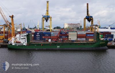
KURLAND
General Cargo
Current Trip
| Time Travelled | 9 h, 7 mins |
|---|---|
| Remaining Time | --- |
| Distance Travelled | 88.03 nm |
| Remaining Distance | --- |
| AVG Speed | 10.1 Knots |
| MAX Speed | 10.5 Knots |
| AVG Wind | 13.9 knots |
| MAX Wind | 18.7 knots |
| MIN Temp | --- |
| MAX Temp | 2.6°C / 36.68°F |
| Dybgang | 5.5 m |
| Position Modtaget | 2 m siden |
Current Position
| Longitude | 23.61846° |
|---|---|
| Latitude | 59.69337° |
| Status | Under way using engine |
| Fart | 10.2 Knots |
| Kurs | 258.3° |
| Område | Gulf of Finland |
| Station | T-AIS |
| Position Modtaget | 2 m siden |
Info
Information
The current position of KURLAND is in Gulf of Finland with coordinates 59.69337° / 23.61846° as reported on 2025-02-06 03:02 by AIS to our vessel tracker app. The vessel's current speed is 10.2 Knots and is heading at the port of IGGESUND. The estimated time of arrival as calculated by MyShipTracking vessel tracking app is 2025-02-07 03:00 LT
The vessel KURLAND (IMO: 9226803, MMSI: 210853000) is a General Cargo that was built in 2002 ( 23 år gamle ). It's sailing under the flag of [CY] Cyprus.
In this page you can find informations about the vessels current position, last detected port calls, and current voyage information. If the vessels is not in coverage by AIS you will find the latest position.
The current position of KURLAND is detected by our AIS receivers and we are not responsible for the reliability of the data. The last position was recorded while the vessel was in Coverage by the Ais receivers of our vessel tracking app.
The current draught of KURLAND as reported by AIS is 5.5 meters
Weather
| Temperature | 1.8°C / 35.24°F |
|---|---|
| Wind Speed | 9 knots |
| Direction | 339° NNW |
| Pressure | 1032.3 hPa |
| Humidity | 93.4 % |
| Cloud Coverage | 100 % |
Featured Company
Last Port Calls
| Port | Arrival | Departure | Time In Port |
|---|---|---|---|
| 2025-02-04 21:56 | 2025-02-05 17:57 | 20 h | |
| 2025-02-01 23:42 | 2025-02-03 14:38 | 1 d | |
| 2025-01-24 05:17 | 2025-01-24 20:25 | 15 h | |
| 2025-01-18 21:45 | 2025-01-19 19:05 | 21 h | |
| 2025-01-15 09:33 | 2025-01-17 11:06 | 2 d | |
| 2025-01-09 16:26 | 2025-01-10 14:03 | 21 h | |
| 2025-01-05 21:37 | 2025-01-07 17:17 | 1 d | |
| 2024-12-29 06:43 | 2024-12-30 16:51 | 1 d | |
| 2024-12-25 11:01 | 2024-12-27 17:06 | 2 d | |
| 2024-12-22 06:17 | 2024-12-23 08:05 | 1 d |
Most Visited Ports (Last year)
| Port | Arrivals | |
|---|---|---|
| 8 | ||
| 8 | ||
| 6 | ||
| 6 | ||
| 6 | ||
| 6 |
Last Trips
| Origin | Departure | Destination | Arrival | Distance | |
|---|---|---|---|---|---|
| 2025-02-03 15:38 | 2025-02-04 23:56 | 330.93 nm | |||
| 2025-01-24 21:25 | 2025-02-02 00:42 | 732.98 nm | |||
| 2025-01-19 20:05 | 2025-01-24 06:17 | 837.20 nm | |||
| 2025-01-17 12:06 | 2025-01-18 22:45 | 380.02 nm | |||
| 2025-01-10 16:03 | 2025-01-15 10:33 | 749.96 nm | |||
| 2025-01-07 18:17 | 2025-01-09 18:26 | 473.21 nm | |||
| 2024-12-30 17:51 | 2025-01-05 22:37 | 811.63 nm | |||
| 2024-12-27 19:06 | 2024-12-29 07:43 | 365.19 nm | |||
| 2024-12-23 10:05 | 2024-12-25 13:01 | 533.29 nm | |||
| 2024-12-20 10:06 | 2024-12-22 08:17 | 416.84 nm |
Events
| Tid | Hændelsen | Detaljer | Position / Dest | Info |
|---|---|---|---|---|
| 2025-02-06 02:26 | Status er ændret | Under way using engine Default |
59.71246 / 23.81643
IGGESUND
|
Fart: 10.1 kn Kurs: 259° |
| 2025-02-06 02:18 | Status er ændret | Default Under way using engine |
59.71664 / 23.86126
IGGESUND
|
Fart: 10.3 kn Kurs: 257.3° |
| 2025-02-06 01:55 | Status er ændret | Under way using engine Default |
59.72920 / 23.98673
IGGESUND
|
Fart: 10.2 kn Kurs: 256° |
| 2025-02-06 01:01 | Status er ændret | Default Under way using engine |
59.76304 / 24.27873
IGGESUND
|
Fart: 9.9 kn Kurs: 258.1° |
| 2025-02-06 00:48 | Status er ændret | Under way using engine Default |
59.77006 / 24.34652
IGGESUND
|
Fart: 10.3 kn Kurs: 258° |
| 2025-02-06 00:42 | Status er ændret | Default Under way using engine |
59.77360 / 24.37957
IGGESUND
|
Fart: 9.9 kn Kurs: 257.5° |
| 2025-02-05 23:59 | Ændre havområde | Finnish part of the Gulf of Finland Estonian part of the Gulf of Finland |
59.79525 / 24.61579
Gulf of Finland
IGGESUND
|
Fart: 10.1 kn Kurs: 273.7° |
| 2025-02-05 23:59 | Status er ændret | Under way using engine Default |
59.79525 / 24.61579
IGGESUND
|
Fart: 9.9 kn Kurs: 276° |
| 2025-02-05 23:50 | Status er ændret | Default Under way using engine |
59.79246 / 24.66722
IGGESUND
|
Fart: 10.2 kn Kurs: 278.3° |
| 2025-02-05 23:00 | ETA er ændret | 2025/02/07 03:00 2025/02/07 06:00 |
59.77383 / 24.94166
IGGESUND
|
Fart: 10.2 kn Kurs: 281.9° |