
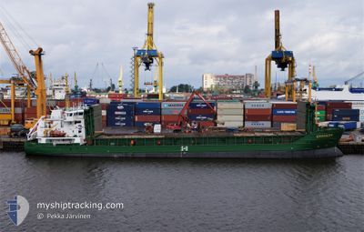
KURLAND
General Cargo
Current Trip
| Time Travelled | 17 h, 17 mins |
|---|---|
| Remaining Time | 6 h, 4 mins |
| Distance Travelled | 154.20 морская миля |
| Remaining Distance | 61.04 морская миля |
| AVG Speed | 9.8 Узлы |
| MAX Speed | 10 Узлы |
| AVG Wind | 8 knots |
| MAX Wind | 11.6 knots |
| MIN Temp | -0.3°C / 31.46°F |
| MAX Temp | 1.8°C / 35.24°F |
| Осадка | 4.6 м |
| Позиция Получена | 2 m тому назад |
Current Position
| Долгота | 17.93105° |
|---|---|
| Широта | 57.74318° |
| Статус | Under way using engine |
| Скорость | 9.9 Узлы |
| Курс | 235.7° |
| Район | Baltic Sea |
| Станция | T-AIS |
| Позиция Получена | 2 m тому назад |
Info
Information
The current position of KURLAND is in Baltic Sea with coordinates 57.74318° / 17.93105° as reported on 2025-02-11 07:30 by AIS to our vessel tracker app. The vessel's current speed is 9.9 Узлы and is heading at the port of MONSTERAS. The estimated time of arrival as calculated by MyShipTracking vessel tracking app is 2025-02-11 13:37 LT
The vessel KURLAND (IMO: 9226803, MMSI: 210853000) is a General Cargo that was built in 2002 ( 23 лет ). It's sailing under the flag of [CY] Cyprus.
In this page you can find informations about the vessels current position, last detected port calls, and current voyage information. If the vessels is not in coverage by AIS you will find the latest position.
The current position of KURLAND is detected by our AIS receivers and we are not responsible for the reliability of the data. The last position was recorded while the vessel was in Coverage by the Ais receivers of our vessel tracking app.
The current draught of KURLAND as reported by AIS is 4.6 meters
Weather
| Temperature | 1.1°C / 33.98°F |
|---|---|
| Wind Speed | 9 knots |
| Direction | 99° E |
| Pressure | 1041.5 hPa |
| Humidity | 82.7 % |
| Cloud Coverage | 7 % |
Featured Company
Last Port Calls
| Port | Arrival | Departure | Time In Port |
|---|---|---|---|
| 2025-02-09 13:43 | 2025-02-10 14:16 | 1 d | |
| 2025-02-07 08:05 | 2025-02-08 06:10 | 22 h | |
| 2025-02-04 21:56 | 2025-02-05 17:57 | 20 h | |
| 2025-02-01 23:42 | 2025-02-03 14:38 | 1 d | |
| 2025-01-24 05:17 | 2025-01-24 20:25 | 15 h | |
| 2025-01-18 21:45 | 2025-01-19 19:05 | 21 h | |
| 2025-01-15 09:33 | 2025-01-17 11:06 | 2 d | |
| 2025-01-09 16:26 | 2025-01-10 14:03 | 21 h | |
| 2025-01-05 21:37 | 2025-01-07 17:17 | 1 d | |
| 2024-12-29 06:43 | 2024-12-30 16:51 | 1 d |
Most Visited Ports (Last year)
| Port | Arrivals | |
|---|---|---|
| 8 | ||
| 8 | ||
| 7 | ||
| 6 | ||
| 6 | ||
| 6 |
Last Trips
| Origin | Departure | Destination | Arrival | Distance | |
|---|---|---|---|---|---|
| 2025-02-08 07:10 | 2025-02-09 15:43 | 310.82 морская миля | |||
| 2025-02-05 19:57 | 2025-02-07 09:05 | 350.11 морская миля | |||
| 2025-02-03 15:38 | 2025-02-04 23:56 | 330.93 морская миля | |||
| 2025-01-24 21:25 | 2025-02-02 00:42 | 732.98 морская миля | |||
| 2025-01-19 20:05 | 2025-01-24 06:17 | 837.20 морская миля | |||
| 2025-01-17 12:06 | 2025-01-18 22:45 | 380.02 морская миля | |||
| 2025-01-10 16:03 | 2025-01-15 10:33 | 749.96 морская миля | |||
| 2025-01-07 18:17 | 2025-01-09 18:26 | 473.21 морская миля | |||
| 2024-12-30 17:51 | 2025-01-05 22:37 | 811.63 морская миля | |||
| 2024-12-27 19:06 | 2024-12-29 07:43 | 365.19 морская миля |
Events
| Время | Событие | Детали | Позиция / Направление | Информация |
|---|---|---|---|---|
| 2025-02-11 01:22 | Осадка изменилась | 4.6 3.9 |
58.09100 / 19.62863
MONSTERAS
|
Скорость: 9.9 kn Курс: 284.9° |
| 2025-02-11 01:22 | Пункт назначения изменился | MONSTERAS ROOMASSAARE |
58.09100 / 19.62863
MONSTERAS
|
Скорость: 9.9 kn Курс: 284.9° |
| 2025-02-11 01:22 | ETA изменился | 2025/02/11 12:30 2025/02/09 13:00 |
58.09100 / 19.62863
MONSTERAS
|
Скорость: 9.9 kn Курс: 284.9° |
| 2025-02-11 01:20 | Статус изменился | Under way using engine Default |
58.08982 / 19.63687
ROOMASSAARE
|
Скорость: 9.8 kn Курс: 285° |
| 2025-02-11 01:17 | Статус изменился | Default Under way using engine |
58.08795 / 19.65022
ROOMASSAARE
|
Скорость: 9.8 kn Курс: 283.5° |
| 2025-02-11 00:59 | Обнаружено в море | Swedish part of the Baltic Sea |
58.07542 / 19.74397
Baltic Sea
|
Скорость: 9.9 kn Курс: 283° |
| 2025-02-11 00:58 | Статус изменился | Under way using engine Default |
58.07520 / 19.74573
ROOMASSAARE
|
Скорость: 9.9 kn Курс: 284° |
| 2025-02-11 00:45 | В покрытии |
58.07542 / 19.74397
Baltic Sea
|
Скорость: 9.9 kn Курс: 283° |
|
| 2025-02-10 14:16 | ПОРТ ОТПРАВЛЕНИЯ |
|
58.03303 / 22.35159
ROOMASSAARE
|
Скорость: 2 kn Курс: 116° |
| 2025-02-09 13:43 | Окончание движения |
58.21338 / 22.50673
[EE] ROOMASSAARE
|
Скорость: 0.3 kn Курс: 79° |