
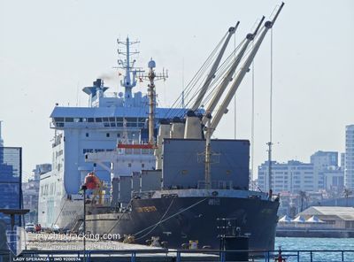
LADY SPERANZA
Bulk Carrier
Current Trip
| Time Travelled | 15 days |
|---|---|
| Remaining Time | --- |
| Distance Travelled | 1628.47 nm |
| Remaining Distance | --- |
| AVG Speed | 8.4 Knots |
| MAX Speed | 14.2 Knots |
| AVG Wind | 18.8 knots |
| MAX Wind | 37 knots |
| MIN Temp | 1.4°C / 34.52°F |
| MAX Temp | 17.9°C / 64.22°F |
| Dybgang | 7.9 m |
| Position Modtaget | 5 h, 14 m siden |
Current Position
| Longitude | 29.36099° |
|---|---|
| Latitude | 41.34214° |
| Status | Under way using engine |
| Fart | 6.6 Knots |
| Kurs | 157.3° |
| Område | Black Sea |
| Station | T-AIS |
| Position Modtaget | 5 h, 14 m siden |
Info
Information
The current position of LADY SPERANZA is in Black Sea with coordinates 41.34214° / 29.36099° as reported on 2026-01-03 14:56 by AIS to our vessel tracker app. The vessel's current speed is 6.6 Knots and is heading at the port of CASABLANCA. The estimated time of arrival as calculated by MyShipTracking vessel tracking app is 2026-01-10 11:00 LT
The vessel LADY SPERANZA (IMO: 9200574, MMSI: 630001013) is a Bulk Carrier that was built in 2000 ( 26 år gamle ). It's sailing under the flag of [GW] Guinea-Bissau.
In this page you can find informations about the vessels current position, last detected port calls, and current voyage information. If the vessels is not in coverage by AIS you will find the latest position.
The current position of LADY SPERANZA is detected by our AIS receivers and we are not responsible for the reliability of the data. The last position was recorded while the vessel was in Coverage by the Ais receivers of our vessel tracking app.
The current draught of LADY SPERANZA as reported by AIS is 7.9 meters
Weather
| Temperature | 14.1°C / 57.38°F |
|---|---|
| Wind Speed | 26 knots |
| Direction | 218° SW |
| Pressure | 1014.8 hPa |
| Humidity | 66 % |
| Cloud Coverage | 86 % |
Featured Company
Most Visited Ports (Last year)
| Port | Arrivals | |
|---|---|---|
| 3 | ||
| 2 | ||
| 2 | ||
| 2 | ||
| 2 | ||
| 2 |
Events
| Tid | Hændelsen | Detaljer | Position / Dest | Info |
|---|---|---|---|---|
| 2026-01-03 15:32 | STOP Sejllads | 12.28 nm, North West of SILE |
41.28833 / 29.37500
MA CAS
|
Fart: Kurs: -1° |
| 2026-01-03 15:00 | Status er ændret | Default Under way using engine |
41.33362 / 29.36512
MA CAS
|
Fart: 6.6 kn Kurs: 157.3° |
| 2026-01-03 14:56 | Udenfor Dækning |
41.34214 / 29.36099
Black Sea
MA CAS
|
Fart: 6.6 kn Kurs: 157.3° |
|
| 2026-01-03 14:02 | Status er ændret | Under way using engine Default |
41.42537 / 29.29281
MA CAS
|
Fart: 6.5 kn Kurs: 149° |
| 2026-01-03 13:57 | Status er ændret | Default Under way using engine |
41.43436 / 29.28592
MA CAS
|
Fart: 6.8 kn Kurs: 145.1° |
| 2026-01-03 13:48 | Status er ændret | Under way using engine Default |
41.44728 / 29.27591
MA CAS
|
Fart: 6.8 kn Kurs: 149° |
| 2026-01-03 13:33 | Status er ændret | Default Under way using engine |
41.47109 / 29.25427
MA CAS
|
Fart: 6.4 kn Kurs: 147.3° |
| 2026-01-03 12:55 | Status er ændret | Under way using engine Default |
41.49974 / 29.16034
MA CAS
|
Fart: 6.7 kn Kurs: 128° |
| 2026-01-03 12:52 | Indenfor Dækning |
41.49630 / 29.17065
Black Sea
MA CAS
|
Fart: 8.2 kn Kurs: 109.8° |
|
| 2026-01-03 11:16 | Udenfor Dækning |
41.49439 / 29.10545
Black Sea
MA CAS
|
Fart: 2.8 kn Kurs: 25.6° |