
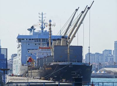
LADY SPERANZA
Bulk Carrier
Current Trip
| Time Travelled | 18 days |
|---|---|
| Remaining Time | --- |
| Distance Travelled | 1772.78 nm |
| Remaining Distance | --- |
| AVG Speed | 8.5 Noeuds |
| MAX Speed | 14.2 Noeuds |
| AVG Wind | 16.7 knots |
| MAX Wind | 37 knots |
| MIN Temp | 1.4°C / 34.52°F |
| MAX Temp | 17.9°C / 64.22°F |
| Tirant d eau | 7.9 m |
| Position reçue | 9 h, 11 m depuis |
Current Position
| Longitude | 27.59492° |
|---|---|
| Latitude | 40.75974° |
| Etat | Under way using engine |
| Vitesse | 11.1 Noeuds |
| Parcours | 243.9° |
| Zone | Sea of Marmara |
| Station | T-AIS |
| Position reçue | 9 h, 11 m depuis |
Info
Information
The current position of LADY SPERANZA is in Sea of Marmara with coordinates 40.75974° / 27.59492° as reported on 2026-01-06 11:59 by AIS to our vessel tracker app. The vessel's current speed is 11.1 Noeuds and is heading at the port of CASABLANCA. The estimated time of arrival as calculated by MyShipTracking vessel tracking app is 2026-01-10 11:00 LT
The vessel LADY SPERANZA (IMO: 9200574, MMSI: 630001013) is a Bulk Carrier that was built in 2000 ( 26 Age ). It's sailing under the flag of [GW] Guinea-Bissau.
In this page you can find informations about the vessels current position, last detected port calls, and current voyage information. If the vessels is not in coverage by AIS you will find the latest position.
The current position of LADY SPERANZA is detected by our AIS receivers and we are not responsible for the reliability of the data. The last position was recorded while the vessel was in Coverage by the Ais receivers of our vessel tracking app.
The current draught of LADY SPERANZA as reported by AIS is 7.9 meters
Weather
| Temperature | 15.6°C / 60.08°F |
|---|---|
| Wind Speed | 19 knots |
| Direction | 196° SSW |
| Pressure | 1013 hPa |
| Humidity | 74.7 % |
| Cloud Coverage | 9 % |
Featured Company
Most Visited Ports (Last year)
| Port | Arrivals | |
|---|---|---|
| 3 | ||
| 2 | ||
| 2 | ||
| 2 | ||
| 2 | ||
| 2 |
Events
| Heure | Evenement | Détails | Position/ Destination | Info |
|---|---|---|---|---|
| 2026-01-06 20:47 | Démarrage | 8.48 nm, North West of KEMER |
40.50333 / 26.90500
MA CAS
|
Vitesse: 10 kn Parcours: 232° |
| 2026-01-06 15:26 | Arret | 8.55 nm, North West of KEMER |
40.52170 / 26.92529
MA CAS
|
Vitesse: Parcours: 88° |
| 2026-01-06 12:05 | Etat Changé | Default Under way using engine |
40.75178 / 27.57359
MA CAS
|
Vitesse: 11.1 kn Parcours: 243.9° |
| 2026-01-06 11:59 | Hors de la zone couverte |
40.75974 / 27.59492
Sea of Marmara
MA CAS
|
Vitesse: 11.1 kn Parcours: 243.9° |
|
| 2026-01-06 11:57 | Etat Changé | Under way using engine Default |
40.76200 / 27.60099
MA CAS
|
Vitesse: 11.1 kn Parcours: 243° |
| 2026-01-06 11:53 | Etat Changé | Default Under way using engine |
40.76794 / 27.61675
MA CAS
|
Vitesse: 11 kn Parcours: 243° |
| 2026-01-06 11:52 | Etat Changé | Under way using engine Default |
40.76882 / 27.61903
MA CAS
|
Vitesse: 11.1 kn Parcours: 249° |
| 2026-01-06 11:25 | Etat Changé | Default Under way using engine |
40.78362 / 27.72939
MA CAS
|
Vitesse: 11.3 kn Parcours: 264° |
| 2026-01-06 06:10 | Démarrage | 1.97 nm, South of ZEYTINBURNU |
40.94799 / 28.90684
MA CAS
|
Vitesse: 3.2 kn Parcours: 226° |
| 2026-01-06 06:10 | Etat Changé | Under way using engine At anchor |
40.94843 / 28.90737
MA CAS
|
Vitesse: 2.3 kn Parcours: 210° |