
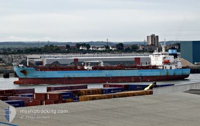
MAERSK TACOMA
Tanker
Current Trip
| Time Travelled | 17 days |
|---|---|
| Remaining Time | 2 h, 41 mins |
| Distance Travelled | 5288.17 nm |
| Remaining Distance | 33.38 nm |
| AVG Speed | 12.2 Knots |
| MAX Speed | 14.5 Knots |
| AVG Wind | 10.8 knots |
| MAX Wind | 22 knots |
| MIN Temp | 10.4°C / 50.72°F |
| MAX Temp | 28.2°C / 82.76°F |
| Dybgang | 11.7 m |
| Position Modtaget | 10 h, 20 m siden |
Current Position
| Longitude | 12.44730° |
|---|---|
| Latitude | -21.55456° |
| Status | Under way using engine |
| Fart | 10.9 Knots |
| Kurs | 122.1° |
| Område | South Atlantic Ocean |
| Station | T-AIS |
| Position Modtaget | 10 h, 20 m siden |
Info
Information
The current position of MAERSK TACOMA is in South Atlantic Ocean with coordinates -21.55456° / 12.44730° as reported on 2025-02-07 09:22 by AIS to our vessel tracker app. The vessel's current speed is 10.9 Knots and is heading at the port of WALVIS BAY. The estimated time of arrival as calculated by MyShipTracking vessel tracking app is 2025-02-07 22:24 LT
The vessel MAERSK TACOMA (IMO: 9708617, MMSI: 219179000) is a Tanker It's sailing under the flag of [DK] Denmark.
In this page you can find informations about the vessels current position, last detected port calls, and current voyage information. If the vessels is not in coverage by AIS you will find the latest position.
The current position of MAERSK TACOMA is detected by our AIS receivers and we are not responsible for the reliability of the data. The last position was recorded while the vessel was in Coverage by the Ais receivers of our vessel tracking app.
The current draught of MAERSK TACOMA as reported by AIS is 11.7 meters
Weather
| Temperature | 17.7°C / 63.86°F |
|---|---|
| Wind Speed | 6 knots |
| Direction | 190° S |
| Pressure | 1013 hPa |
| Humidity | 91.8 % |
| Cloud Coverage | 61 % |
Featured Company
Last Port Calls
| Port | Arrival | Departure | Time In Port |
|---|---|---|---|
| 2025-01-19 10:34 | 2025-01-21 03:28 | 1 d | |
| 2024-12-26 14:41 | 2025-01-02 10:28 | 6 d |
Most Visited Ports (Last year)
| Port | Arrivals | |
|---|---|---|
| 2 | ||
| 2 | ||
| 2 | ||
| 1 | ||
| 1 | ||
| 1 |
Last Trips
| Origin | Departure | Destination | Arrival | Distance | |
|---|---|---|---|---|---|
| 2025-01-02 12:28 | 2025-01-19 11:34 | 1927.79 nm | |||
| 2024-11-28 17:45 | 2024-12-26 16:41 | 7480.79 nm |
Events
| Tid | Hændelsen | Detaljer | Position / Dest | Info |
|---|---|---|---|---|
| 2025-02-07 09:28 | Status er ændret | Default Under way using engine |
-21.56489 / 12.46530
NA WVB
|
Fart: 10.9 kn Kurs: 122.1° |
| 2025-02-07 09:22 | Status er ændret | Under way using engine Default |
-21.55456 / 12.44730
NA WVB
|
Fart: 10.9 kn Kurs: 122° |
| 2025-02-07 09:22 | Udenfor Dækning |
-21.55456 / 12.44730
South Atlantic Ocean
|
Fart: 10.9 kn Kurs: 122.1° |
|
| 2025-02-07 08:52 | Status er ændret | Default Under way using engine |
-21.50716 / 12.36414
NA WVB
|
Fart: 10.8 kn Kurs: 118.5° |
| 2025-02-07 08:38 | Status er ændret | Under way using engine Default |
-21.48622 / 12.32731
NA WVB
|
Fart: 10.6 kn Kurs: 120° |
| 2025-02-07 08:22 | Status er ændret | Default Under way using engine |
-21.46105 / 12.28407
NA WVB
|
Fart: 10.6 kn Kurs: 120.6° |
| 2025-02-07 08:12 | Status er ændret | Under way using engine Default |
-21.44563 / 12.25716
NA WVB
|
Fart: 10.7 kn Kurs: 125° |
| 2025-02-07 08:00 | Status er ændret | Default Under way using engine |
-21.42689 / 12.22349
NA WVB
|
Fart: 10.8 kn Kurs: 121.8° |
| 2025-02-07 07:56 | Status er ændret | Under way using engine Default |
-21.42044 / 12.21285
NA WVB
|
Fart: 10.7 kn Kurs: 128° |
| 2025-02-07 07:51 | Status er ændret | Default Under way using engine |
-21.41163 / 12.19892
NA WVB
|
Fart: 11 kn Kurs: 122° |