

MARIA
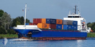
Tanker

Current Trip
| Time Travelled | 3 days |
|---|---|
| Remaining Time | --- |
| Distance Travelled | 520.18 nm |
| Remaining Distance | --- |
| AVG Speed | 7.5 Knots |
| MAX Speed | 8.8 Knots |
| AVG Wind | 15.1 knots |
| MAX Wind | 24.4 knots |
| MIN Temp | 26°C / 78.8°F |
| MAX Temp | 29.9°C / 85.82°F |
| Dybgang | 6 m |
| Position Modtaget | 12 d siden |
Current Position
| Longitude | 57.37450° |
|---|---|
| Latitude | 25.21805° |
| Status | Under way using engine |
| Fart | 8.1 Knots |
| Kurs | 122.9° |
| Område | Gulf of Oman |
| Station | T-AIS |
| Position Modtaget | 12 d siden |
Information
The current position of MARIA is in Gulf of Oman with coordinates 25.21805° / 57.37450° as reported on 2025-05-13 08:17 by AIS to our vessel tracker app. The vessel's current speed is 8.1 Knots and is heading at the port of KARWAR. The estimated time of arrival as calculated by MyShipTracking vessel tracking app is 2025-05-19 02:30 LT
The vessel MARIA (IMO: 9661845, MMSI: 305119000) is a Tanker It's sailing under the flag of [AG] Antigua Barbuda.
In this page you can find informations about the vessels current position, last detected port calls, and current voyage information. If the vessels is not in coverage by AIS you will find the latest position.
The current position of MARIA is detected by our AIS receivers and we are not responsible for the reliability of the data. The last position was recorded while the vessel was in Coverage by the Ais receivers of our vessel tracking app.
The current draught of MARIA as reported by AIS is 6 meters
Weather
| Temperature | 29.2°C / 84.56°F |
|---|---|
| Wind Speed | 15 knots |
| Direction | 268° W |
| Pressure | 1002.7 hPa |
| Humidity | 81.8 % |
| Cloud Coverage | 100 % |


Featured Company
Last Port Calls
| Port | Arrival | Departure | Time In Port |
|---|---|---|---|
| 2025-05-20 09:20 | 2025-05-22 13:04 | 2 d | |
| 2025-05-08 15:52 | 2025-05-09 17:20 | 1 d | |
| 2025-04-27 13:06 | 2025-04-28 22:40 | 1 d | |
| 2025-04-14 11:55 | 2025-04-15 16:05 | 1 d | |
| 2025-03-12 15:24 | 2025-03-13 17:04 | 1 d | |
| 2025-03-01 16:43 |
Last Trips
| Origin | Departure | Destination | Arrival | Distance | |
|---|---|---|---|---|---|
| 2025-05-09 17:20 | 2025-05-20 09:20 | 1545.45 nm | |||
| 2025-04-28 22:40 | 2025-05-08 15:52 | 1761.06 nm | |||
| 2025-04-15 16:05 | 2025-04-27 13:06 | 1631.53 nm | |||
| 2025-03-13 17:04 | 2025-04-14 11:55 | 4112.97 nm | |||
| 2025-03-01 16:43 | 2025-03-12 15:24 | 1046.06 nm |
Events
| Tid | Hændelsen | Detaljer | Position / Dest | Info |
|---|---|---|---|---|
| 2025-05-22 07:34 | Afsejlet fra sidste havn |
|
12.92215 / 74.78475
KARWAR
|
Fart: 7.9 kn Kurs: 254° |
| 2025-05-22 07:28 | START Sejllads |
12.92542 / 74.79933
[IN] PANAMBUR
|
Fart: 7.9 kn Kurs: 254° |
|
| 2025-05-20 03:50 | Skibe i havn |
|
12.92694 / 74.81027
[IN] PANAMBUR
|
Fart: 7.2 kn Kurs: 92° |
| 2025-05-20 02:38 | START Sejllads | 8.73 nm, West of PANAMBUR |
12.96599 / 74.66271
KARWAR
|
Fart: 9.1 kn Kurs: 110° |
| 2025-05-19 12:11 | STOP Sejllads | 10.54 nm, West of PANAMBUR |
12.97979 / 74.63458
KARWAR
|
Fart: 0.1 kn Kurs: 323° |