
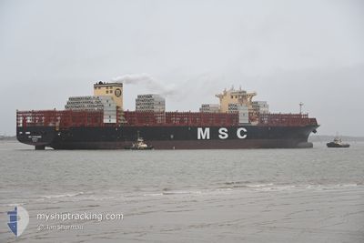
MSC CASSANDRE
Cargo
Current Trip
| Time Travelled | 1 day |
|---|---|
| Remaining Time | 6 days |
| Distance Travelled | 163.17 nm |
| Remaining Distance | 1089.38 nm |
| AVG Speed | 12.1 Knots |
| MAX Speed | 19 Knots |
| AVG Wind | 9.9 knots |
| MAX Wind | 14.9 knots |
| MIN Temp | 6.6°C / 43.88°F |
| MAX Temp | 10.2°C / 50.36°F |
| Dybgang | 11.8 m |
| Position Modtaget | 1 m siden |
Current Position
| Longitude | 2.14290° |
|---|---|
| Latitude | 51.78079° |
| Status | Under way using engine |
| Fart | 0.7 Knots |
| Kurs | 289° |
| Område | North Sea |
| Station | T-AIS |
| Position Modtaget | 1 m siden |
Info
Information
The current position of MSC CASSANDRE is in North Sea with coordinates 51.78079° / 2.14290° as reported on 2025-03-06 23:36 by AIS to our vessel tracker app. The vessel's current speed is 0.7 Knots and is heading at the port of SINES. The estimated time of arrival as calculated by MyShipTracking vessel tracking app is 2025-03-13 15:13 LT
The vessel MSC CASSANDRE (IMO: 9785471, MMSI: 636021364) is a Cargo It's sailing under the flag of [LR] Liberia.
In this page you can find informations about the vessels current position, last detected port calls, and current voyage information. If the vessels is not in coverage by AIS you will find the latest position.
The current position of MSC CASSANDRE is detected by our AIS receivers and we are not responsible for the reliability of the data. The last position was recorded while the vessel was in Coverage by the Ais receivers of our vessel tracking app.
The current draught of MSC CASSANDRE as reported by AIS is 11.8 meters
Weather
| Temperature | 9.7°C / 49.46°F |
|---|---|
| Wind Speed | 13 knots |
| Direction | 200° SSW |
| Pressure | 1014.1 hPa |
| Humidity | 84.8 % |
| Cloud Coverage | 84 % |
Featured Company
Last Port Calls
| Port | Arrival | Departure | Time In Port |
|---|---|---|---|
| 2025-03-04 12:06 | 2025-03-05 22:28 | 1 d | |
| 2025-03-02 21:34 | 2025-03-03 18:25 | 20 h | |
| 2025-02-28 23:19 | 2025-03-01 19:10 | 19 h | |
| 2025-02-14 08:00 | 2025-02-18 06:51 | 3 d | |
| 2025-02-11 20:29 | 2025-02-12 11:38 | 15 h | |
| 2025-02-09 13:30 | 2025-02-09 20:27 | 6 h | |
| 2025-02-06 19:18 | 2025-02-07 19:42 | 1 d | |
| 2025-02-01 00:20 | 2025-02-02 03:19 | 1 d | |
| 2025-01-29 16:53 | 2025-01-31 07:13 | 1 d | |
| 2025-01-28 00:59 | 2025-01-29 03:40 | 1 d |
Most Visited Ports (Last year)
| Port | Arrivals | |
|---|---|---|
| 5 | ||
| 4 | ||
| 4 | ||
| 4 | ||
| 4 | ||
| 3 |
Last Trips
| Origin | Departure | Destination | Arrival | Distance | |
|---|---|---|---|---|---|
| 2025-03-03 18:25 | 2025-03-04 13:06 | 193.20 nm | |||
| 2025-03-01 20:10 | 2025-03-02 21:34 | 177.62 nm | |||
| 2025-02-18 01:51 | 2025-03-01 00:19 | 4993.68 nm | |||
| 2025-02-12 06:38 | 2025-02-14 03:00 | 57.18 nm | |||
| 2025-02-09 15:27 | 2025-02-11 15:29 | 867.82 nm | |||
| 2025-02-07 14:42 | 2025-02-09 08:30 | 517.07 nm | |||
| 2025-02-02 00:19 | 2025-02-06 14:18 | 1305.00 nm | |||
| 2025-01-31 04:13 | 2025-01-31 21:20 | 272.23 nm | |||
| 2025-01-29 00:40 | 2025-01-29 13:53 | 236.04 nm | |||
| 2025-01-24 21:38 | 2025-01-27 21:59 | 1337.70 nm |
Events
| Tid | Hændelsen | Detaljer | Position / Dest | Info |
|---|---|---|---|---|
| 2025-03-06 19:01 | START Sejllads |
51.85970 / 2.18067
PTSIE
|
Fart: 3.1 kn Kurs: 84° |
|
| 2025-03-06 15:32 | STOP Sejllads |
51.77490 / 2.12650
PTSIE
|
Fart: 0.3 kn Kurs: 27° |
|
| 2025-03-06 15:09 | START Sejllads |
51.78608 / 2.12303
PTSIE
|
Fart: 3.1 kn Kurs: 312° |
|
| 2025-03-06 11:29 | ETA er ændret | 2025/03/12 06:00 2025/03/11 08:00 |
51.82702 / 2.20976
PTSIE
|
Fart: 0.7 kn Kurs: 276° |
| 2025-03-06 10:19 | STOP Sejllads |
51.82716 / 2.21986
PTSIE
|
Fart: 0.3 kn Kurs: 292° |
|
| 2025-03-06 07:22 | Ændre havområde | United Kingdom part of the North Sea Belgian part of the North Sea |
51.86004 / 2.51947
North Sea
PTSIE
|
Fart: 11.5 kn Kurs: 305.9° |
| 2025-03-06 05:23 | Ændre havområde | Belgian part of the North Sea French part of the North Sea |
51.50468 / 2.27094
North Sea
PTSIE
|
Fart: 13.2 kn Kurs: 38.9° |
| 2025-03-06 04:01 | Ændre havområde | French part of the North Sea Belgian part of the North Sea |
51.34939 / 2.34443
North Sea
PTSIE
|
Fart: 9.7 kn Kurs: 251.9° |
| 2025-03-06 01:13 | Ændre havområde | Belgian part of the North Sea Dutch part of the North Sea |
51.40696 / 3.31047
North Sea
PTSIE
|
Fart: 17.3 kn Kurs: 276.7° |
| 2025-03-05 22:28 | Afsejlet fra sidste havn |
|
51.36839 / 4.22050
PTSIE
|
Fart: 17.7 kn Kurs: 342° |