

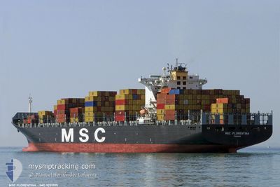
MSC FLORENTINA
Container Ship

Current Trip
| Time Travelled | 15 days |
|---|---|
| Remaining Time | 13 mins |
| Distance Travelled | 5741.25 nm |
| Remaining Distance | 15.13 nm |
| AVG Speed | 16.6 Knots |
| MAX Speed | 20.1 Knots |
| AVG Wind | 12.1 knots |
| MAX Wind | 22.8 knots |
| MIN Temp | 11.1°C / 51.98°F |
| MAX Temp | 30.3°C / 86.54°F |
| Dybgang | 11 m |
| Position Modtaget | 1 m siden |
Current Position
| Longitude | -97.63252° |
|---|---|
| Latitude | 22.50421° |
| Status | Under way using engine |
| Fart | 1.7 Knots |
| Kurs | 212° |
| Område | Gulf of Mexico |
| Station | T-AIS |
| Position Modtaget | 1 m siden |
Information
The current position of MSC FLORENTINA is in Gulf of Mexico with coordinates 22.50421° / -97.63252° as reported on 2025-06-13 03:26 by AIS to our vessel tracker app. The vessel's current speed is 1.7 Knots and is heading at the port of ALTAMIRA. The estimated time of arrival as calculated by MyShipTracking vessel tracking app is 2025-06-12 22:40 LT
The vessel MSC FLORENTINA (IMO: 9251705, MMSI: 352870000) is a Container Ship that was built in 2003 ( 22 år gamle ). It's sailing under the flag of [PA] Panama.
In this page you can find informations about the vessels current position, last detected port calls, and current voyage information. If the vessels is not in coverage by AIS you will find the latest position.
The current position of MSC FLORENTINA is detected by our AIS receivers and we are not responsible for the reliability of the data. The last position was recorded while the vessel was in Coverage by the Ais receivers of our vessel tracking app.
The current draught of MSC FLORENTINA as reported by AIS is 11 meters
Weather
| Temperature | 28.6°C / 83.48°F |
|---|---|
| Wind Speed | 14 knots |
| Direction | 128° SE |
| Pressure | 1009.8 hPa |
| Humidity | 84.6 % |
| Cloud Coverage | 73 % |


Featured Company
Last Port Calls
| Port | Arrival | Departure | Time In Port |
|---|---|---|---|
| 2025-05-27 05:03 | 2025-05-28 09:25 | 1 d | |
| 2025-05-25 17:23 | 2025-05-26 09:11 | 15 h | |
| 2025-05-22 23:55 | 2025-05-25 07:11 | 2 d | |
| 2025-05-08 00:48 | 2025-05-08 22:32 | 21 h | |
| 2025-05-05 10:44 | 2025-05-06 02:04 | 15 h | |
| 2025-05-03 05:39 | 2025-05-04 09:29 | 1 d | |
| 2025-04-30 03:33 | 2025-05-01 23:49 | 1 d | |
| 2025-04-26 14:27 | 2025-04-27 13:45 | 23 h | |
| 2025-04-12 02:38 | 2025-04-12 18:05 | 15 h | |
| 2025-04-08 20:56 | 2025-04-09 21:32 | 1 d |
Most Visited Ports (Last year)
| Port | Arrivals | |
|---|---|---|
| 4 | ||
| 3 | ||
| 3 | ||
| 3 | ||
| 3 | ||
| 2 |
Last Trips
| Origin | Departure | Destination | Arrival | Distance | |
|---|---|---|---|---|---|
| 2025-05-26 09:11 | 2025-05-27 05:03 | 274.64 nm | |||
| 2025-05-25 07:11 | 2025-05-25 17:23 | 119.01 nm | |||
| 2025-05-08 22:32 | 2025-05-22 23:55 | 4462.89 nm | |||
| 2025-05-06 02:04 | 2025-05-08 00:48 | 822.50 nm | |||
| 2025-05-04 09:29 | 2025-05-05 10:44 | 238.81 nm | |||
| 2025-05-01 23:49 | 2025-05-03 05:39 | 441.71 nm | |||
| 2025-04-27 13:45 | 2025-04-30 03:33 | 491.69 nm | |||
| 2025-04-12 18:05 | 2025-04-26 14:27 | 5803.82 nm | |||
| 2025-04-09 21:32 | 2025-04-12 02:38 | 299.37 nm | |||
| 2025-04-07 19:00 | 2025-04-08 20:56 | 388.07 nm |
Events
| Tid | Hændelsen | Detaljer | Position / Dest | Info |
|---|---|---|---|---|
| 2025-06-13 01:21 | Status er ændret | Under way using engine Default |
22.46346 / -97.58916
MXATM
|
Fart: 0.5 kn Kurs: 161° |
| 2025-06-13 01:02 | Status er ændret | Default Under way using engine |
22.46363 / -97.58518
MXATM
|
Fart: 0.7 kn Kurs: 169° |
| 2025-06-12 23:21 | Destination er ændret | MXATM MXVER |
22.35191 / -97.45238
MXATM
|
Fart: 8.3 kn Kurs: 318.4° |
| 2025-06-12 23:21 | ETA er ændret | 2025/06/13 02:00 |
22.35191 / -97.45238
MXATM
|
Fart: 8.3 kn Kurs: 318.4° |
| 2025-06-12 23:10 | Status er ændret | Under way using engine Default |
22.33051 / -97.43468
MXVER
|
Fart: 8.6 kn Kurs: 330° |
| 2025-06-12 23:07 | Status er ændret | Default Under way using engine |
22.32639 / -97.43192
MXVER
|
Fart: 8.7 kn Kurs: 332.1° |
| 2025-06-12 23:01 | Fundet i havområde | Mexican part of the Gulf of Mexico |
22.31336 / -97.42428
Gulf of Mexico
|
Fart: 8.7 kn Kurs: 332.1° |
| 2025-06-12 23:01 | Status er ændret | Under way using engine Default |
22.31336 / -97.42428
MXVER
|
Fart: 8.7 kn Kurs: 333° |
| 2025-06-12 22:55 | Indenfor Dækning |
22.31336 / -97.42428
Gulf of Mexico
|
Fart: 8.7 kn Kurs: 332.1° |
|
| 2025-06-12 03:32 | START Sejllads | 2.93 nm, North West of VERACRUZ |
19.23192 / -96.16711
MXVER
|
Fart: 6.6 kn Kurs: 171° |