
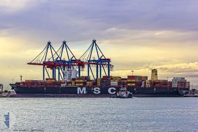
MSC MICHELA
Cargo A
Current Trip
| Time Travelled | 3 h, 26 mins |
|---|---|
| Remaining Time | --- |
| Distance Travelled | 1.80 nm |
| Remaining Distance | --- |
| AVG Speed | 3.4 Knots |
| MAX Speed | 3.4 Knots |
| AVG Wind | 7.8 knots |
| MAX Wind | 11 knots |
| MIN Temp | 24.7°C / 76.46°F |
| MAX Temp | 25.3°C / 77.54°F |
| Dybgang | 10.4 m |
| Position Modtaget | 18 m siden |
Current Position
| Longitude | -48.58384° |
|---|---|
| Latitude | -26.18250° |
| Status | At anchor |
| Fart | |
| Kurs | 198° |
| Område | South Atlantic Ocean |
| Station | T-AIS |
| Position Modtaget | 18 m siden |
Info
Information
The current position of MSC MICHELA is in South Atlantic Ocean with coordinates -26.18250° / -48.58384° as reported on 2025-12-16 04:46 by AIS to our vessel tracker app. The vessel's current speed is 0 Knots
The vessel MSC MICHELA (IMO: 9720512, MMSI: 255805929) is a Cargo A It's sailing under the flag of [PT] Portugal.
In this page you can find informations about the vessels current position, last detected port calls, and current voyage information. If the vessels is not in coverage by AIS you will find the latest position.
The current position of MSC MICHELA is detected by our AIS receivers and we are not responsible for the reliability of the data. The last position was recorded while the vessel was in Coverage by the Ais receivers of our vessel tracking app.
The current draught of MSC MICHELA as reported by AIS is 10.4 meters
Weather
| Temperature | 24.8°C / 76.64°F |
|---|---|
| Wind Speed | 4 knots |
| Direction | 2° N |
| Pressure | 1005 hPa |
| Humidity | 94.1 % |
| Cloud Coverage | 81 % |
Featured Company
Last Port Calls
| Port | Arrival | Departure | Time In Port |
|---|---|---|---|
| 2025-12-15 06:59 | 2025-12-15 22:39 | 15 h | |
| 2025-12-06 21:55 | 2025-12-07 10:21 | 12 h | |
| 2025-12-03 00:02 | 2025-12-03 23:34 | 23 h | |
| 2025-11-30 09:26 | 2025-11-30 09:32 | 5 m | |
| 2025-11-01 20:42 | 2025-11-03 04:23 | 1 d | |
| 2025-10-12 08:52 | 2025-10-13 17:20 | 1 d | |
| 2025-10-02 16:26 |
Last Trips
| Origin | Departure | Destination | Arrival | Distance | |
|---|---|---|---|---|---|
| 2025-12-07 10:21 | 2025-12-15 06:59 | 261.81 nm | |||
| 2025-12-03 23:34 | 2025-12-06 21:55 | 196.01 nm | |||
| 2025-11-30 09:32 | 2025-12-03 00:02 | 278.06 nm | |||
| 2025-11-03 04:23 | 2025-11-30 09:26 | 9496.25 nm | |||
| 2025-10-13 17:20 | 2025-11-01 20:42 | 4123.65 nm | |||
| 2025-10-02 16:26 | 2025-10-12 08:52 | 2668.23 nm |
Events
| Tid | Hændelsen | Detaljer | Position / Dest | Info |
|---|---|---|---|---|
| 2025-12-16 04:52 | Status er ændret | Default At anchor |
-26.18263 / -48.58373
BRITJ
|
Fart: Kurs: 198° |
| 2025-12-16 04:46 | Status er ændret | At anchor Default |
-26.18250 / -48.58384
BRITJ
|
Fart: 0.1 kn Kurs: 188° |
| 2025-12-16 04:34 | Status er ændret | Default At anchor |
-26.18228 / -48.58437
BRITJ
|
Fart: 0.2 kn Kurs: 171° |
| 2025-12-16 04:28 | Status er ændret | At anchor Default |
-26.18214 / -48.58480
BRITJ
|
Fart: 0.1 kn Kurs: 171° |
| 2025-12-16 04:22 | Indenfor Dækning |
-26.18214 / -48.58480
South Atlantic Ocean
BRITJ
|
Fart: 0.2 kn Kurs: 91.6° |
|
| 2025-12-16 02:03 | STOP Sejllads | 1 nm, East of ITAPOA |
-26.18339 / -48.58467
BRITJ
|
Fart: 0.1 kn Kurs: 59° |
| 2025-12-16 01:47 | START Sejllads | 0.38 nm, South East of ITAPOA |
-26.18845 / -48.59651
BRITJ
|
Fart: 3.5 kn Kurs: 65° |
| 2025-12-16 01:39 | Afsejlet fra sidste havn |
|
-26.18842 / -48.60095
BRITJ
|
Fart: 1.5 kn Kurs: 335° |
| 2025-12-15 23:17 | Status er ændret | Default Moored |
-26.18493 / -48.60199
[BR] ITAPOA
|
Fart: Kurs: 250° |
| 2025-12-15 23:11 | Udenfor Dækning |
-26.18491 / -48.60202
South Atlantic Ocean
[BR] ITAPOA
|
Fart: Kurs: 260.5° |