
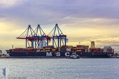
MSC MICHELA
Cargo A
Current Trip
| Time Travelled | 6 days |
|---|---|
| Remaining Time | --- |
| Distance Travelled | 229.39 nm |
| Remaining Distance | --- |
| AVG Speed | 11 Knots |
| MAX Speed | 16.9 Knots |
| AVG Wind | 11.9 knots |
| MAX Wind | 26 knots |
| MIN Temp | 23°C / 73.4°F |
| MAX Temp | 29.7°C / 85.46°F |
| Draught | 10.3 m |
| Position Received | 14 h, 31 m ago |
Current Position
| Longitude | -48.31646° |
|---|---|
| Latitude | -26.15009° |
| Status | At anchor |
| Speed | 0.1 Knots |
| Course | 32° |
| Area | South Atlantic Ocean |
| Station | T-AIS |
| Position Received | 14 h, 31 m ago |
Info
Information
The current position of MSC MICHELA is in South Atlantic Ocean with coordinates -26.15009° / -48.31646° as reported on 2025-12-12 23:26 by AIS to our vessel tracker app. The vessel's current speed is 0.1 Knots
The vessel MSC MICHELA (IMO: 9720512, MMSI: 255805929) is a Cargo A It's sailing under the flag of [PT] Portugal.
In this page you can find informations about the vessels current position, last detected port calls, and current voyage information. If the vessels is not in coverage by AIS you will find the latest position.
The current position of MSC MICHELA is detected by our AIS receivers and we are not responsible for the reliability of the data. The last position was recorded while the vessel was in Coverage by the Ais receivers of our vessel tracking app.
The current draught of MSC MICHELA as reported by AIS is 10.3 meters
Weather
| Temperature | 23.8°C / 74.84°F |
|---|---|
| Wind Speed | 6 knots |
| Direction | 276° W |
| Pressure | 1006.8 hPa |
| Humidity | 78.9 % |
| Cloud Coverage | 100 % |
Featured Company
Last Port Calls
| Port | Arrival | Departure | Time In Port |
|---|---|---|---|
| 2025-12-06 21:55 | 2025-12-07 10:21 | 12 h | |
| 2025-12-03 00:02 | 2025-12-03 23:34 | 23 h | |
| 2025-11-30 09:26 | 2025-11-30 09:32 | 5 m | |
| 2025-11-01 20:42 | 2025-11-03 04:23 | 1 d | |
| 2025-10-12 08:52 | 2025-10-13 17:20 | 1 d | |
| 2025-10-02 16:26 |
Last Trips
| Origin | Departure | Destination | Arrival | Distance | |
|---|---|---|---|---|---|
| 2025-12-03 23:34 | 2025-12-06 21:55 | 196.01 nm | |||
| 2025-11-30 09:32 | 2025-12-03 00:02 | 278.06 nm | |||
| 2025-11-03 04:23 | 2025-11-30 09:26 | 9496.25 nm | |||
| 2025-10-13 17:20 | 2025-11-01 20:42 | 4123.65 nm | |||
| 2025-10-02 16:26 | 2025-10-12 08:52 | 2668.23 nm |
Events
| Time | Event | Details | Position / Dest | Info |
|---|---|---|---|---|
| 2025-12-12 23:32 | Status Changed | Default At anchor |
-26.15040 / -48.31639
BR IOA
|
Speed: 0.1 kn Course: 32° |
| 2025-12-12 23:26 | Status Changed | At anchor Default |
-26.15009 / -48.31646
BR IOA
|
Speed: 0.1 kn Course: 32° |
| 2025-12-12 23:26 | OUT of Coverage |
-26.15009 / -48.31646
South Atlantic Ocean
|
Speed: 0.1 kn Course: 148.6° |
|
| 2025-12-12 23:17 | IN Coverage |
-26.15009 / -48.31646
South Atlantic Ocean
|
Speed: 0.1 kn Course: 148.6° |
|
| 2025-12-12 19:11 | Status Changed | Default At anchor |
-26.14984 / -48.31692
BR IOA
|
Speed: 0.1 kn Course: 59° |
| 2025-12-12 19:05 | OUT of Coverage |
-26.14980 / -48.31702
South Atlantic Ocean
|
Speed: 0.1 kn Course: 126.5° |
|
| 2025-12-12 15:08 | Status Changed | At anchor Default |
-26.14896 / -48.31721
BR IOA
|
Speed: 0.2 kn Course: 50° |
| 2025-12-12 14:59 | Status Changed | Default At anchor |
-26.14943 / -48.31731
BR IOA
|
Speed: Course: 60° |
| 2025-12-12 14:41 | Status Changed | At anchor Default |
-26.14948 / -48.31712
BR IOA
|
Speed: Course: -1° |
| 2025-12-12 14:23 | Status Changed | Default At anchor |
-26.14949 / -48.31702
BR IOA
|
Speed: 0.3 kn Course: 59° |