
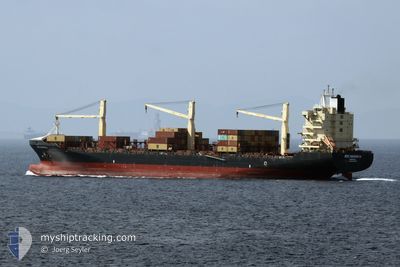
MSC NAISHA III
Container Ship
Current Trip
| Time Travelled | 1 day |
|---|---|
| Remaining Time | 1 day |
| Distance Travelled | 503.00 nm |
| Remaining Distance | 649.15 nm |
| AVG Speed | 15.5 Knots |
| MAX Speed | 20.8 Knots |
| AVG Wind | 20.8 knots |
| MAX Wind | 24 knots |
| MIN Temp | --- |
| MAX Temp | 3.2°C / 37.76°F |
| Dybgang | 11.8 m |
| Position Modtaget | 1 m siden |
Current Position
| Longitude | 11.52801° |
|---|---|
| Latitude | 56.40932° |
| Status | Under way using engine |
| Fart | 12.9 Knots |
| Kurs | 33.9° |
| Område | Kattegat |
| Station | T-AIS |
| Position Modtaget | 1 m siden |
Info
Information
The current position of MSC NAISHA III is in Kattegat with coordinates 56.40932° / 11.52801° as reported on 2025-02-10 16:22 by AIS to our vessel tracker app. The vessel's current speed is 12.9 Knots and is heading at the port of ANTWERP. The estimated time of arrival as calculated by MyShipTracking vessel tracking app is 2025-02-12 05:14 LT
The vessel MSC NAISHA III (IMO: 9307839, MMSI: 636021061) is a Container Ship that was built in 2005 ( 20 år gamle ). It's sailing under the flag of [LR] Liberia.
In this page you can find informations about the vessels current position, last detected port calls, and current voyage information. If the vessels is not in coverage by AIS you will find the latest position.
The current position of MSC NAISHA III is detected by our AIS receivers and we are not responsible for the reliability of the data. The last position was recorded while the vessel was in Coverage by the Ais receivers of our vessel tracking app.
The current draught of MSC NAISHA III as reported by AIS is 11.8 meters
Weather
| Temperature | 2.9°C / 37.22°F |
|---|---|
| Wind Speed | 18 knots |
| Direction | 80° E |
| Pressure | 1038.3 hPa |
| Humidity | 76 % |
| Cloud Coverage | 31 % |
Featured Company
Last Port Calls
| Port | Arrival | Departure | Time In Port |
|---|---|---|---|
| 2025-02-08 22:24 | 2025-02-09 08:35 | 10 h | |
| 2025-02-06 12:53 | 2025-02-07 22:21 | 1 d | |
| 2025-02-03 06:38 | 2025-02-04 20:34 | 1 d | |
| 2025-01-29 10:58 | 2025-01-30 21:43 | 1 d | |
| 2025-01-25 12:54 | 2025-01-26 00:49 | 11 h | |
| 2025-01-22 13:48 | 2025-01-23 20:56 | 1 d | |
| 2025-01-20 04:24 | 2025-01-21 01:45 | 21 h | |
| 2025-01-17 11:15 | 2025-01-17 21:34 | 10 h | |
| 2025-01-14 07:42 | 2025-01-15 19:59 | 1 d | |
| 2025-01-09 06:00 | 2025-01-10 02:55 | 20 h |
Last Trips
| Origin | Departure | Destination | Arrival | Distance | |
|---|---|---|---|---|---|
| 2025-02-07 23:21 | 2025-02-09 00:24 | 371.01 nm | |||
| 2025-02-04 21:34 | 2025-02-06 13:53 | 327.23 nm | |||
| 2025-01-30 22:43 | 2025-02-03 07:38 | 1207.76 nm | |||
| 2025-01-26 02:49 | 2025-01-29 11:58 | 1179.53 nm | |||
| 2025-01-23 21:56 | 2025-01-25 14:54 | 366.80 nm | |||
| 2025-01-21 02:45 | 2025-01-22 14:48 | 328.52 nm | |||
| 2025-01-17 22:34 | 2025-01-20 05:24 | 574.07 nm | |||
| 2025-01-15 20:59 | 2025-01-17 12:15 | 702.61 nm | |||
| 2025-01-10 03:55 | 2025-01-14 08:42 | 602.09 nm | |||
| 2025-01-08 17:18 | 2025-01-09 07:00 | 112.88 nm |
Events
| Tid | Hændelsen | Detaljer | Position / Dest | Info |
|---|---|---|---|---|
| 2025-02-10 16:08 | ETA er ændret | 2025/02/12 05:00 2025/02/12 05:05 |
56.36707 / 11.47702
BEANR
|
Fart: 12.5 kn Kurs: 30.4° |
| 2025-02-10 15:28 | ETA er ændret | 2025/02/12 05:05 2025/02/12 05:00 |
56.23354 / 11.34070
BEANR
|
Fart: 17.7 kn Kurs: 29.3° |
| 2025-02-10 14:48 | ETA er ændret | 2025/02/12 05:00 2025/02/12 05:05 |
56.07057 / 11.14085
BEANR
|
Fart: 18 kn Kurs: 11° |
| 2025-02-10 14:42 | ETA er ændret | 2025/02/12 05:05 2025/02/12 05:00 |
56.04339 / 11.13256
BEANR
|
Fart: 14.4 kn Kurs: 9.2° |
| 2025-02-10 12:40 | ETA er ændret | 2025/02/12 05:00 2025/02/12 05:05 |
55.57851 / 10.82514
BEANR
|
Fart: 17.7 kn Kurs: 336.5° |
| 2025-02-10 09:07 | Ændre havområde | Danish part of the Kattegat Danish part of the Baltic Sea |
54.73909 / 10.78017
Kattegat
BEANR
|
Fart: 16.1 kn Kurs: 23.5° |
| 2025-02-10 08:37 | Ændre havområde | Danish part of the Baltic Sea German part of the Baltic Sea |
54.63626 / 10.89962
Baltic Sea
BEANR
|
Fart: 17.2 kn Kurs: 300.3° |
| 2025-02-10 07:37 | Ændre havområde | German part of the Baltic Sea Danish part of the Baltic Sea |
54.54268 / 11.35769
Baltic Sea
BEANR
|
Fart: 16.8 kn Kurs: 298.1° |
| 2025-02-10 05:49 | Ændre havområde | Danish part of the Baltic Sea German part of the Baltic Sea |
54.44005 / 12.14644
Baltic Sea
BEANR
|
Fart: 15.5 kn Kurs: 264.6° |
| 2025-02-10 05:35 | Ændre havområde | German part of the Baltic Sea Danish part of the Baltic Sea |
54.48618 / 12.20719
Baltic Sea
BEANR
|
Fart: 15.9 kn Kurs: 195° |