
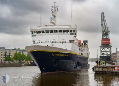
NG EXPLORER
Passengers Ship
Current Trip
CIERVA COVE
| Time Travelled | 4 days |
|---|---|
| Remaining Time | --- |
| Distance Travelled | 868.06 nm |
| Remaining Distance | --- |
| AVG Speed | 10.2 Knots |
| MAX Speed | 16.8 Knots |
| AVG Wind | 6.9 knots |
| MAX Wind | 28 knots |
| MIN Temp | -9.4°C / 15.08°F |
| MAX Temp | 9.1°C / 48.38°F |
| Dybgang | 4.9 m |
| Position Modtaget | 1 m siden |
Current Position
| Longitude | -63.40333° |
|---|---|
| Latitude | -64.95996° |
| Status | Under way using engine |
| Fart | 8.9 Knots |
| Kurs | 62.2° |
| Område | Southern Ocean |
| Station | T-AIS |
| Position Modtaget | 1 m siden |
Info
Information
The current position of NG EXPLORER is in Southern Ocean with coordinates -64.95996° / -63.40333° as reported on 2025-02-09 00:15 by AIS to our vessel tracker app. The vessel's current speed is 8.9 Knots
The vessel NG EXPLORER (IMO: 8019356, MMSI: 309336000) is a Passengers Ship that was built in 1982 ( 43 år gamle ). It's sailing under the flag of [BS] Bahamas.
In this page you can find informations about the vessels current position, last detected port calls, and current voyage information. If the vessels is not in coverage by AIS you will find the latest position.
The current position of NG EXPLORER is detected by our AIS receivers and we are not responsible for the reliability of the data. The last position was recorded while the vessel was in Coverage by the Ais receivers of our vessel tracking app.
The current draught of NG EXPLORER as reported by AIS is 4.9 meters
Weather
| Temperature | -0.8°C / 30.56°F |
|---|---|
| Wind Speed | 4 knots |
| Direction | 327° NNW |
| Pressure | 981.1 hPa |
| Humidity | 98.8 % |
| Cloud Coverage | 100 % |
Featured Company
Last Port Calls
Most Visited Ports (Last year)
| Port | Arrivals | |
|---|---|---|
| 9 | ||
| 6 | ||
| 4 | ||
| 3 | ||
| 3 | ||
| 3 |
Last Trips
| Origin | Departure | Destination | Arrival | Distance | |
|---|---|---|---|---|---|
| 2025-01-17 20:24 | 2025-02-03 20:15 | 2702.11 nm | |||
| 2025-01-16 14:17 | 2025-01-16 16:19 | 27.99 nm | |||
| 2024-12-28 19:06 | 2025-01-16 11:06 | 2770.72 nm | |||
| 2024-12-09 19:23 | 2024-12-28 07:43 | 2925.01 nm | |||
| 2024-11-20 18:56 | 2024-12-08 19:39 | 2725.39 nm |
Events
| Tid | Hændelsen | Detaljer | Position / Dest | Info |
|---|---|---|---|---|
| 2025-02-08 22:42 | Destination er ændret | CIERVA COVE WILHELMINA BAY |
-65.03039 / -63.88523
CIERVA COVE
|
Fart: 9.1 kn Kurs: 34.5° |
| 2025-02-08 22:42 | ETA er ændret | 2025/02/09 10:30 2025/02/07 11:30 |
-65.03039 / -63.88523
CIERVA COVE
|
Fart: 9.1 kn Kurs: 34.5° |
| 2025-02-08 22:40 | Status er ændret | Under way using engine Default |
-65.03495 / -63.89214
WILHELMINA BAY
|
Fart: 3.2 kn Kurs: 32° |
| 2025-02-08 22:40 | Indenfor Dækning |
-65.03495 / -63.89214
Southern Ocean
|
Fart: 6.4 kn Kurs: 31.3° |
|
| 2025-02-08 21:25 | START Sejllads |
-65.16609 / -64.10107
WILHELMINA BAY
|
Fart: 8.8 kn Kurs: 44° |
|
| 2025-02-08 18:40 | STOP Sejllads |
-65.17652 / -64.12628
WILHELMINA BAY
|
Fart: 0.3 kn Kurs: 254° |
|
| 2025-02-08 17:47 | Status er ændret | Default Under way using engine |
-65.08794 / -63.96672
WILHELMINA BAY
|
Fart: 6.3 kn Kurs: 187.1° |
| 2025-02-08 17:45 | Udenfor Dækning |
-65.08516 / -63.96624
Southern Ocean
|
Fart: 6.3 kn Kurs: 187.1° |
|
| 2025-02-08 14:18 | Status er ændret | Under way using engine Default |
-64.90630 / -62.93543
WILHELMINA BAY
|
Fart: 2.6 kn Kurs: 233° |
| 2025-02-08 14:18 | START Sejllads |
-64.90630 / -62.93543
WILHELMINA BAY
|
Fart: 8.9 kn Kurs: 249.7° |