
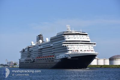
NIEUW STATENDAM
Passenger
Current Trip
| Time Travelled | 7 h, 0 mins |
|---|---|
| Remaining Time | 22 h, 1 mins |
| Distance Travelled | 111.68 nm |
| Remaining Distance | 421.23 nm |
| AVG Speed | 16.7 Knots |
| MAX Speed | 17 Knots |
| AVG Wind | 25.1 knots |
| MAX Wind | 28 knots |
| MIN Temp | 25.8°C / 78.44°F |
| MAX Temp | 26.7°C / 80.06°F |
| Dybgang | 8 m |
| Position Modtaget | 2 d siden |
Current Position
| Longitude | -73.94961° |
|---|---|
| Latitude | 23.29535° |
| Status | Under way using engine |
| Fart | 7.4 Knots |
| Kurs | 107.9° |
| Område | North Atlantic Ocean |
| Station | T-AIS |
| Position Modtaget | 2 d siden |
Info
Information
The current position of NIEUW STATENDAM is in North Atlantic Ocean with coordinates 23.29535° / -73.94961° as reported on 2025-02-10 14:42 by AIS to our vessel tracker app. The vessel's current speed is 7.4 Knots and is heading at the port of HALF MOON CAY. The estimated time of arrival as calculated by MyShipTracking vessel tracking app is 2025-02-14 01:05 LT
The vessel NIEUW STATENDAM (MMSI: 244140580) is a Passenger It's sailing under the flag of [NL] Netherlands.
In this page you can find informations about the vessels current position, last detected port calls, and current voyage information. If the vessels is not in coverage by AIS you will find the latest position.
The current position of NIEUW STATENDAM is detected by our AIS receivers and we are not responsible for the reliability of the data. The last position was recorded while the vessel was in Coverage by the Ais receivers of our vessel tracking app.
The current draught of NIEUW STATENDAM as reported by AIS is 8 meters
Weather
| Temperature | 25.9°C / 78.62°F |
|---|---|
| Wind Speed | 25 knots |
| Direction | 90° E |
| Pressure | 1018.1 hPa |
| Humidity | 82.3 % |
| Cloud Coverage | 100 % |
Featured Company
Last Port Calls
| Port | Arrival | Departure | Time In Port |
|---|---|---|---|
| 2025-02-12 10:45 | 2025-02-12 20:04 | 9 h | |
| 2025-02-11 12:22 | 2025-02-11 21:58 | 9 h | |
| 2025-02-09 13:24 | 2025-02-09 22:06 | 8 h | |
| 2025-02-08 11:29 | 2025-02-08 20:57 | 9 h | |
| 2025-02-08 11:12 | 2025-02-08 11:27 | 15 m | |
| 2025-02-06 15:16 | 2025-02-07 01:45 | 10 h | |
| 2025-02-04 12:30 | 2025-02-04 20:56 | 8 h | |
| 2025-02-02 14:00 | 2025-02-02 22:54 | 8 h | |
| 2025-02-01 11:18 | 2025-02-01 21:01 | 9 h | |
| 2025-02-01 11:04 | 2025-02-01 11:17 | 12 m |
Most Visited Ports (Last year)
| Port | Arrivals | |
|---|---|---|
| 21 | ||
| 18 | ||
| 17 | ||
| 10 | ||
| 8 | ||
| 7 |
Last Trips
| Origin | Departure | Destination | Arrival | Distance | |
|---|---|---|---|---|---|
| 2025-02-11 16:58 | 2025-02-12 06:45 | 106.79 nm | |||
| 2025-02-09 17:06 | 2025-02-11 07:22 | 335.23 nm | |||
| 2025-02-08 15:57 | 2025-02-09 08:24 | 274.65 nm | |||
| 2025-02-08 06:27 | 2025-02-08 06:29 | 0.03 nm | |||
| 2025-02-06 20:45 | 2025-02-08 06:12 | 548.02 nm | |||
| 2025-02-04 15:56 | 2025-02-06 10:16 | 590.11 nm | |||
| 2025-02-01 16:01 | 2025-02-02 09:00 | 275.13 nm | |||
| 2025-02-01 06:17 | 2025-02-01 06:18 | 0.01 nm | |||
| 2025-01-31 14:43 | 2025-02-01 06:04 | 272.68 nm | |||
| 2025-01-29 16:01 | 2025-01-31 07:24 | 731.01 nm |
Events
| Tid | Hændelsen | Detaljer | Position / Dest | Info |
|---|---|---|---|---|
| 2025-02-12 20:06 | START Sejllads | 0.37 nm, North East of AMBER COVE |
19.83909 / -70.77254
US PEF > BS HMC
|
Fart: 5.9 kn Kurs: 41° |
| 2025-02-12 20:04 | Afsejlet fra sidste havn |
|
19.83909 / -70.77254
US PEF > BS HMC
|
Fart: 0.1 kn Kurs: 32° |
| 2025-02-12 11:17 | STOP Sejllads |
19.83571 / -70.77512
[DO] AMBER COVE
|
Fart: 0.1 kn Kurs: 32° |
|
| 2025-02-12 10:45 | Skibe i havn |
|
19.83758 / -70.77394
[DO] AMBER COVE
|
Fart: 7.9 kn Kurs: 208° |
| 2025-02-11 22:22 | START Sejllads | 3.7 nm, South West of GRAND TURK |
21.40503 / -71.20843
US PEF > BS HMC
|
Fart: 9.1 kn Kurs: 235° |
| 2025-02-11 21:58 | Afsejlet fra sidste havn |
|
21.40503 / -71.20843
US PEF > BS HMC
|
Fart: 0.1 kn Kurs: 126° |
| 2025-02-11 12:22 | Skibe i havn |
|
21.42950 / -71.14852
[TC] GRAND TURK
|
Fart: 8.6 kn Kurs: 124° |
| 2025-02-10 14:49 | Status er ændret | Default Under way using engine |
23.29135 / -73.93445
US PEF > BS HMC
|
Fart: 7.4 kn Kurs: 107.9° |
| 2025-02-10 14:42 | Status er ændret | Under way using engine Default |
23.29535 / -73.94961
US PEF > BS HMC
|
Fart: 7.4 kn Kurs: 107° |
| 2025-02-10 14:42 | Udenfor Dækning |
23.29535 / -73.94961
North Atlantic Ocean
|
Fart: 7.4 kn Kurs: 107.9° |