
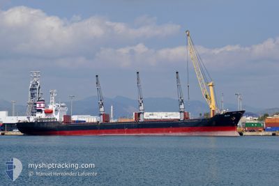
OLGA
Bulk Carrier
Current Trip
| Trip Time | 10 days |
|---|---|
| Trip Distance | 1080.38 nm |
| AVG Speed | 7.5 Knots |
| MAX Speed | 7.5 Knots |
| Dybgang | 5.3 m |
| AVG Wind | 13.7 knots |
| MAX Wind | 33 knots |
| MIN Temp | -2.8°C / 26.96°F |
| MAX Temp | 24.4°C / 75.92°F |
| Position Modtaget | 2 d siden |
Current Position
| Longitude | 31.74203° |
|---|---|
| Latitude | 31.61181° |
| Status | At anchor |
| Fart | 0.1 Knots |
| Kurs | 140° |
| Område | Mediterranean Sea - Eastern Basin |
| Station | T-AIS |
| Position Modtaget | 2 d siden |
Info
Information
The current position of OLGA is in Mediterranean Sea - Eastern Basin with coordinates 31.61181° / 31.74203° as reported on 2026-01-08 06:03 by AIS to our vessel tracker app. The vessel's current speed is 0.1 Knots and is currently inside the port of DAMIETTA.
The vessel OLGA (IMO: 9109548, MMSI: 636016374) is a Bulk Carrier that was built in 1996 ( 30 år gamle ). It's sailing under the flag of [LR] Liberia.
In this page you can find informations about the vessels current position, last detected port calls, and current voyage information. If the vessels is not in coverage by AIS you will find the latest position.
The current position of OLGA is detected by our AIS receivers and we are not responsible for the reliability of the data. The last position was recorded while the vessel was in Coverage by the Ais receivers of our vessel tracking app.
The current draught of OLGA as reported by AIS is 5.3 meters
Weather
| Temperature | 18.1°C / 64.58°F |
|---|---|
| Wind Speed | 9 knots |
| Direction | 294° WNW |
| Pressure | 1018.5 hPa |
| Humidity | 70.1 % |
| Cloud Coverage | 31 % |
Featured Company
Events
| Tid | Hændelsen | Detaljer | Position / Dest | Info |
|---|---|---|---|---|
| 2026-01-10 11:10 | STOP Sejllads |
31.45704 / 31.76790
[EG] DAMIETTA
|
Fart: 0.1 kn Kurs: 135° |
|
| 2026-01-10 10:25 | Skibe i havn |
|
31.48667 / 31.75667
[EG] DAMIETTA
|
Fart: 6 kn Kurs: 194° |
| 2026-01-10 09:05 | START Sejllads | 8.54 nm, North of DAMIETTA |
31.60865 / 31.73583
LBBEY
|
Fart: 5.3 kn Kurs: 85° |
| 2026-01-09 20:53 | STOP Sejllads | 8.1 nm, North of DAMIETTA |
31.60167 / 31.73833
LBBEY
|
Fart: Kurs: -1° |
| 2026-01-09 02:27 | START Sejllads | 8.83 nm, North of DAMIETTA |
31.61207 / 31.72450
LBBEY
|
Fart: 4.9 kn Kurs: 282° |
| 2026-01-08 06:06 | Status er ændret | Default At anchor |
31.61178 / 31.74202
LBBEY
|
Fart: 0.1 kn Kurs: 140° |
| 2026-01-08 06:03 | Status er ændret | At anchor Default |
31.61181 / 31.74203
LBBEY
|
Fart: Kurs: 142° |
| 2026-01-08 06:03 | Udenfor Dækning |
31.61181 / 31.74203
Mediterranean Sea - Eastern Basin
|
Fart: 0.1 kn Kurs: 121.4° |
|
| 2026-01-08 06:00 | Indenfor Dækning |
31.61181 / 31.74203
Mediterranean Sea - Eastern Basin
|
Fart: 0.1 kn Kurs: 121.4° |
|
| 2026-01-08 04:39 | Udenfor Dækning |
31.61146 / 31.74181
Mediterranean Sea - Eastern Basin
|
Fart: 0.1 kn Kurs: 121.4° |