
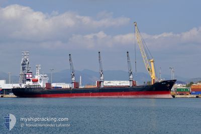
OLGA
Bulk Carrier
Current Trip
| Time Travelled | 5 days |
|---|---|
| Remaining Time | 17 h, 40 mins |
| Distance Travelled | 961.95 nm |
| Remaining Distance | 240.16 nm |
| AVG Speed | 8.6 Knots |
| MAX Speed | 18.9 Knots |
| AVG Wind | 14.2 knots |
| MAX Wind | 25.5 knots |
| MIN Temp | -2.8°C / 26.96°F |
| MAX Temp | 18.1°C / 64.58°F |
| Draught | 5.3 m |
| Position Received | 1 d ago |
Current Position
| Longitude | 26.87071° |
|---|---|
| Latitude | 36.36256° |
| Status | Under way using engine |
| Speed | 11 Knots |
| Course | 140.6° |
| Area | Aegean Sea |
| Station | T-AIS |
| Position Received | 1 d ago |
Info
Information
The current position of OLGA is in Aegean Sea with coordinates 36.36256° / 26.87071° as reported on 2026-01-03 05:46 by AIS to our vessel tracker app. The vessel's current speed is 11 Knots and is heading at the port of BEIRUT. The estimated time of arrival as calculated by MyShipTracking vessel tracking app is 2026-01-05 14:41 LT
The vessel OLGA (IMO: 9109548, MMSI: 636016374) is a Bulk Carrier that was built in 1996 ( 30 years old ). It's sailing under the flag of [LR] Liberia.
In this page you can find informations about the vessels current position, last detected port calls, and current voyage information. If the vessels is not in coverage by AIS you will find the latest position.
The current position of OLGA is detected by our AIS receivers and we are not responsible for the reliability of the data. The last position was recorded while the vessel was in Coverage by the Ais receivers of our vessel tracking app.
The current draught of OLGA as reported by AIS is 5.3 meters
Weather
| Temperature | 17.8°C / 64.04°F |
|---|---|
| Wind Speed | 11 knots |
| Direction | 74° ENE |
| Pressure | 1021.4 hPa |
| Humidity | 61.4 % |
| Cloud Coverage | 69 % |
Featured Company
Events
| Time | Event | Details | Position / Dest | Info |
|---|---|---|---|---|
| 2026-01-04 15:24 | STOP Moving | 8.6 nm, North of DAMIETTA |
31.61041 / 31.74173
LBBEY
|
Speed: 0.3 kn Course: 58° |
| 2026-01-03 06:02 | Status Changed | Default Under way using engine |
36.33167 / 26.91500
LBBEY
|
Speed: 11 kn Course: 140.6° |
| 2026-01-03 05:46 | Status Changed | Under way using engine Default |
36.36256 / 26.87071
LBBEY
|
Speed: 10 kn Course: 145° |
| 2026-01-03 05:46 | OUT of Coverage |
36.36256 / 26.87071
Aegean Sea
LBBEY
|
Speed: 11 kn Course: 140.6° |
|
| 2026-01-03 05:13 | Status Changed | Default Under way using engine |
36.44727 / 26.81780
LBBEY
|
Speed: 10.6 kn Course: 159.8° |
| 2026-01-03 02:47 | Draught Changed | 5.3 5 |
36.86755 / 26.63780
LBBEY
|
Speed: 11.1 kn Course: 158.3° |
| 2026-01-03 02:47 | ETA Changed | 2026/01/06 05:00 |
36.86755 / 26.63780
LBBEY
|
Speed: 11.1 kn Course: 158.3° |
| 2026-01-03 02:29 | Draught Changed | 5 5.3 |
36.91842 / 26.61137
LBBEY
|
Speed: 11 kn Course: 156° |
| 2026-01-03 02:23 | Draught Changed | 5.3 5 |
36.93659 / 26.60136
LBBEY
|
Speed: 10.8 kn Course: 157° |
| 2026-01-03 02:23 | ETA Changed | 2026/01/06 05:00 |
36.93659 / 26.60136
LBBEY
|
Speed: 10.8 kn Course: 157° |